
A few showers moving thru this mid-morning. these are no worries.
Our severe chances have increased just a tad since yesterday.

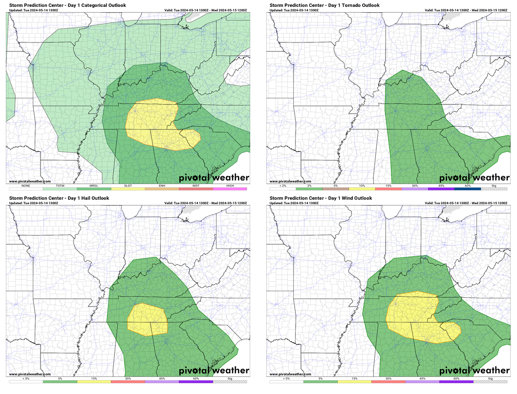
Within 25 miles of you, there is a 15% chance of damaging straight-line winds, 15% chance of large hail, and a 2% chance of a tornado. (another way to look at it is there is a 98% chance that there will not be a tornado within 25 miles of you!)
Timing:

The latest HRRR model shows the majority of possibly strong to severe storms in the 2-6 pm timeframe. This could change, so be sure to check back in for updates! We’ll be tweeting as necessary today and will go live on our YouTube channel if either part of our county is included in a warning. Activity should wind down quickly after sunset.
Our main threat will be damaging straight-line winds and large hail. The chance of a tornado is very low, but not zero. No need to panic, just be prepared and don’t get caught off guard.
1-2 inches of rain are possible in some of the heavier downpours, this could aggravate some creeks and streams. We’ll keep an eye on them. If you come across a flooded roadway, turn around, don’t drown.
More spotty showers are possible Wednesday afternoon and evening, shown below by the HRRR model. No strong to severe chances with any of these, or for the rest of the week for that matter.

Rain chances will relax a bit Thursday before picking back up Friday and Saturday. Timing still looks fuzzy; we’ll have to wait until we get a bit closer. Not the best news for grad szn.
Temperatures stay nice and warm throughout the week.

Categories: Featured Blog