Although there are still some Wattery winners today, fewer tickets have been chosen. Similar to past days, any “winner” could see some brief heavy rain, lightning and gusty winds. These storms tend to fall apart just as fast as they pop up, but a quick inch or so of rain is possible. read more
A few Wattery winners have already been chosen today, and a few more will be announced tomorrow, although chances look lower.
With any storm today or tomorrow, brief heavy rain, lightning and gusty winds will all be possible. A quick inch or so of rain is possible, while your friend on the other side of town gets nada. read more
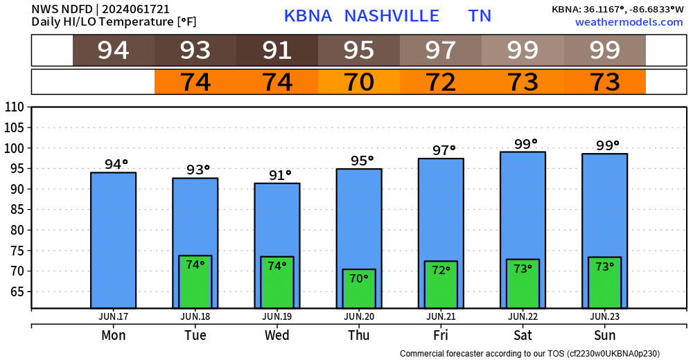
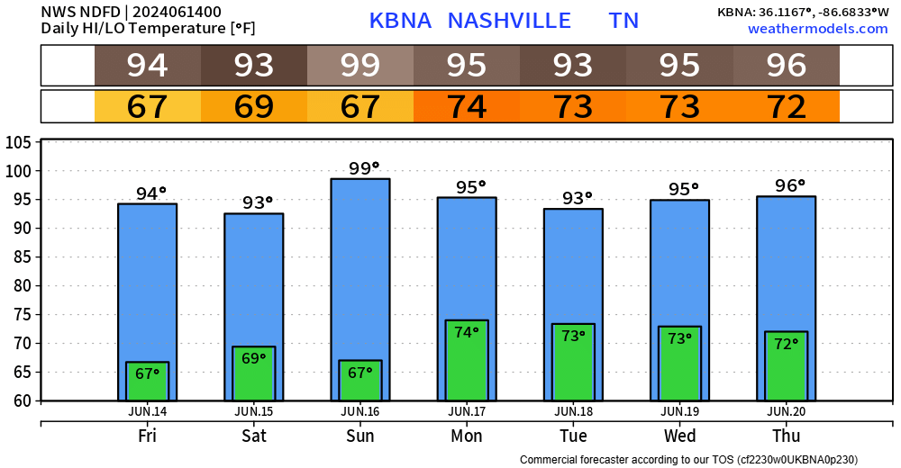
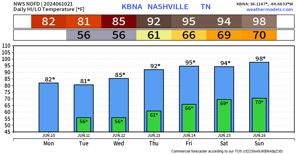
Today we’ve experienced one of, if not the hottest day thus far this year. Thankfully, dewpoints in the low 60s have kept the heat index right near the actual air temperature.
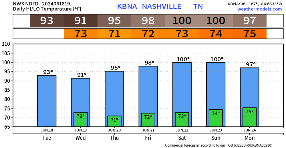
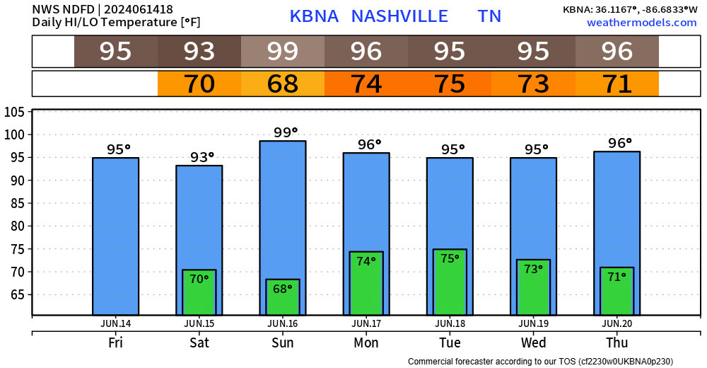
These hot temperatures aren’t going anywhere, with high temps in the 90s thru the remainder of the forecast.read more
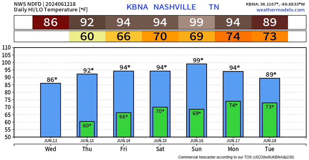
Although it is a dry weekend, it sure is a hot one.
Today and Saturday will be hot, but the heat index won’t differ too much from the actual air temperature.
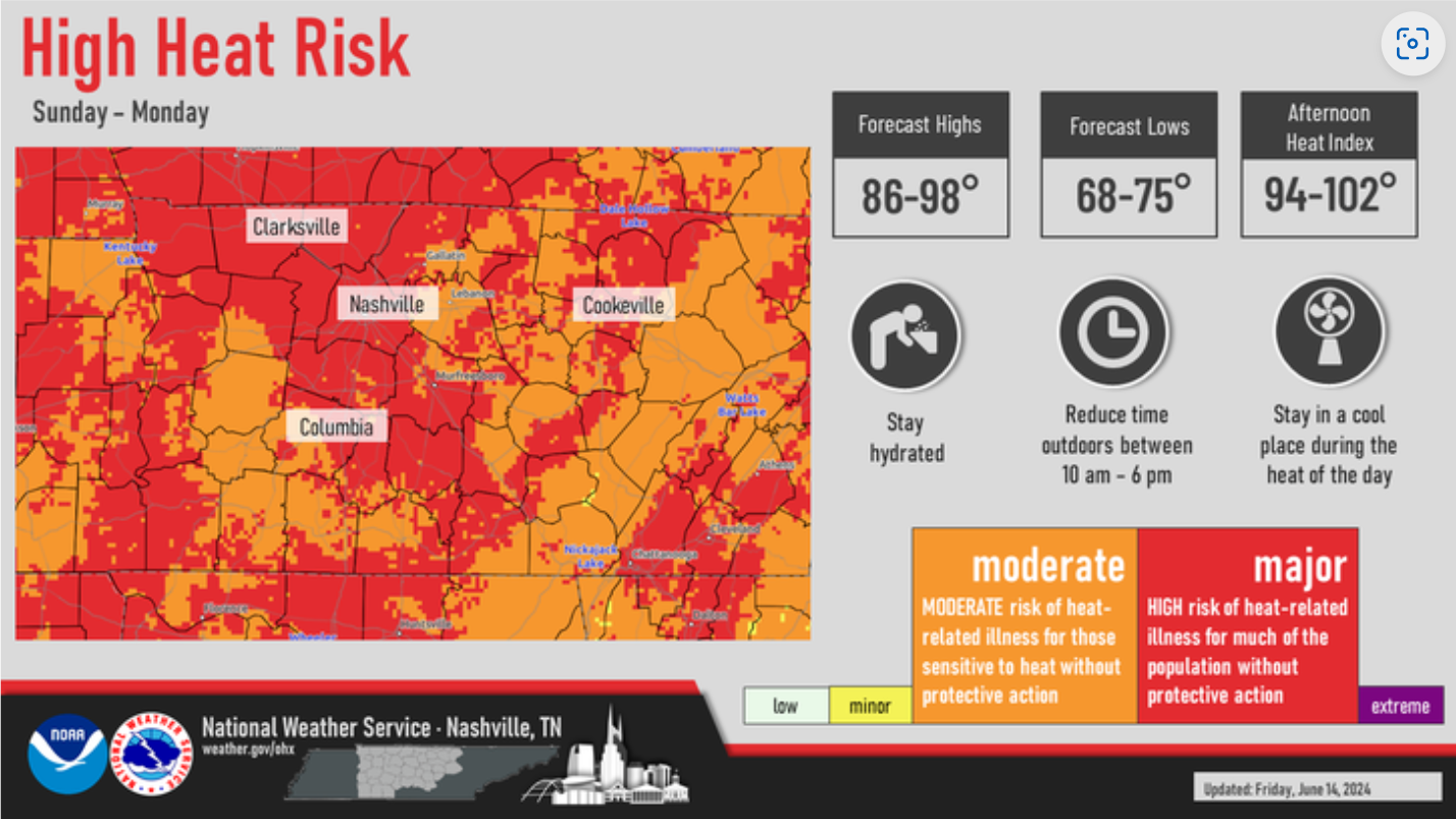
Sunday and Monday will be the hottest. Dewpoints will creep up, allowing for the heat index to surpass 100°. If you have to be outside either of those days, take it easy. Take frequent breaks in the shade and/or A/C.
Monday seems to be our only day with rain chances in the forecast, but those chances are low.
"Monday will be Middle TN`s best shot at getting some rain in this forecast package. Unfortunately, it`s still not a great shot. Will maintain a 20-30% chance, however, if you get a storm on Monday afternoon, expect brief heavy rainfall, lots of lightning and even the potential for some gusty winds." - NWS Nashville AFDread more
The humidity could be nicer, but it could also be worse. Dewpoints in the mid to upper 60s will make ya sweat faster.
Peak heat will be Sunday (sorry dads), with high temperatures flirting with the 100° mark, but models think we fall just short. Regardless, heat index values may exceed 100°. Only a little better for days not named Sunday, heat index values in the upper 90s still possible. read more
Today was/will be one of the last days we experience nice temperatures for the foreseeable future.
NWS Nashville made this handy dandy graph to show how to combo of temperatures + humidity will worsen throughout the week. Emphasis on worsen.read more
I am getting the same feeling looking at the temperatures for later this week as I do when I am forced to climb the old, scary, wooden ladder I have – “oh great here we go again.” I don’t like heights – or supahot temps. read more
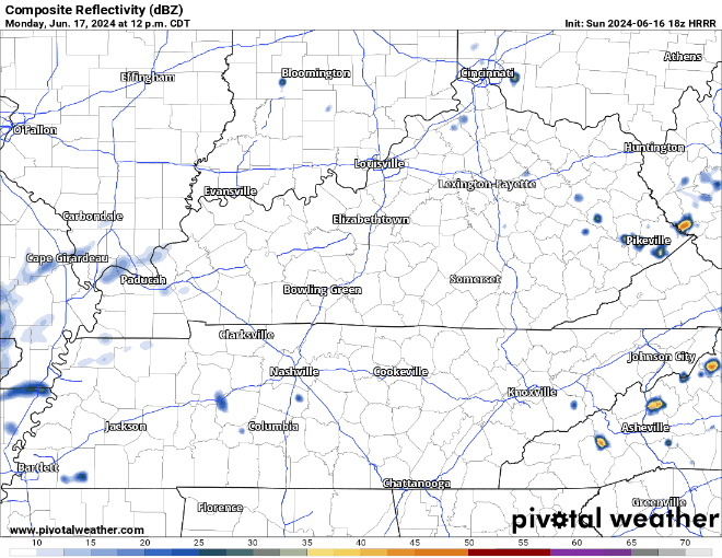
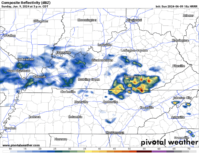
So far today rain has been kind to us – mostly missing us. Models continue to think this trend will continue throughout the day, with only the occasional shower and low thunderstorm chances.
The HRRR model, shown above, thinks we’ll get away with a dry afternoon and only a few light showers along a cold front that will push thru around sunset, bringing relief from the humidity for the next couple of days. Still not a bad idea to bring rain gear to the CMA Fest, just not sure how much you’ll need it.
We are left with a nearly rain-free week ahead.
"Through this week, a stray pop-up shower or storm cannot be ruled out, particularly late week when humidity creeps up. But for the most part, models show the dry air and strong ridge suppressing any significant rain chances." - NWS Nashville AFDread more
Subscribe to Blog via Email
Privacy & Cookies: This site uses cookies. By continuing to use this website, you agree to their use.
To find out more, including how to control cookies, see here:
Privacy Policy


You must be logged in to post a comment.