

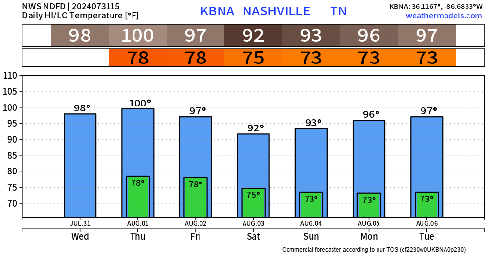
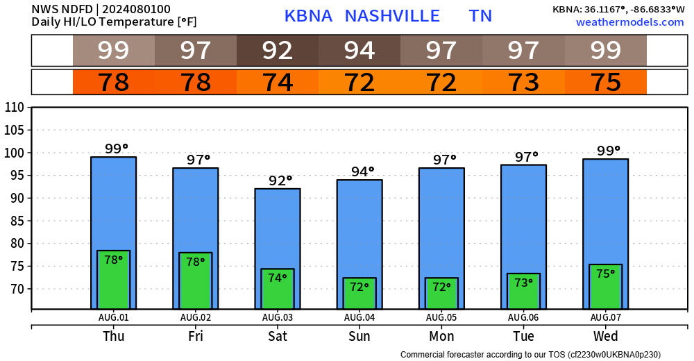
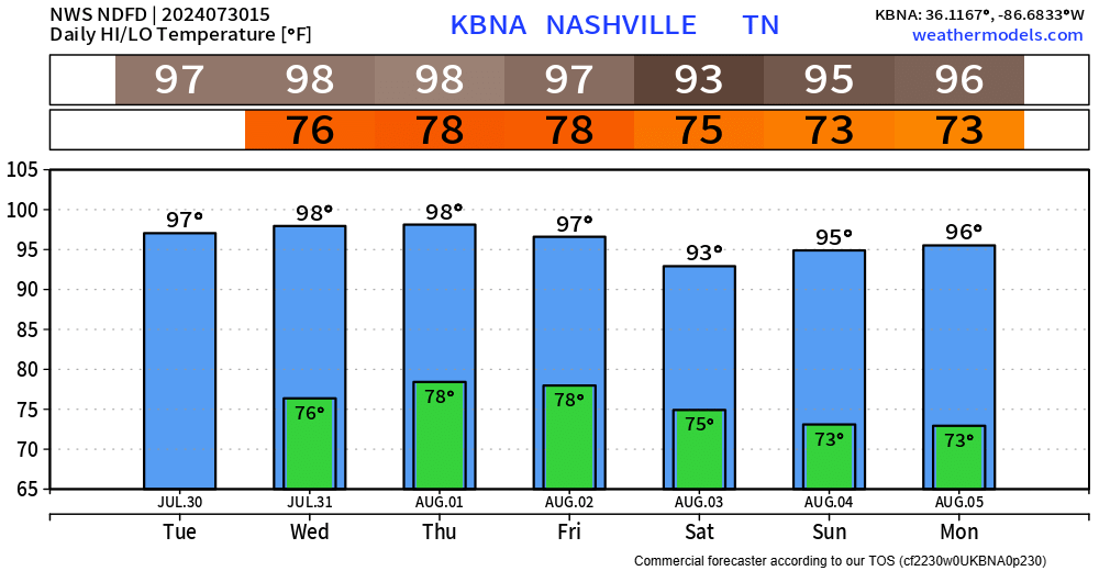
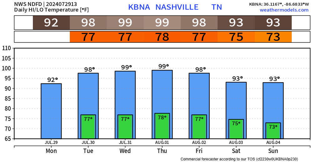
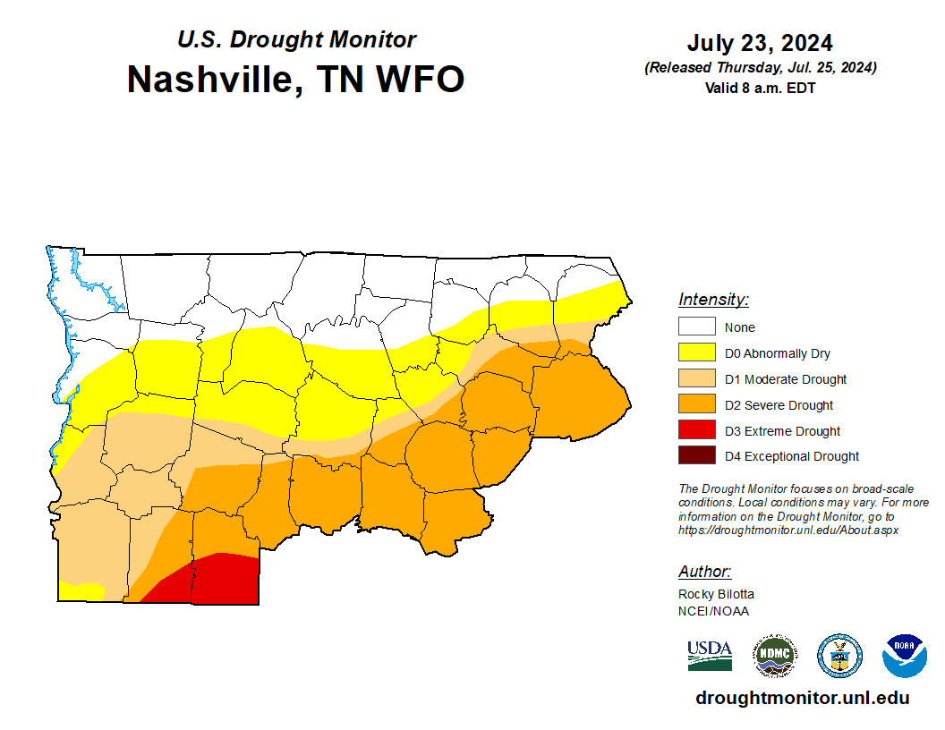
The hot weather isn’t going anywhere. High temps in the 90s for at least the next 6 days. Heat index values will continue to be around 100° during this time.
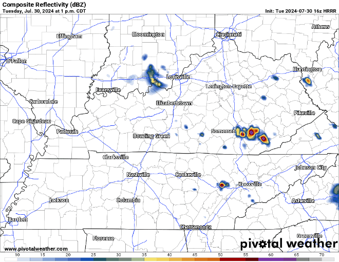
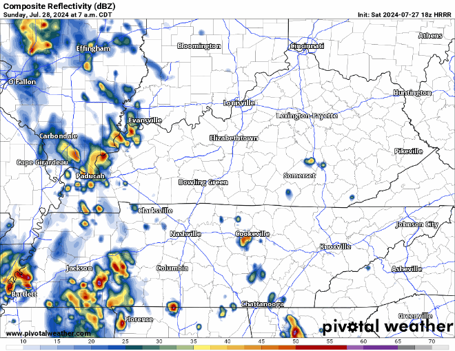
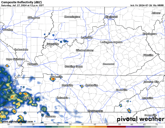
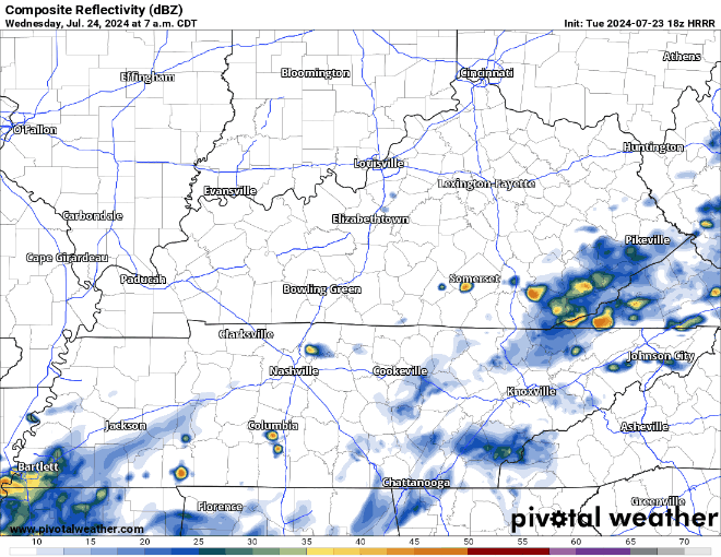
We have one more day of Wattery chances before a pattern shift gives us several days of dry weather.


You must be logged in to post a comment.