
Maybe some occasional mist throughout the evening, but the majority of the rain is gone.
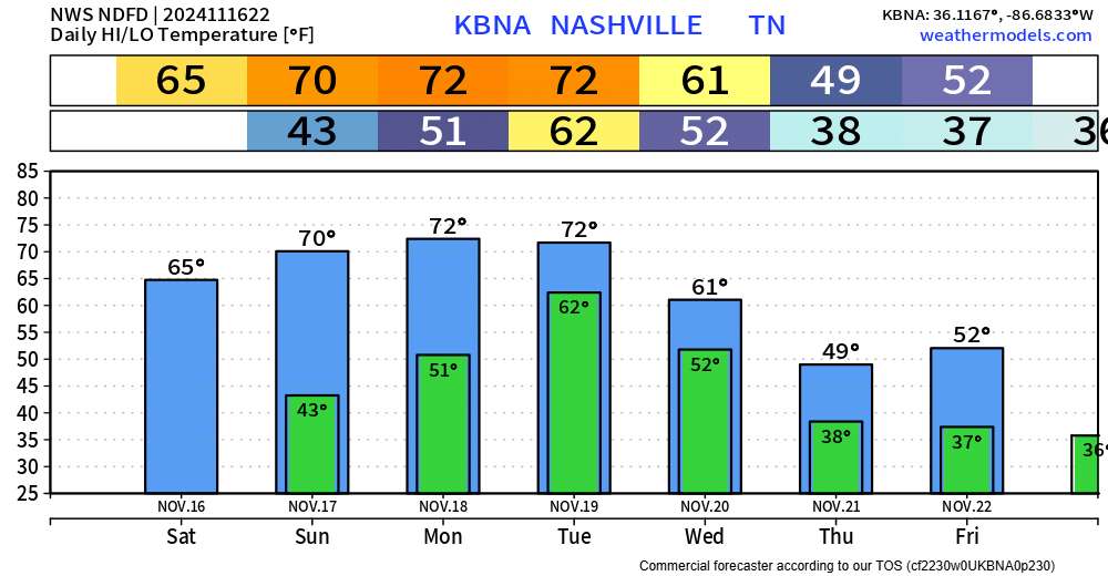
As of 5:45p, dewpoints are in the low 60s across the area, this time tomorrow they will be in the low 30s.
Wind gusts from the NW up to 30 mph (possible Wednesday – Friday during the day) will aid in getting this much colder and drier air mass into our area.


You must be logged in to post a comment.