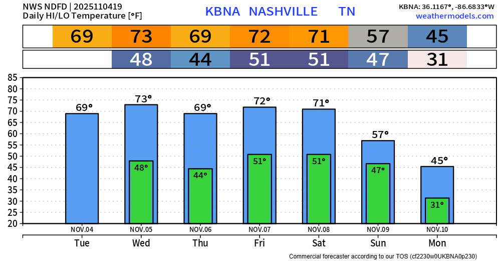
We have very quickly warmed up from the mid 30s this morning, with BNA sitting at 70° at the 1p observation.
High temps near 70° will be common thru Saturday, nearly 10° above average for the start of November.

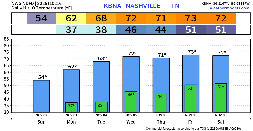
We have very quickly warmed up from the mid 30s this morning, with BNA sitting at 70° at the 1p observation.
High temps near 70° will be common thru Saturday, nearly 10° above average for the start of November.
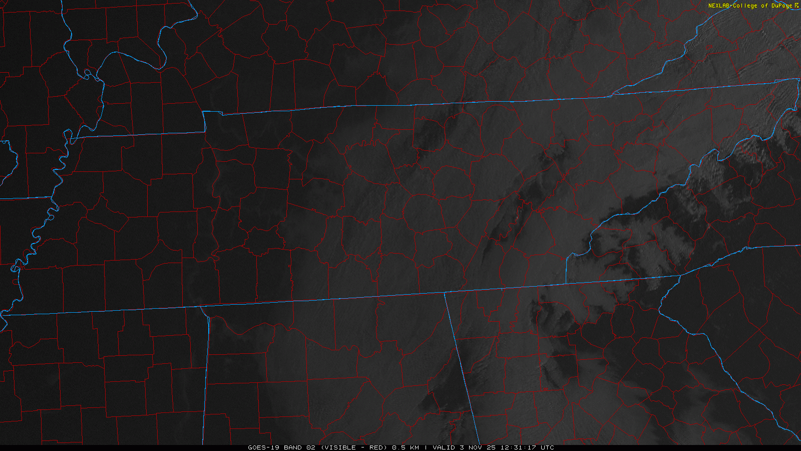
Fog was (still is) so dense this morning, it can be seen from space. Fog should continue to mix out over the next hour or so and visibility will continue to improve.
More fog is possible Tuesday morning, although it likely won’t be as widespread.
A few stray showers can’t be ruled out thru the early afternoon hours, but most of us will stay dry. The sun will start peeking through the clouds more as we go on in the day as well, although the sun will only be up until 4:49p…
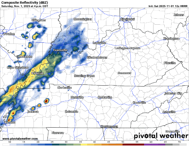
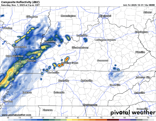
Still expecting some showers, possibly with a few rumbles of thunder, to move in around dinnertime tonight. If you’re going out for dinner or any other evening plans, I’d think about a rain jacket.
Happy Halloween!

All things considered, good weather is in store for Halloween today.
Highs will make it into the low 60s this afternoon, slightly below our average of 67° but still reasonable.
Temperatures for trick or treating will be fairly nice too, starting out in the mid 50s, making it down into the upper 40s for those really dedicated.
We finally get to dry out today. Temps will reach the upper 50s by this afternoon, but gusts up to 25mph from the NW will keep a chill in the air.
Halloween will consist of dry weather and seasonal temperatures. Highs near 60°, with temps in the low 50s during candy time.
Temperatures will likely not get out of the 50s today as showers and plenty of cloud cover hang around throughout the day.
On and off showers will be around for most of today, overall coverage will become more scattered as we get closer to this afternoon.
Can’t rule out some occasional drizzle during the day today, but most of the day should be dry. It’ll stay pretty gloomy with cloud cover hanging on throughout the day.
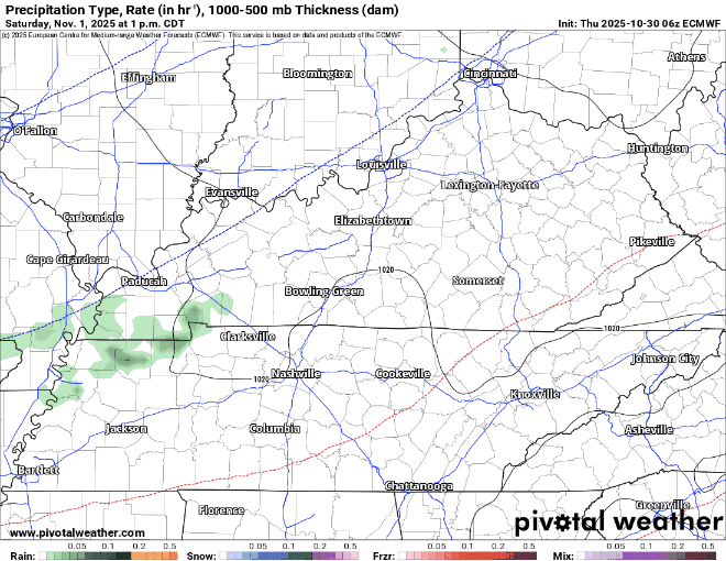
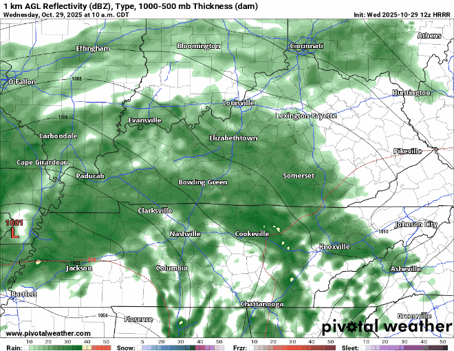
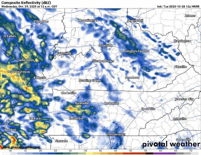
Rain returns late tonight. Light to moderate showers will be on/off throughout the entirety of Wednesday, mostly on. HRRR model gives a guess on what the radar could look like below.
The bulk of the rain has moved on out already, but we’ll still deal with some scattered showers thru this afternoon.
This will not be the end of the rain, as more showers will move in Tuesday evening.
As expected, rain is slowly moving in this morning. We’ll deal with on/off showers throughout most of the day. Not ideal for outdoor plans this afternoon and evening, but rain gear should do the trick. Just some showers, no thunderstorms expected. You can view the radar anytime, for free, on our website: Radar | Nashville Severe Weather
You must be logged in to post a comment.