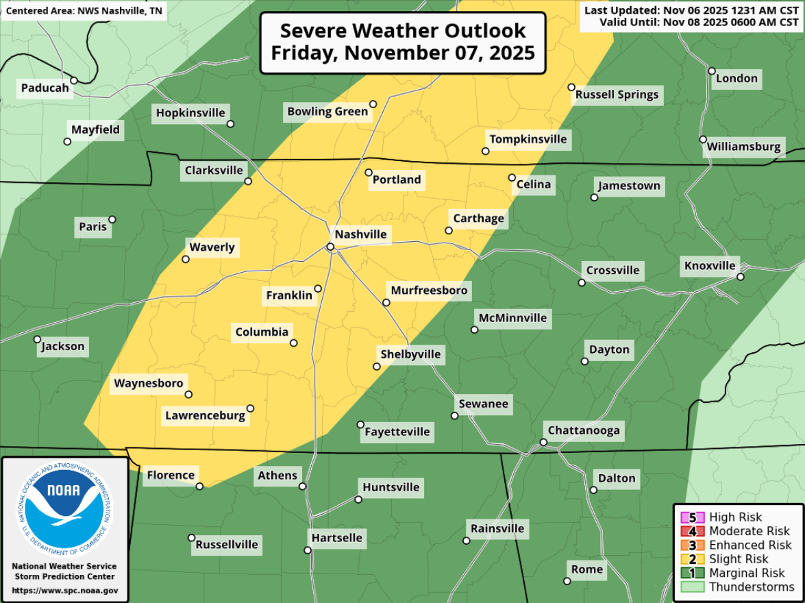
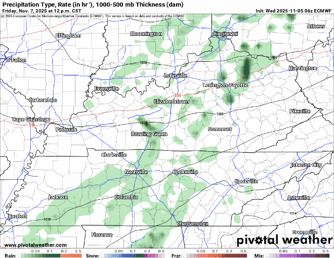
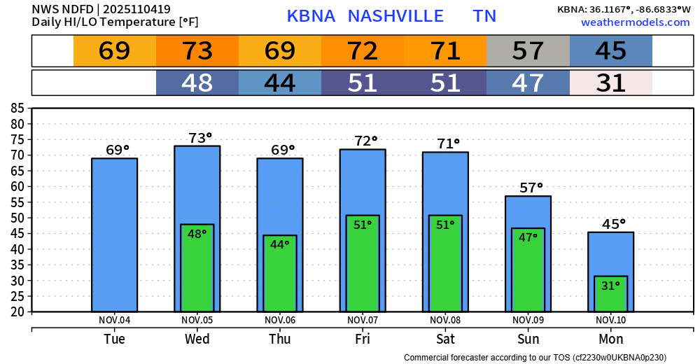
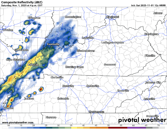
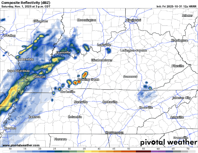
Back to Feelin’ Like Spring Next Week

Few sprinkles possible throughout the evening, but most of us will probably stay dry. Maybe bring a rain jacket just in case; or don’t if you’re feeling dangerous.

Rest of the weekend will be dry besides a few sprinkles possible Sunday morning, NBD. read more

Cool Weekend w/ Unimpressive Rain Chances

Friday will be the exception to “cool” with highs in the mid 60s. Not half bad.

A [mostly] dry cold front will sweep thru Friday night, letting in cooler temps for the rest of the weekend.

Spring-like temperatures return Monday and look to stay with us for most, if not all of next week. read more

Winds Calming Down This Evening, Cooler + Mostly Dry End to the Week

Our Wind Advisory will expire at 6p tonight, when the winds finally chillax. Until then, gusts up to 35 mph will have the cool day feel even cooler.

If you hear anything about accumulating snow – that only applies to the Cumberland Plateau. Can’t totally rule out seeing a few sprinkles, or even a few flurries this evening, but no accumulation is expected here. read more

Wind Gusts Up to 50 mph Today, Thunderstorms This Evening Probably Not Severe

A Wind Advisory is now in effect until 6p Wednesday. Sustained winds in the 20-30 mph range are expected, with gusts up to 50 mph not out of the question.

With the winds coming out of the S/SE, travel (especially for high-profile vehicles) may be a little tricky on W-E oriented roads such as 40 and 840. read more

Windy Tuesday + Wednesday, Storms Probably Staying Below Severe Limits Tuesday PM

Headlines:

A Wind Advisory will be in effect from noon Tuesday to 6p Wednesday for wind gusts up to 45 mph expected.

While thunderstorms are likely Tuesday PM, most should stay below severe criteria.

Let’s dive into the details. read more

Tuesday’s Storms Look Unimpressive, But Worth Watching

Still watching Tuesday for severe storm potential – but the overall chances have come down.

The Storm Prediction Center has outlooked areas S and W of I-24 with a 5% chance of severe weather within 25 miles. This could (probably will) change between now and then. read more

Rain/Storms Likely Tuesday PM, Intensity Unknown

Outdoor burning continues to be discouraged, with gusty winds and low relative humidity values expected thru this evening.

Skipping ahead to Tuesday.

Not much has changed. We continue to be outlooked with a 15% chance of severe weather within 25 miles. read more

Watching Tuesday’s Storm Potential

With warm temps, low relative humidity, and gusty winds today – some elevated fire danger will exist. Under these conditions, fire can spread quickly. Outdoor burning is discouraged.

Jumping ahead to Tuesday. read more

Riding the Temperature Roller Coaster Into Uncertainty on Tuesday

Although this will be a fairly mellow coaster ride, we’ll feel some temperature swings in the upcoming days.

We’ll be at the “top” on Friday with highs nearing 70° – then take a little ride down, bottoming out with highs in the mid 40s on Sunday. 60s return quickly. read more

Temperature Roller Coaster Upcoming

We yet again blew past our forecasted high, getting all the way up to 80° – breaking our old daily record high of 79° set back in 1917.

Some of us may see a quick shower during the early early morning hours of Thursday. “Highest” chances are in N. Davidson Co. (ofc Joelton), but even those chances are still quite low. read more