
A few stray showers can’t be ruled out thru the early afternoon hours, but most of us will stay dry. The sun will start peeking through the clouds more as we go on in the day as well, although the sun will only be up until 4:49p…

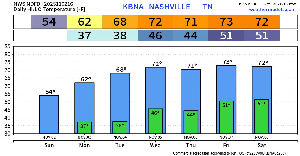
Monday and Tuesday mornings will be the coldest ones so far this Fall. Lows bottoming out in the mid 30s, I won’t be surprised if a few places get really close to freezing – which we have yet to do.
The good news is that we’ll warm up quite nicely each afternoon. Highs in the low 70s by Wednesday and stick around for the rest of the week – nearly 10° above average.
Our next rain chances come along a cold front moving thru sometime Friday PM, and then another one maybe next Sunday – although that timing could change.
“These fronts look strong enough to produce a good chance for showers and some storms. Right now, moisture depth and instability appear to be lacking for any severe storm threat, but given the dynamics / wind energy with these fronts, that could change if things line up a little differently than current models show.” says NWS Nashville.
In short, we could see a thunderstorm, but for now, no severe weather is expected. Things can change between now and then; we’ll keep an eye on things.
Categories: Featured Blog