Few lightning strikes, some those house rattling positive strikes. Most of us will sleep thru it. No severe weather worries tonight. Get some sleep. Rain gone by morning commute. Radar from 1205 AM

Few lightning strikes, some those house rattling positive strikes. Most of us will sleep thru it. No severe weather worries tonight. Get some sleep. Rain gone by morning commute. Radar from 1205 AM

Sleepytime lightning possible overnight. Think most of us will just hear the rain. No severe weather concerns. 939 PM
No lightning detected anywhere close to us at 8:12 PM. Will take a few hours for the heavier rain to slide east over us. No concerns tonight, y’all, no severe weather.
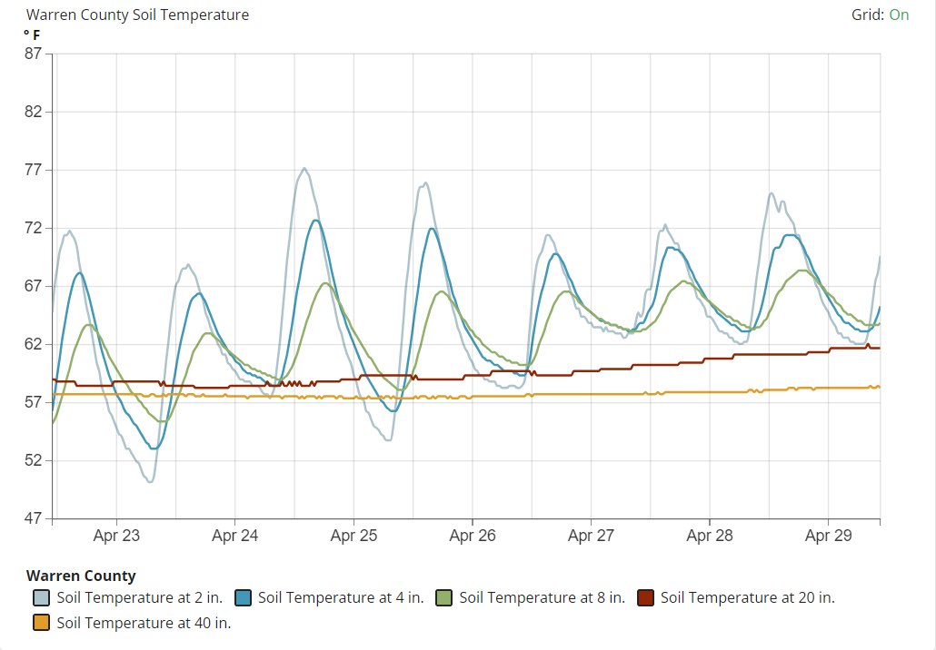
Cicada invasion soon. Little buggers [NOTE: language sanitized] emerge with ground temps at 64F. Closest reliable data source to us – from the KY mesonet in Warren Co KY – shows their soils getting close to the magic number. We are probably a little bit warmer here, being further south. Our forecast has 87F and 89F temps Wed & Thu. So expect them to start showing up this week. Some of us have already seen them. I lived through the invasion in the 80s and it was not pretty. Pro tip: avoid perms, keep it tight, because those lil buggers [again, language sanitized] will pull up in your hair, shoutout to my screaming mother. Also if you have a vehicle with a big front grille, invest in a pressure washer.

Rain, few thunderstorms to begin after dark. HRRR guesses ETA 8-9 PM. Heavier rain after midnight. Lightning only hazard. No hail, damaging winds, or tornado forecast. ETA sunrise Tues.
Planters – First Advisory tomorrow morning. “1 AM TO 8 AM CDT Monday. Temps as low as 33° will result in frost formation.” -@NWSNashville
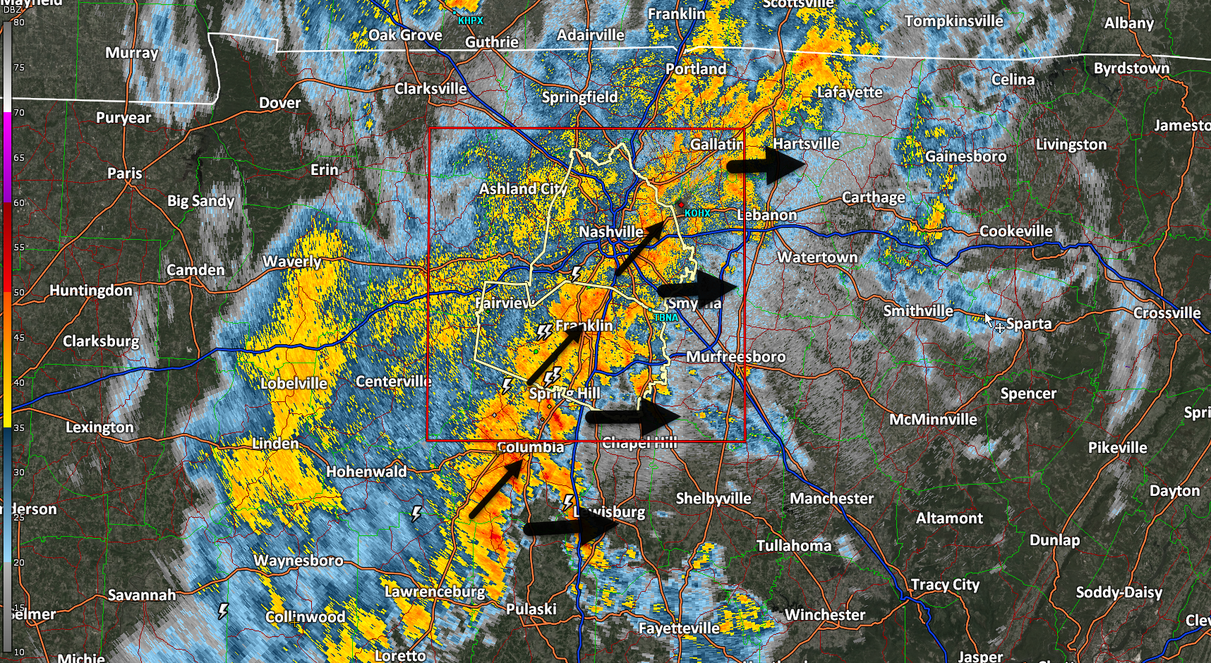
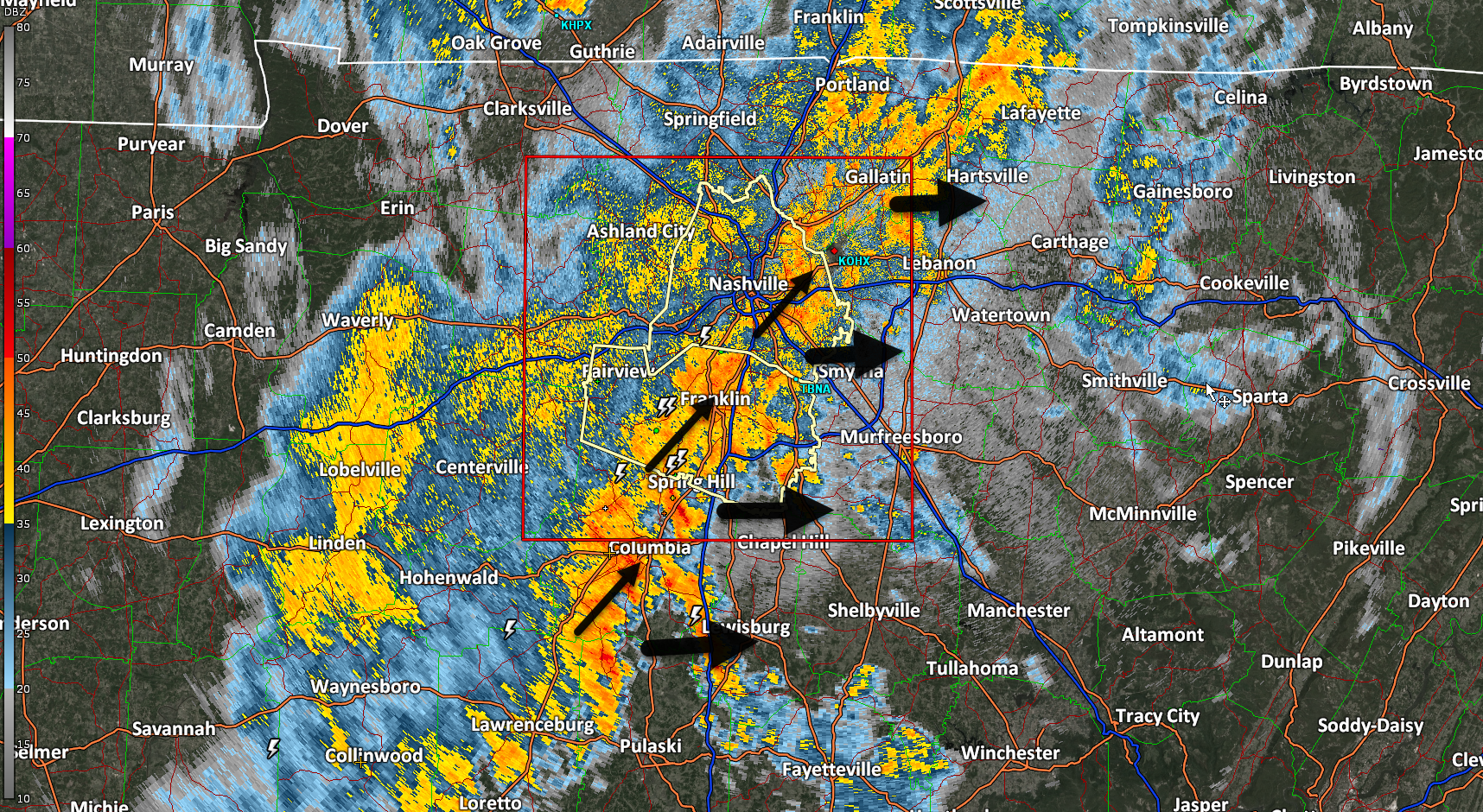
Rain, lightning ongoing. No severe concerns.
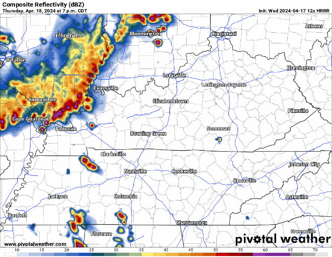
Storms likely Thursday night — Models think no storms today. The atmosphere would support severe weather today if storms could get going, but the last several runs show nothing happening.
But tomorrow/Thursday night a storm complex should drop down I-24 from Kentucky, aka an “I-24 Special.” These are usually dog stressors and noisemakers, with a lightning lottery.
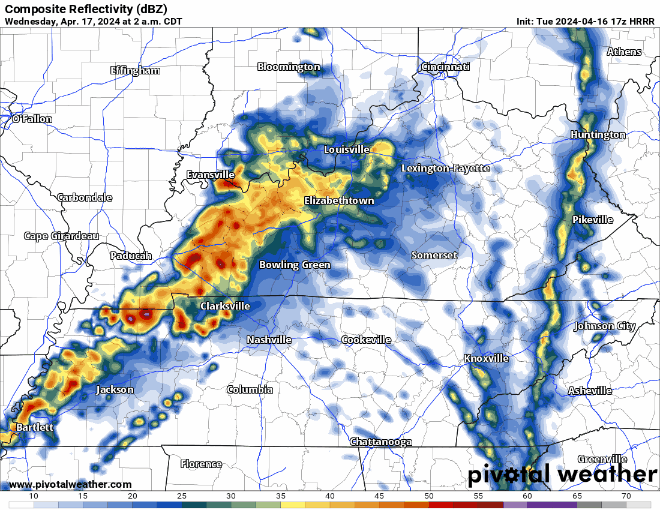
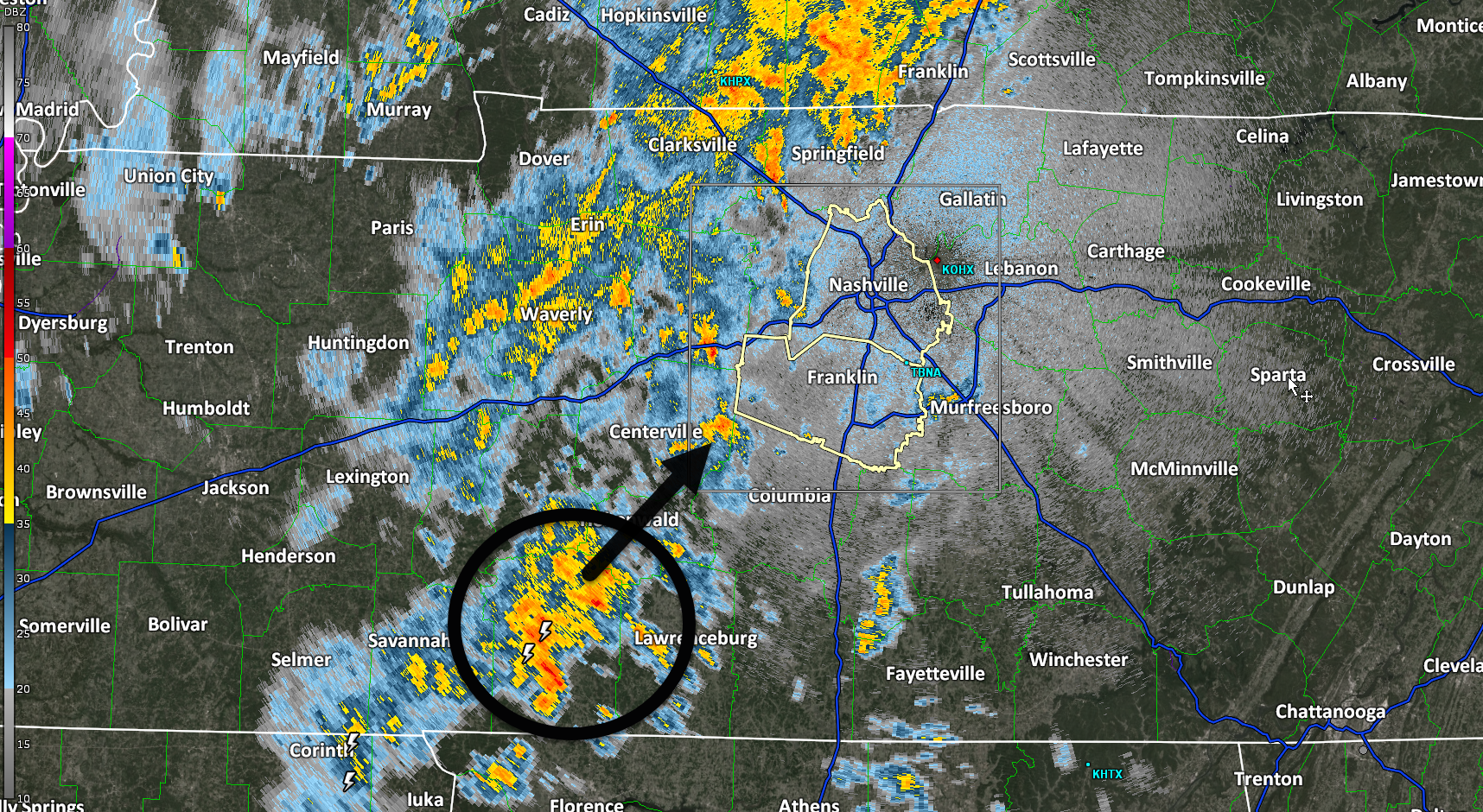
Storms incoming predawn/sunrise tomorrow (Weds) morning. Lightning and briefly heavy rain. Severe weather not expected. Storms lacking key ingredient: CAPE, which is near zero.
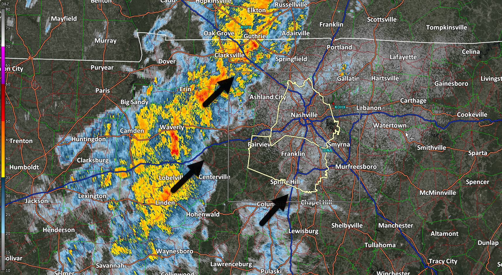
Weds afternoon/evening remains questionable. Previous models showed storms in place, with plenty of storm-making ingredients. While the tornado threat appears to be well north of us, the atmosphere could support heavy downpours, lightning, and low probability of damaging winds and hail. However, the last several model runs do not show any storm formation after the storms that will come through early in the morning.
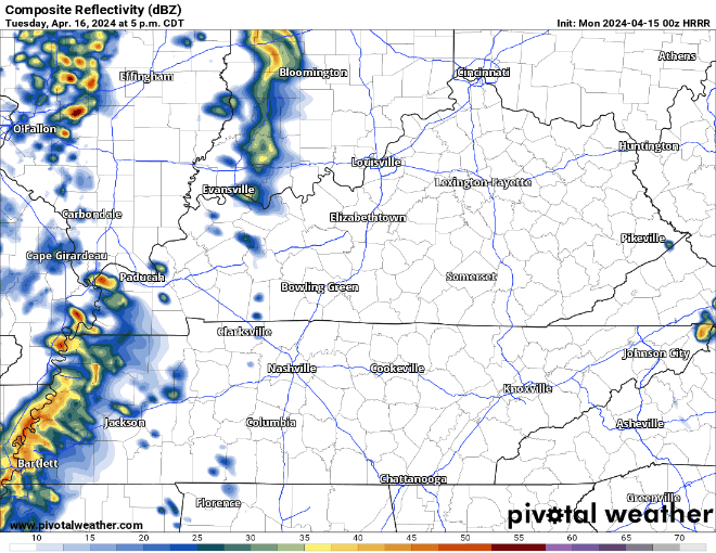
Rain arrives early Tuesday evening if you want to believe the HRRR model. Never believe one run of one model. Remain curious for future runs. Understand rainouts/interruptions will be possible Tuesday night.
You must be logged in to post a comment.