
Storms incoming predawn/sunrise tomorrow (Weds) morning. Lightning and briefly heavy rain. Severe weather not expected. Storms lacking key ingredient: CAPE, which is near zero.
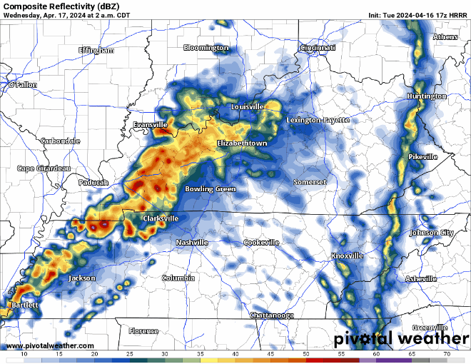
Weds afternoon/evening remains questionable. Previous models showed storms in place, with plenty of storm-making ingredients. While the tornado threat appears to be well north of us, the atmosphere could support heavy downpours, lightning, and low probability of damaging winds and hail. However, the last several model runs do not show any storm formation after the storms that will come through early in the morning.
While the atmosphere could support big storms Weds afternoon/evening, it’s looking more and more like they’ll ghost us.
“This will ultimately be the question and something that will have to be monitored through the day Wednesday. If storms do develop, some could become severe with he greatest threat being wind and hail at this time.“
-NWS Nashville’s mid-day forecast discussion
Categories: Tweet