

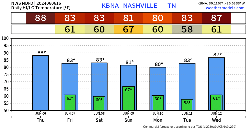
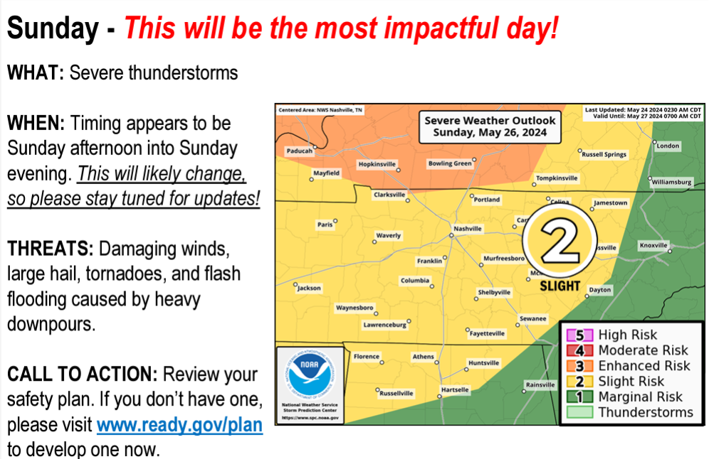
Friday morning rush hour may be rainy, maybe even heavy-rainy. HRRR model:
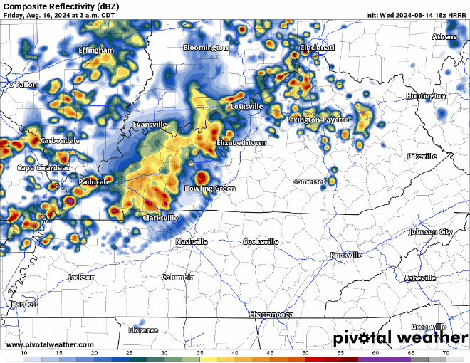
- Previous model runs suggested lightning and maybe a few strong cells. But recent runs show this morning wave weakening on approach. HRRR forecast sounding above shows a big drop in storm fuel as this line arrives.
- Not concerned by this round.
- This forecast may change.
Another storm round is possible later in the day Friday. I’ll update the HRRR model tonight with more data, but from what we see in the data now:


You must be logged in to post a comment.