Light Afternoon Rain
ETAs
HRRR model thinks 1 PM to 2 PM, but it only lasts for an hour or so and is pretty light:
NAM3 model thinks ETA noon to 1 PM, lasting about an hour or so, maybe a little longer, still light:

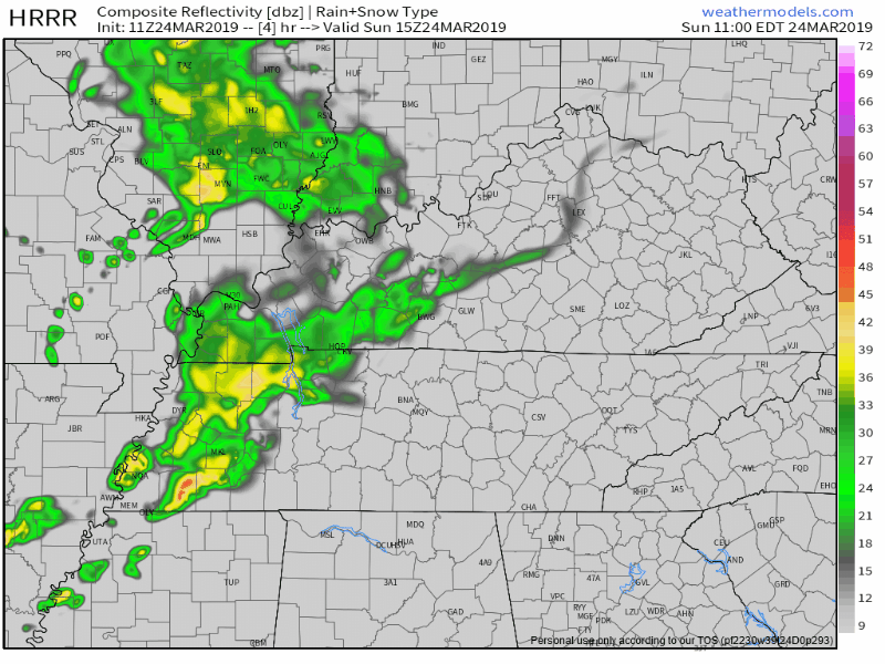
ETAs
HRRR model thinks 1 PM to 2 PM, but it only lasts for an hour or so and is pretty light:
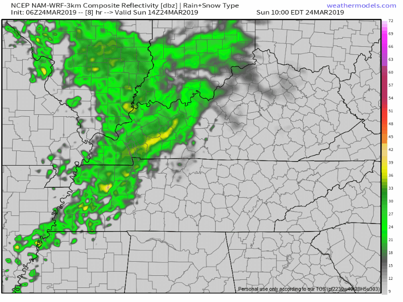
NAM3 model thinks ETA noon to 1 PM, lasting about an hour or so, maybe a little longer, still light:
No clouds in the way today.
Today and tomorrow:

Sunday, clouds roll in and rain chances return.
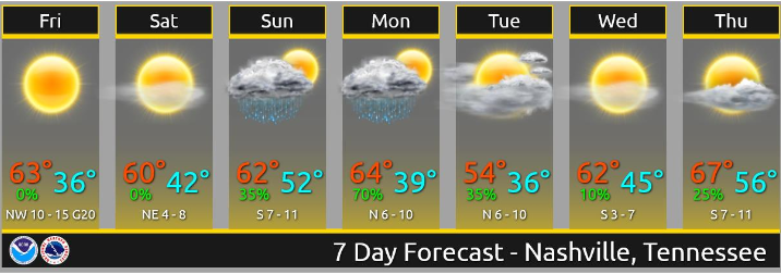
Off and on showers Sunday through Monday with around ½” of rain or less expected. (NWS-Nashville).
Severe weather is on Spring Break. Medium and long range models show no severe weather through at least the rest of March into early April. These models aren’t always right but this is what we want them to say.
Dry today. Tonight more clouds arrive and we resume talking rain.
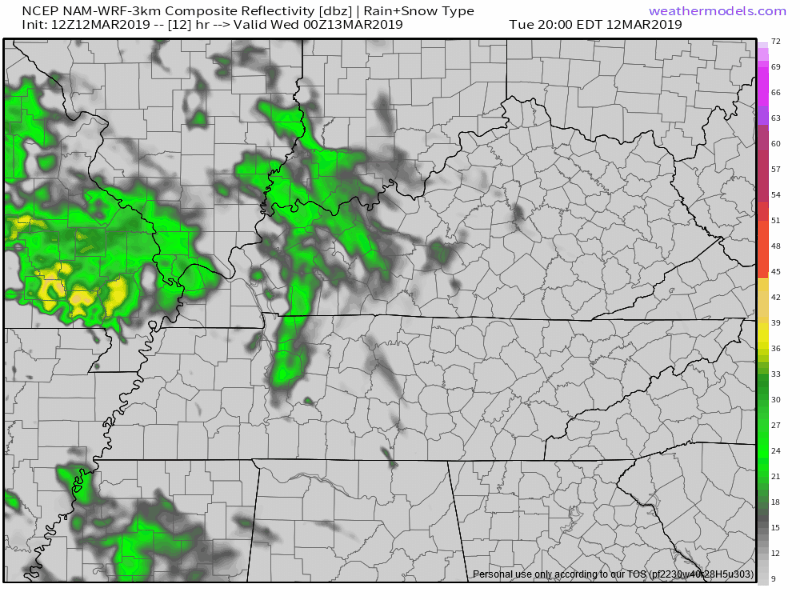
The NAM3 model thinks light rain is possible at times tonight and again before sunrise Wednesday:
HRRR model thinks no rain tonight, but maybe a light shower before sunrise Wednesday morning:

Last night’s forecast was “no rain until Thursday!”
Uhhhh. Then this morning happened.
Light rain this morning surprised me. Rain was supposed to pass completely south of us. Most of it did. But we still got some this morning. At 5:56 AM NWS-Nashville noted approaching rain in West Tennessee was not reaching the ground thanks to a low level Dry Air Monster.
Dry days ahead!
Pretty warm, too.
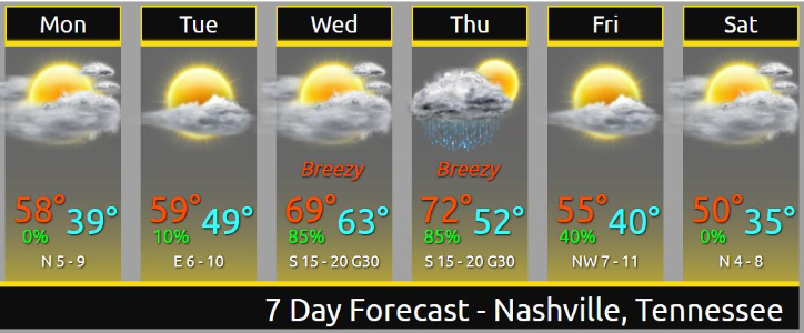
Rain and storms may start late Wednesday night/wee hours Thursday morning.
South winds will be strong. The Euro model thinks winds will gust over 40 MPH. Storm strength will depend on instability and dewpoint levels. No two storm events are the same, but this looks pretty similar to what we saw yesterday/Saturday — plenty of wind energy, questionable instability. As usual, considerable uncertainty, especially this far away.
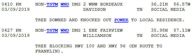
Last night’s storm reports weren’t from storms but from the Wind Advisory. “Non thunderstorm-winds,” they call it.
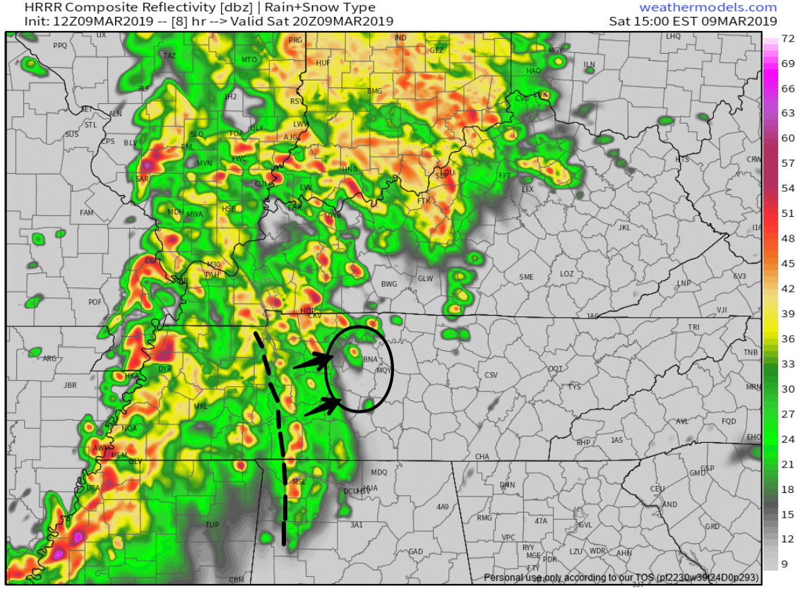
Rain reached 2″+ in spots yesterday. Creeks and streams rose quickly and fell not as quickly. A few rivers reached pre-flood “action stage.” For more on that, this.
Severe weather requires the right ingredients coming together at the right time. Severe weather ingredients may come together this afternoon and/or early tonight.
Two waves of storms, both with severe potential.

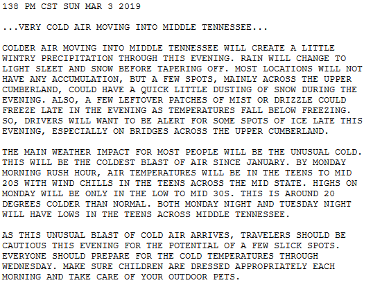
Cold continues. Wind chills in the low 20°s around sundown then upper teens tonight.
Even colder tomorrow morning. Wake up low 19°, wind chill 13°.
I mean, yeah, technically it’s still winter.
Wednesday’s high is 39° – a meaningful improvement – then Thursday morning another ice boxer 24° (wind chill 21°), but 52° Thursday afternoon.
Radar images coming out of Georgia this afternoon are upsetting. Numerous tornado debris signatures, obvious tornadoes, some tearing through towns, from what’s fair to say they’re enduring: a tornado outbreak.
You must be logged in to post a comment.