
It’s been a great weather week. Well, the good times never stay. And the cheap thrills always seem to fade away.
Fall begins at 803 PM in one week (September 22) so you’d expect temps to be easing on down into Autumn range, but, no.

It’s been a great weather week. Well, the good times never stay. And the cheap thrills always seem to fade away.
Fall begins at 803 PM in one week (September 22) so you’d expect temps to be easing on down into Autumn range, but, no.

Boring is good.
A ridge is an elongated area of high pressure. We’ll have one for a while. That means
We will still sweat.
When will the heat break?
Models disagree (shocking, I know).
Euro (below) thinks late next week (Friday the 23rd), the first full day of Fall!

/stands up, stacks papers/
Just one item y’all. We ride. Check this out 👇🏽.
Warmer each day, eventually to 90° because it’s still summer.
I will now take questions.

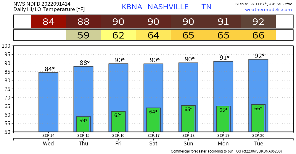
How Long Will We Ride This Lower Humidity?

Today-Tuesday is back-to-back glorious. Temps either side of 80°. Pleasant humidity.
We warm up Weds and should be to 90° by Friday.
Dewpoints should stay below 60° all week. Last week dewps were in the upper 60°s and low 70°.


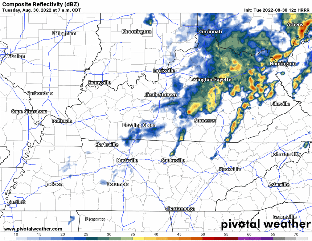
The HRRR model isn’t exactly sure what will happen this afternoon but the latest HRRR model run wants football.
HRRR Model Noon – 3 PM, tailgating off/on rain with a few lightning strikes possible:

Yesterday’s uncomfortable humidity is gone … for a few days. Comfortable air will hang around today and Thursday.
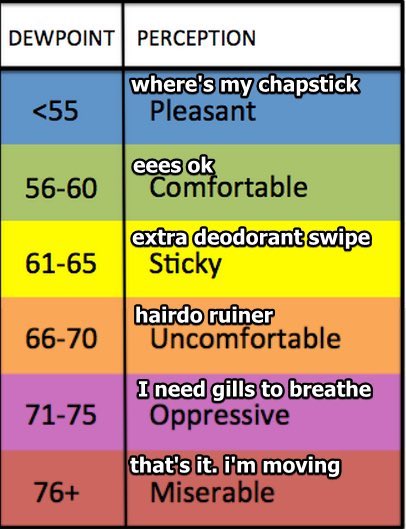
Humidity turns Uncomfortable Friday and hangs on for a while.
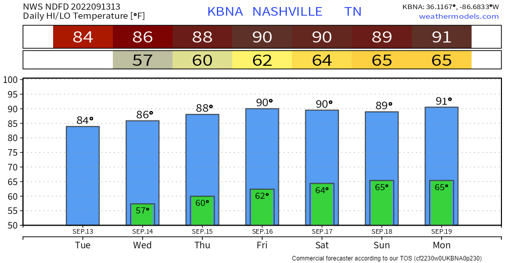
Model data high temps for the next seven days says It’s Still Summer:

Doubt much’ll happen today.
Quiet Weds, Thurs, and most of Friday while dewpoints drop from Uncomfortable to Comfortable.

Humidity returns to Uncomfortable Friday night through the weekend. Another swampy airmass supportive of random pop up showers and storms. Late afternoons and early evenings the most likely times. Wattery Szn runs through September?

This blog has no concerning SPC/WPC outlooks for flash flooding, tornado, hail, or widespread damaging straight line winds. How-Ever! There will probably be rain and lightningstorms?
Only a few storms around regionally this afternoon and early tonight. Models think storms will stay west of us today like they did yesterday (we will see about that). Few clouds will allow mid nineties temps. High humidity will send the heat index to 102°.

Hot, probably quiet weekend.
Rain/storm coverage looks to be considerably less today than yesterday which will likely allow temperatures to get a few degrees warmer than yesterday, too. Sunday should be similar, with only isolated to widely scattered rain chances and temperatures running into the low 90s.

I took my kid to the orthodontist yesterday and greeted the two lovely reception staffers with a sincere Hello Teeth People! They said we are more than that! Indeed! They shined light through the office while they straightened teeth. Also they had some great teeth hygiene analogies that has got me flossing more. May your Friday encounter these lights, not storms, but you may encounter a storm.
You must be logged in to post a comment.