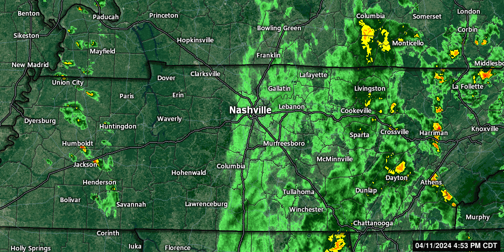
5:54 pm, maybe not quiiite done with the thundershowers. A few more cells have developed west of us and may come through later. Moving NW to SE. Non-severe.

5:54 pm, maybe not quiiite done with the thundershowers. A few more cells have developed west of us and may come through later. Moving NW to SE. Non-severe.
Incoming storms are non-severe, but will produce brief heavy rain and lightning. Get wherever you’re going if you have lunch plans. 12:06 pm
Back into the 60s today! Sun, high of 63°.
First Saturday of the month. Tornado siren tests are today. Davidson Co at noon. Williamson at 1:00 pm.
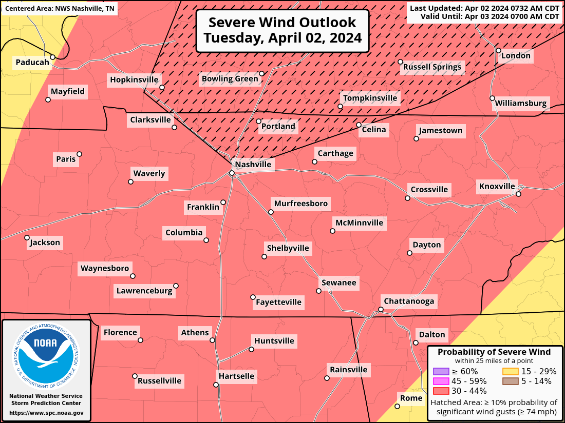
Our probabilities from the SPC remain unchanged for now. Within 25 miles of you, there is a 30% chance of damaging straight-line winds, a 30% chance of large hail and a 10% chance of a tornado, which could be strong (EF2+).
A favor? Y’all click this link real quick so we can test capacity? nashvillesevereweather.com Try and break it. Testing some website stuff.
Except for blog posts, all updates from now until the storms move out on Tuesday night will be over on X (@NashSevereWx). We’ll see ya there. Latest blog post below.
Tuesday: “Storms could produce damaging winds that could blow down trees, cause power outages, and cause some structure damage; large hail that could damage roofs and cars; frequent cloud to ground lightning; and a few tornadoes. Outdoor events may need to enact safety procedures due to fast storm motions and significant impacts.” – NWS Nashville

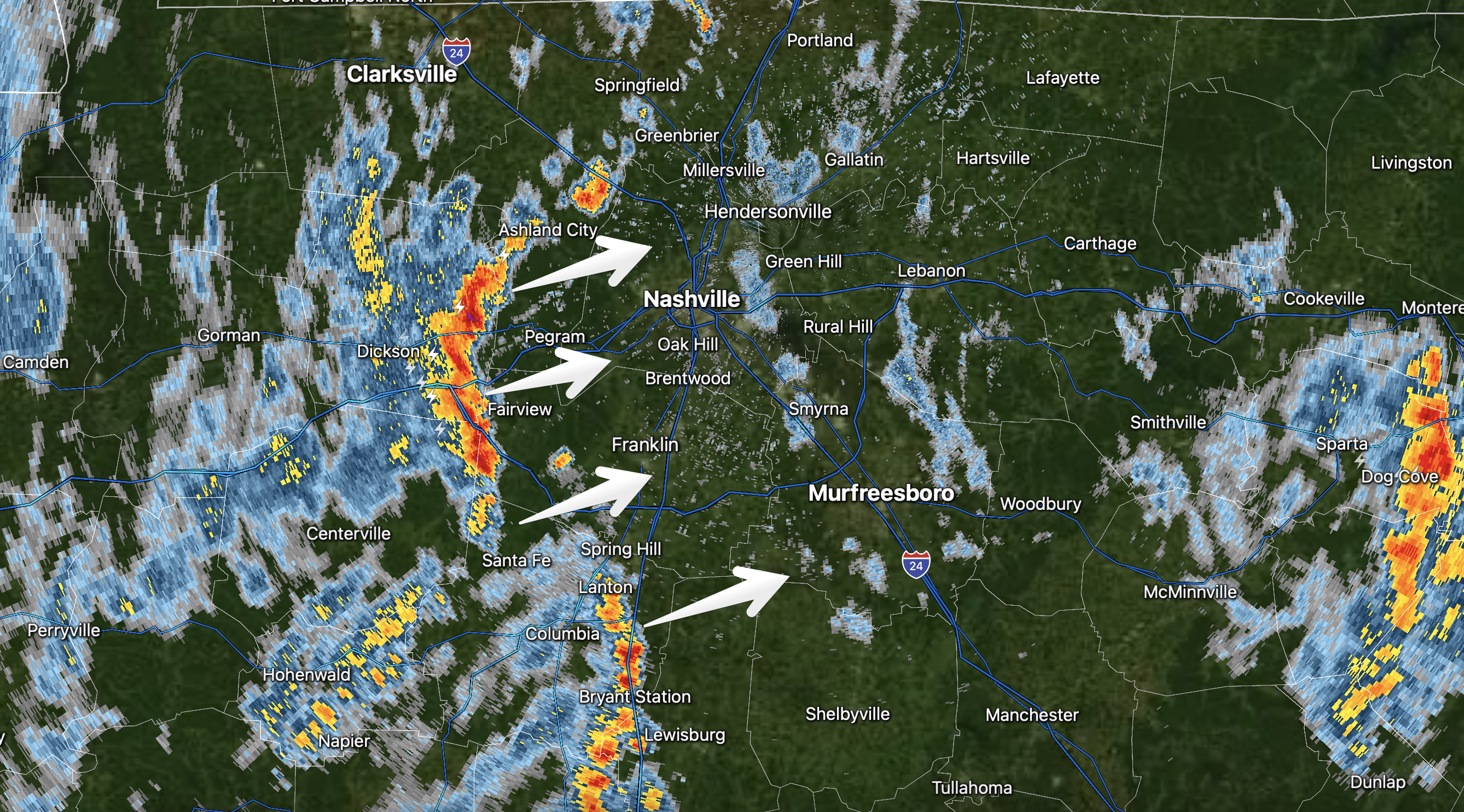
Latest HRRR for tomorrow shows showers in the morning and the “main event” storms after noon into the evening. Don’t get caught up in exact placement of storms on this one model run. Stay connected. The forecast could change. Loop 2am-10pm.
Preparing for severe weather tomorrow, some tips:
You must be logged in to post a comment.