
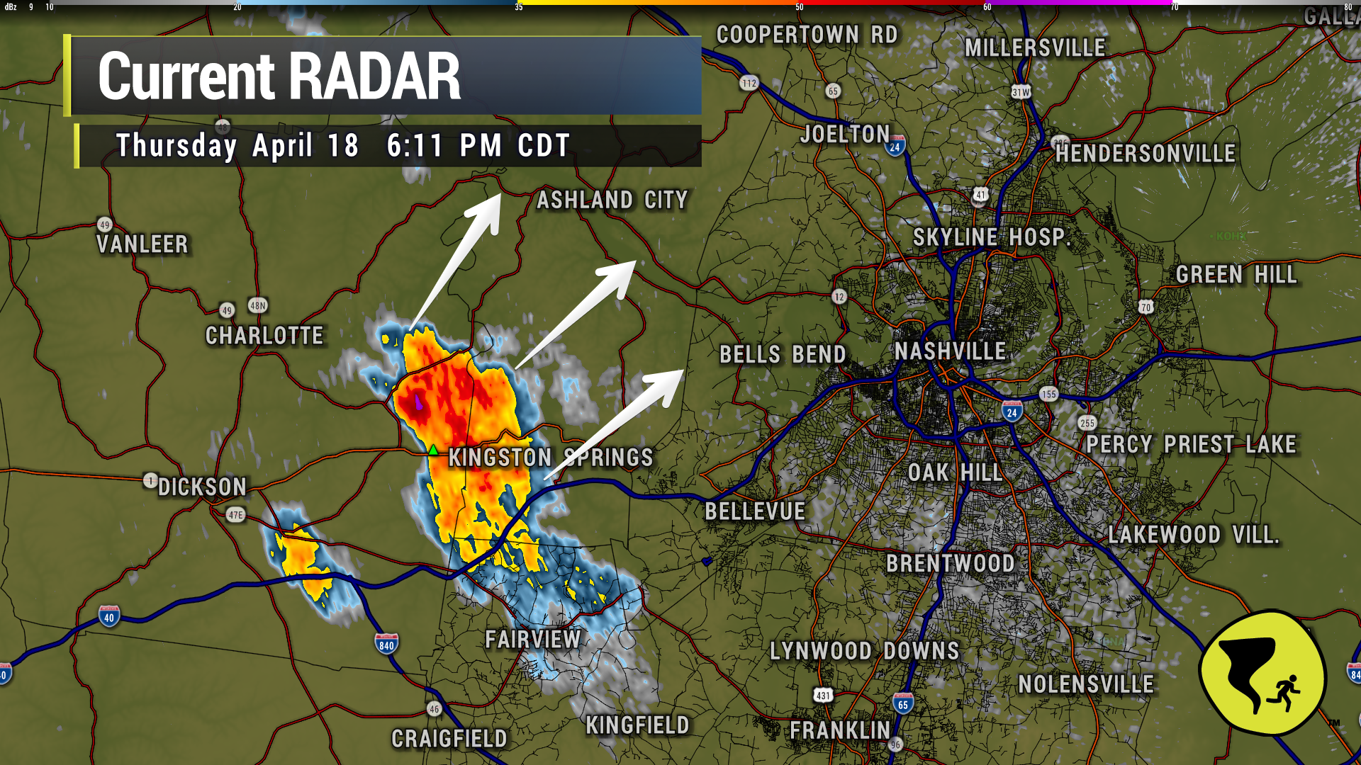
40 mph winds and pea-size hail possible inside the white polygon (Joelton) if this cell holds together, per NWS.

40 mph winds and pea-size hail possible inside the white polygon (Joelton) if this cell holds together, per NWS.
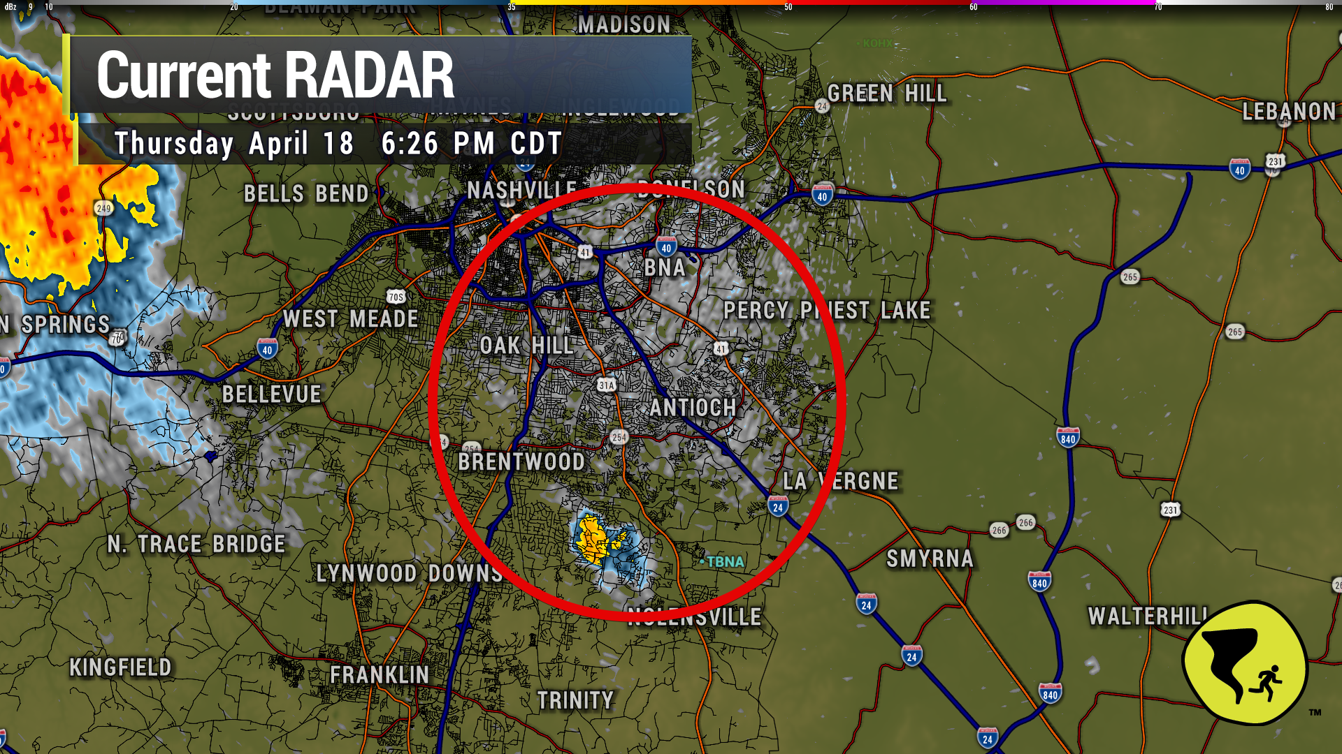
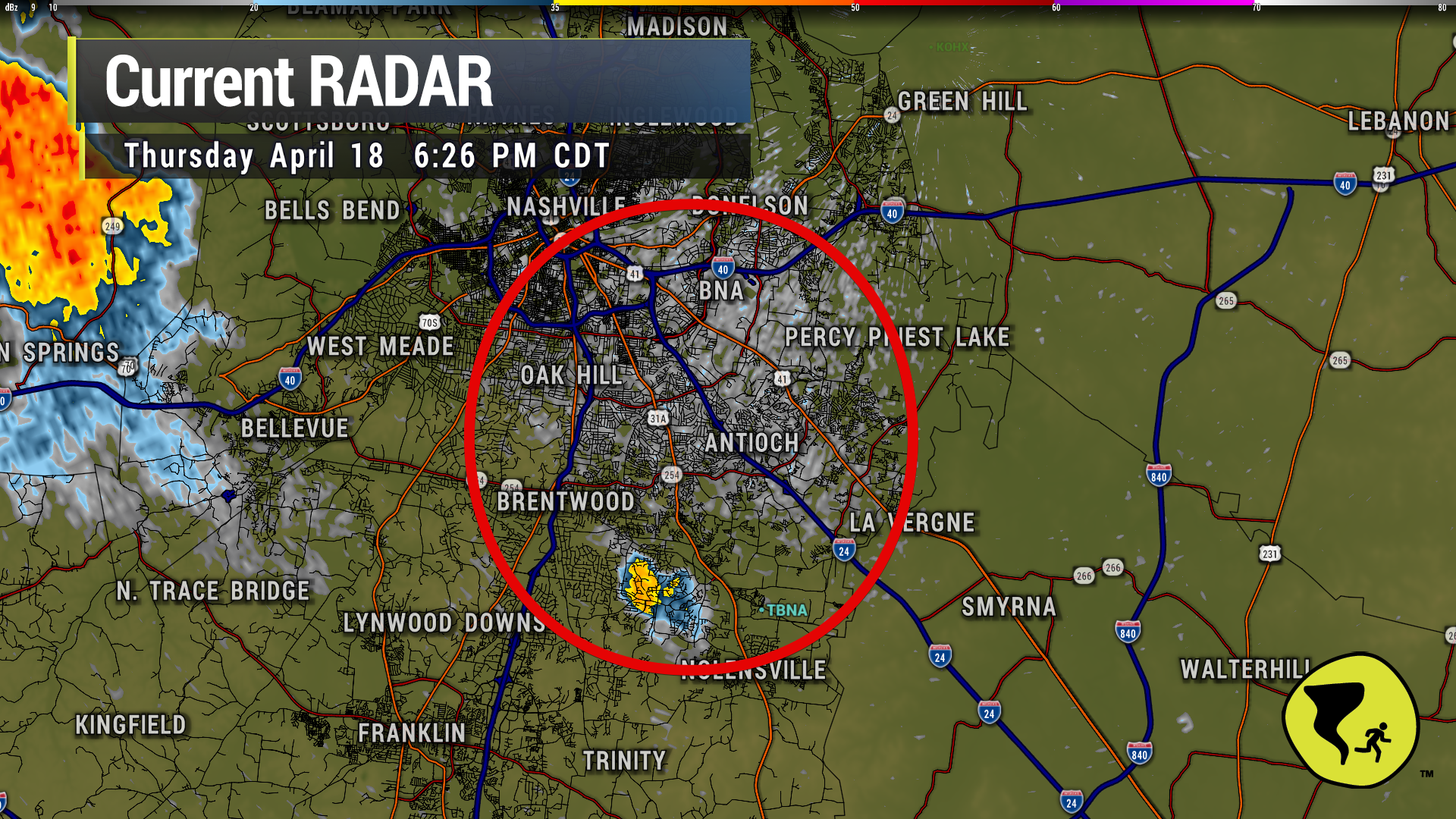
Little cell is tryyying to get going in E Brentwood. Watching it aloft to see if it starts gathering a bunch of water up there. Might get rain soon inside the circle.
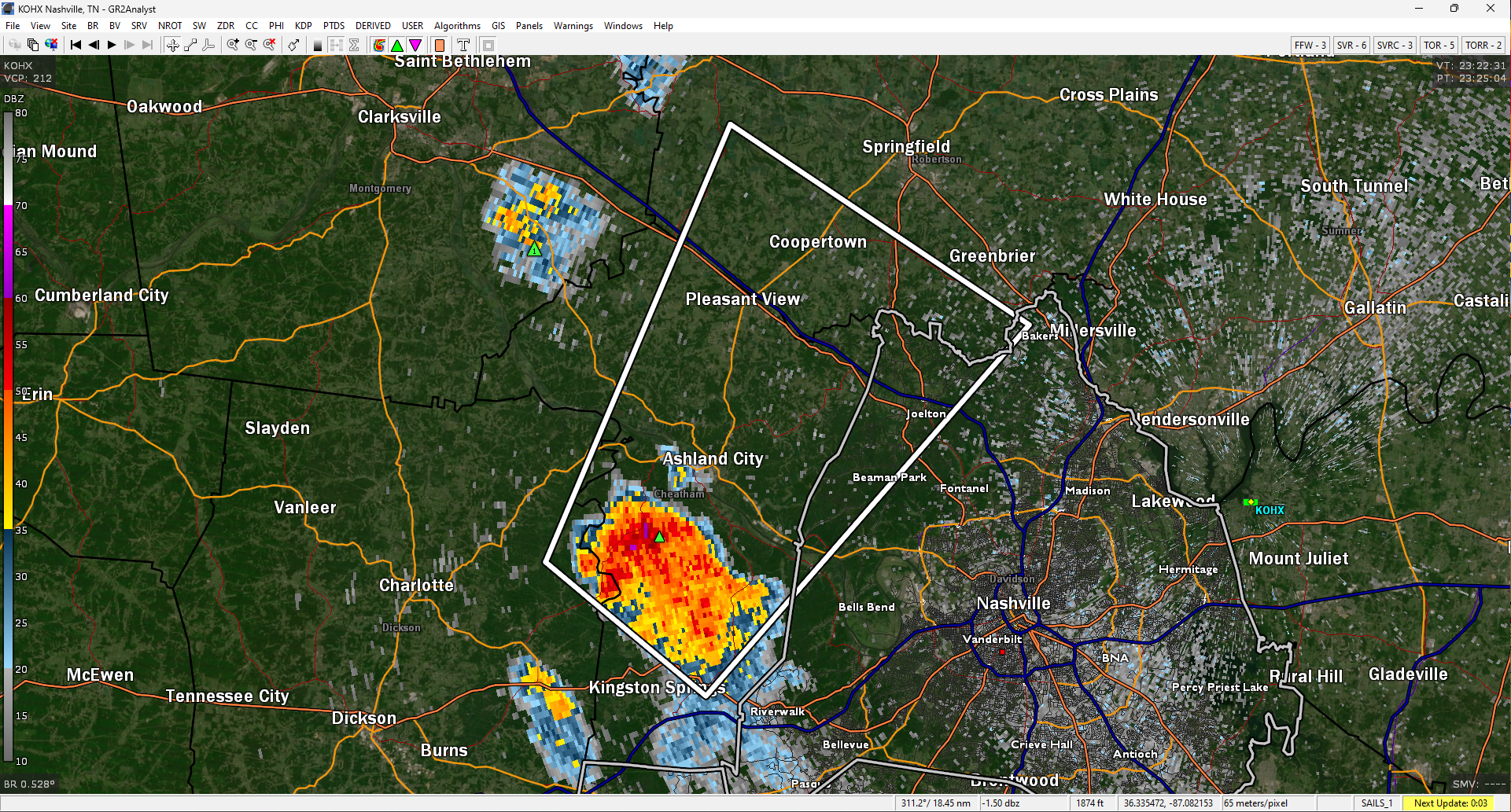
The winds aloft are trying to push this storm into Nashville, but there’s a carrot on a stick pulling the horse’s head toward the left as it follows a good lift source just ahead of the storm. So…the strongest part of the storm will stay near that lift source and tend to be on the north side. Should miss downtown Nashville. Might even miss Joelton. We’ll see. Lightning still an issue with this storm. 6:18 pm
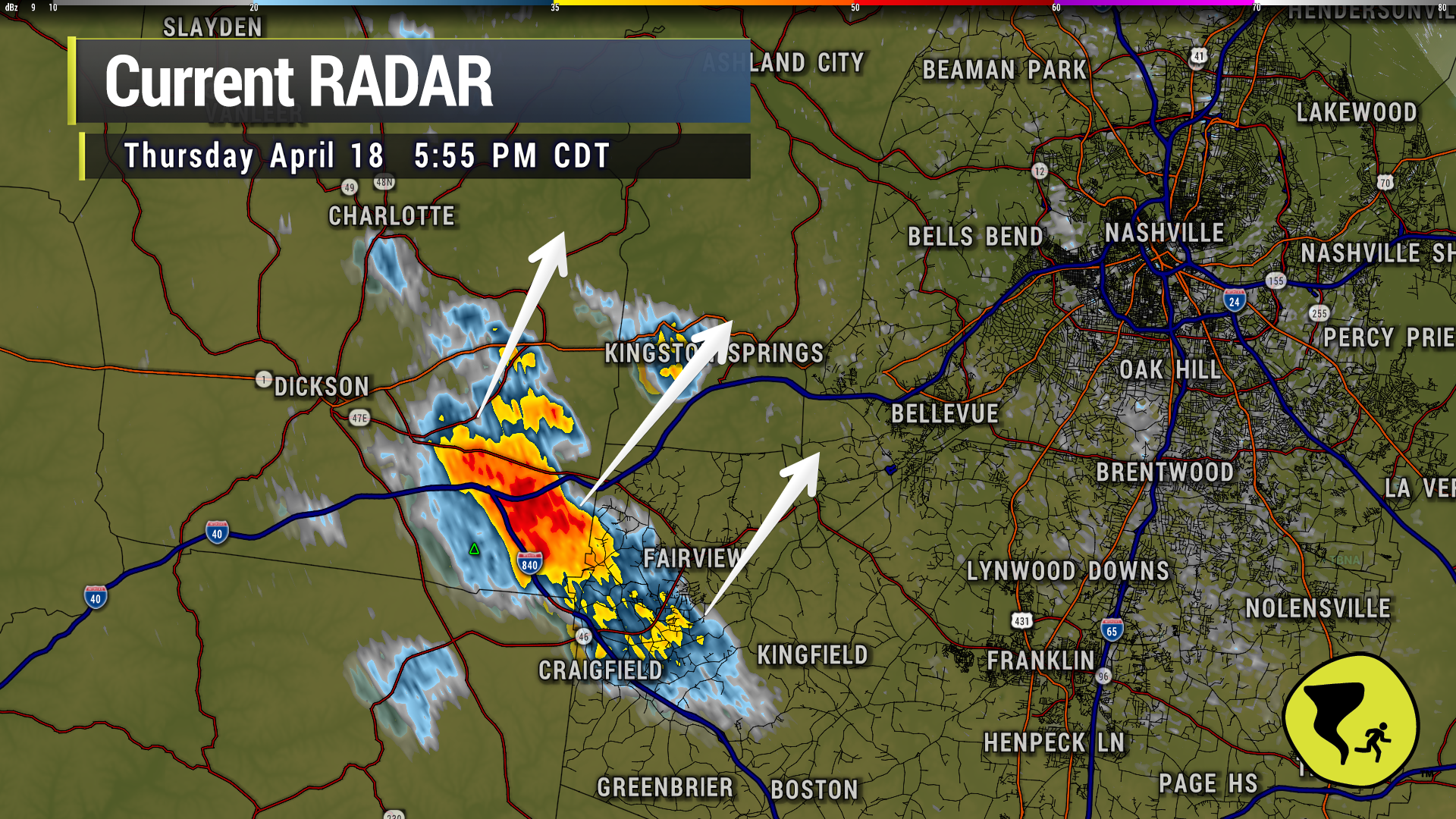

The core of this cell is trending more NNE than NE. Looks to miss Fairview and Bellevue and more toward Cheatham Co. Still…lightning will likely strike beyond the core of the storm. If you hear thunder, head indoors. 5:56 pm
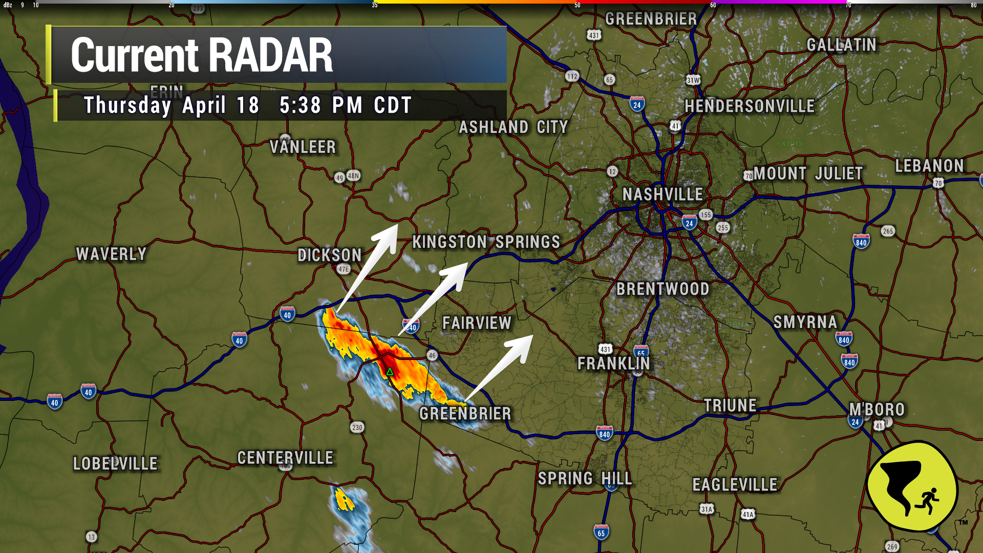
Storm has perked up entering western Williamson Co. Headed for Bellevue and perhaps Nashville W of 65 over the next hour….if it holds together. Lightning IS occurring. Head inside if you hear thunder. 5:39 pm
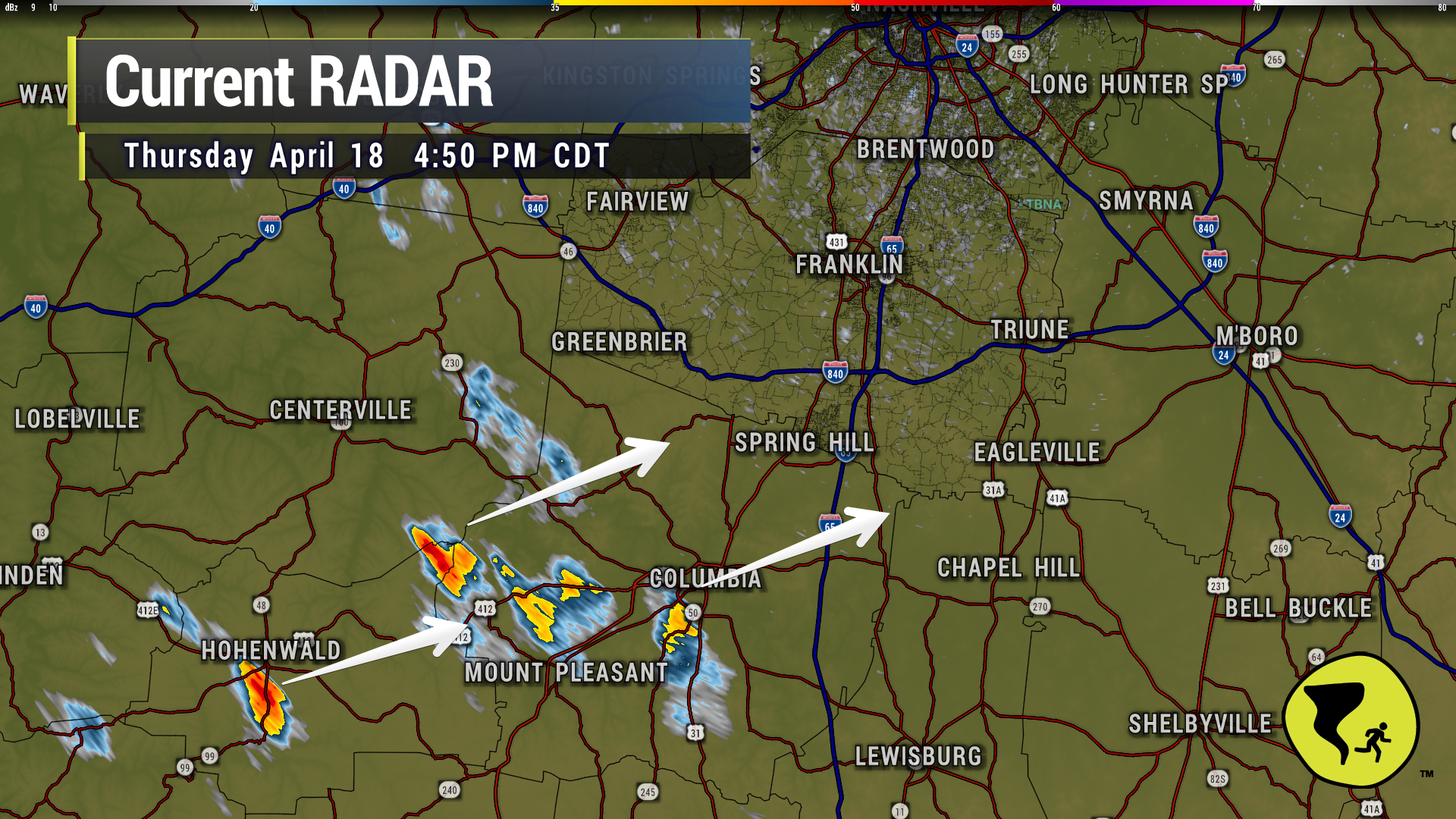
Coupla no big deal downpours moving NE through Maury Co. Could be in Spring Hill and Bethesda in the next 30 min or so. Might be lightning makers if they gain strength. 4:52 pm
NWS: “We continue to expect a few instances of localized gusty winds and marginal severe hail with the early evening scattered storms. Later storms coming in from the west northwest after 10 PM will have better shear, so gusty winds and maybe a QLCS spinup tornado cannot be ruled out as the storms approach. But the late storms will weaken considerably as they push into our area and especially toward I-65.”
NWS: “We continue to expect a few instances of localized gusty winds and marginal severe hail with the early evening scattered storms. Later storms coming in from the west northwest after 10 PM will have better shear, so gusty winds and maybe a QLCS spinup tornado cannot be ruled out as the storms approach. But the late storms will weaken considerably as they push into our area and especially toward I-65.”
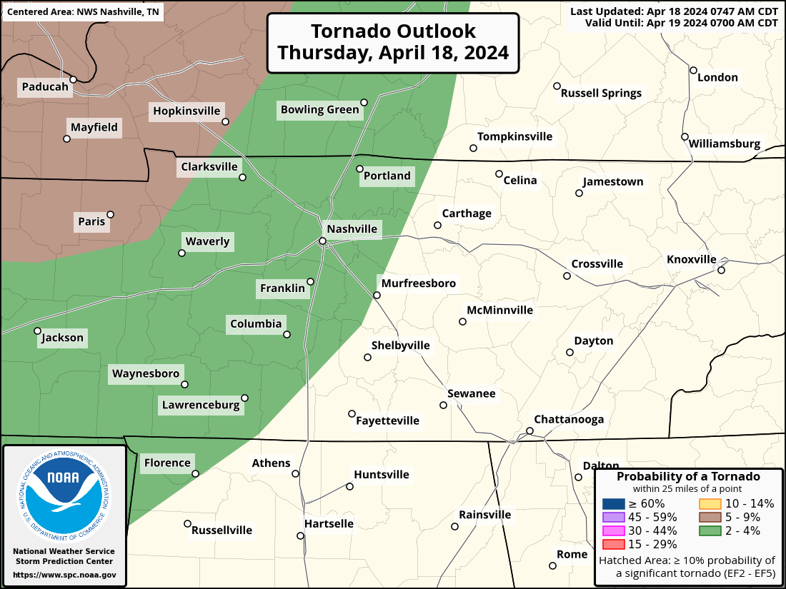
Storms expected this evening and tonight. Low tornado thread added.
Within 25 miles of you tonight, there is a 2% chance of a tornado occurring, a 15% chance of damaging wind occurring and a 5% chance of large hail.
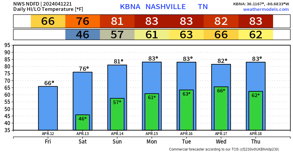
Winds will die down tonight, leaving us with crisp temps in the mid to upper 40s. Big warm-up starts Saturday, with a high of 76° and mid-80s by early next week.
Since it’s Spring and all…we live among the battle of the air masses. So, our next storm system moves across the central US just as we start warming up. The system should arrive here around Wednesday and could hang around until the weekend. While we are not currently outlooked for severe weather, it will bear watching. We can’t turn our backs to the western sky this time of year.
You must be logged in to post a comment.