Author Archives

Andrew

Eyes on Next Weekend

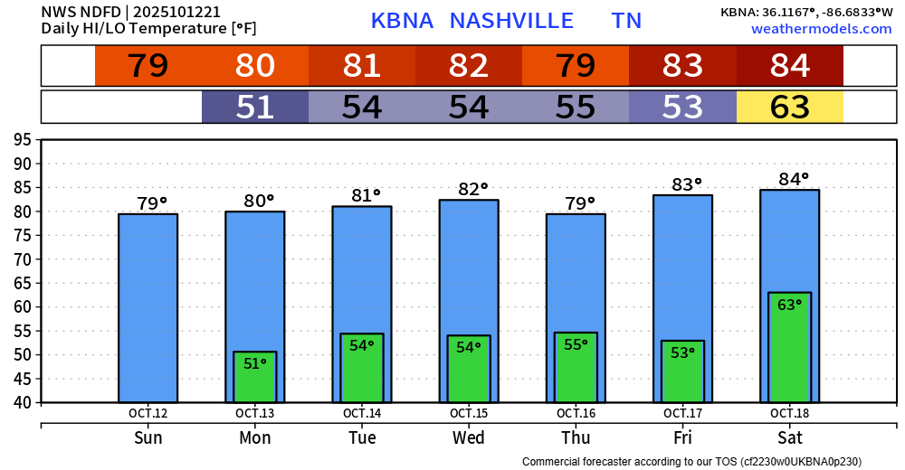
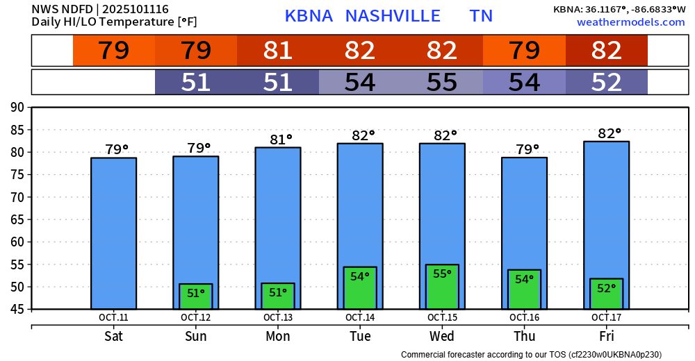
In the near-term, our days and nights will be near carbon copies of each other, highs around 80….morning lows in the low-mid 50s.

Looking toward next weekend, a trough of low pressure “of decent strength” (NWS) could move through from west to east. While it’s too soon to tell whether we could get severe weather out of it, these are the types of Fall systems that can deliver such. read more

The Drought Monitor Is Back

We call it the Wattery. It’s like the lottery, except with…rain. Been around Nashville long enough, and you know, rain chances verify with a little bit of luck this time of year. Those rain chances start very low today and gradually ramp up by mid-week, likely peaking Wednesday. We’ll give them shout-outs on socials when they get going each day. As usual, storms are most likely during the hot afternoon/early evening. read more

Tornado Watch Until 11:00 pm

What’s left of Beryl is a low end severe threat for us. SPC calls it a 5% chance of a tornado occurring within 25 miles of you. Lower chances SE of Nashville.

There is also a low risk of damaging straight-line winds with storms that occur where you are. read more

On Patreon and Something New

While this isn’t a forecast blog, this is a look ahead to something coming soon!

David, Will and I remember the days, not so long ago, when we were financially supporting NashSevereWx out of our own pockets. Granted, we didn’t have as many ongoing costs as we do now. But, being weather twitterers was a sandbox we wanted to play in, and our families were gracious enough to humor us (and still do). read more