
Really nice day today, BNA got up to 64° for a high temperature.
Tomorrow will be more of the same, high temperatures will get close to 70°. Winds will pick up tomorrow afternoon, gusts up to 20 – 25 mph will be possible.

Really nice day today, BNA got up to 64° for a high temperature.
Tomorrow will be more of the same, high temperatures will get close to 70°. Winds will pick up tomorrow afternoon, gusts up to 20 – 25 mph will be possible.
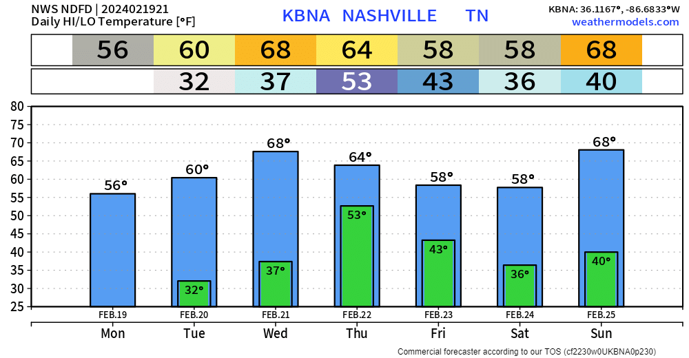
Warm + dry weather expected the next two days. High temps get into the low 60s tomorrow, and even surge into the upper 60s Wednesday.
Our relative humidity values will be in the low to mid 20% range Tuesday and Wednesday, but thanks to recent rains and light winds (besides Wednesday), our fire danger will remain very low.
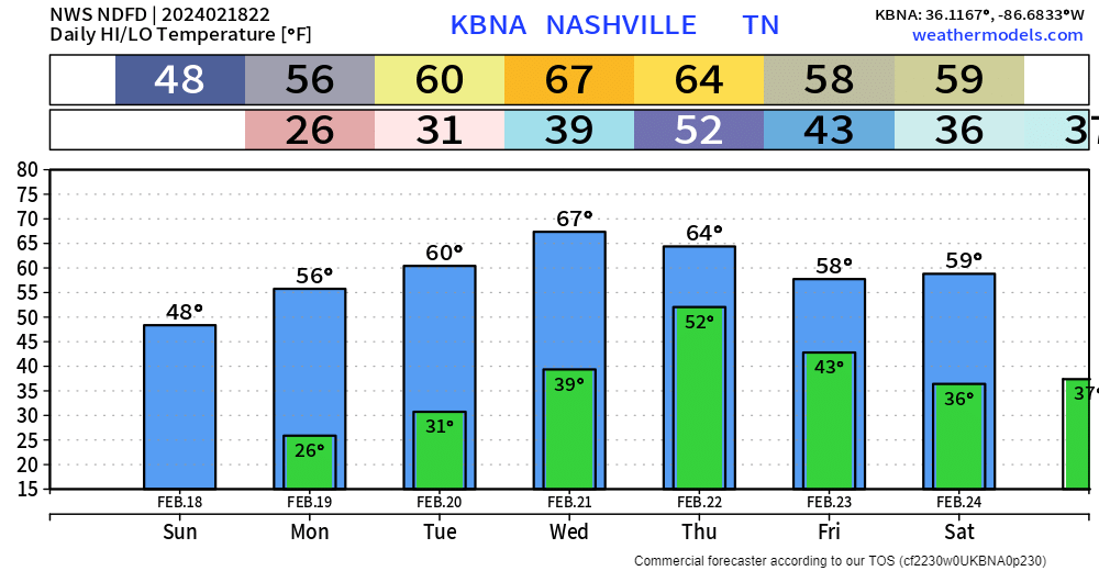
Sun feels a lot better than the shade, but overall, pretty chilly. Thankfully, we have a good warm-up coming up.
High temperatures will be back in the 60s by Tuesday and remain there for several days. Nice weather all week besides Thursday.
The sun helps out a bit, but we are still stuck in the mid 30s, with our wind chills in the upper 20s. Not very ideal weather.
Thankfully, we’ll gradually warm up throughout the week.
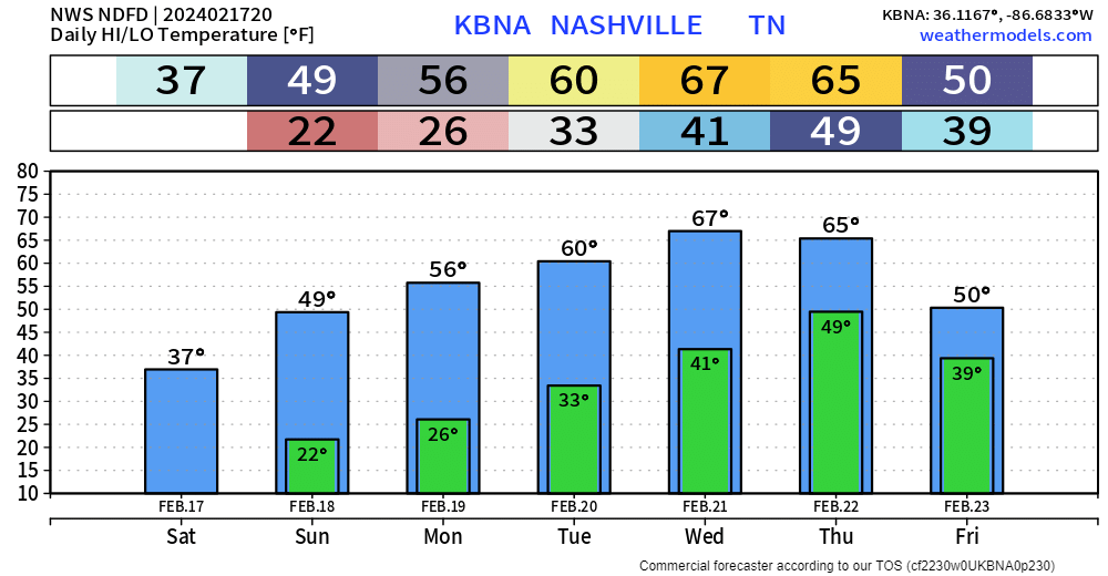
Still several cold mornings to get thru, Sunday morning we’ll wake up in the low 20s, Monday morning in the mid 20s, but temperatures will recover well during the day.
Housekeeping: well y’all crashed our site again. We’ve been in process of migrating to a wayyy more robust server. Should complete this weekend. So we’ll let the website smolder now and will go OG and cover this event on X.

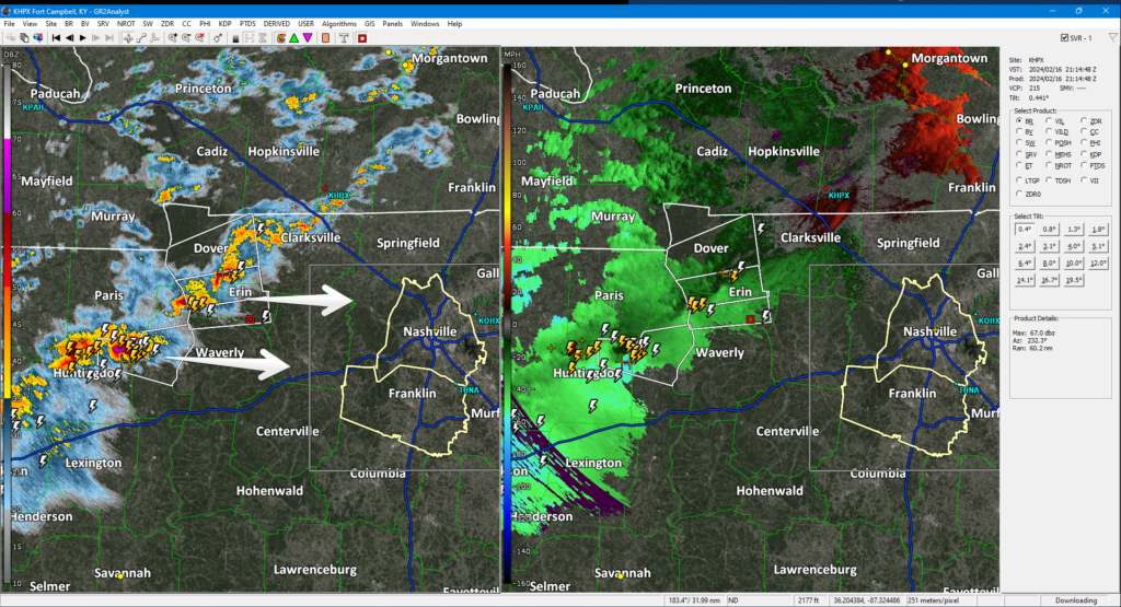
Approaching storm line healthy. Producing frequent lightning. Even rotating at mid levels. Expect here heavy rain, lightning, gusty winds, maybe small hail 5-6 PM, give or take an hour or so.
Brace yourself for a drastic temp change. 60°s this afternoon. 30°s before midnight with subfreezing wind chills lasting until late Sunday AM.
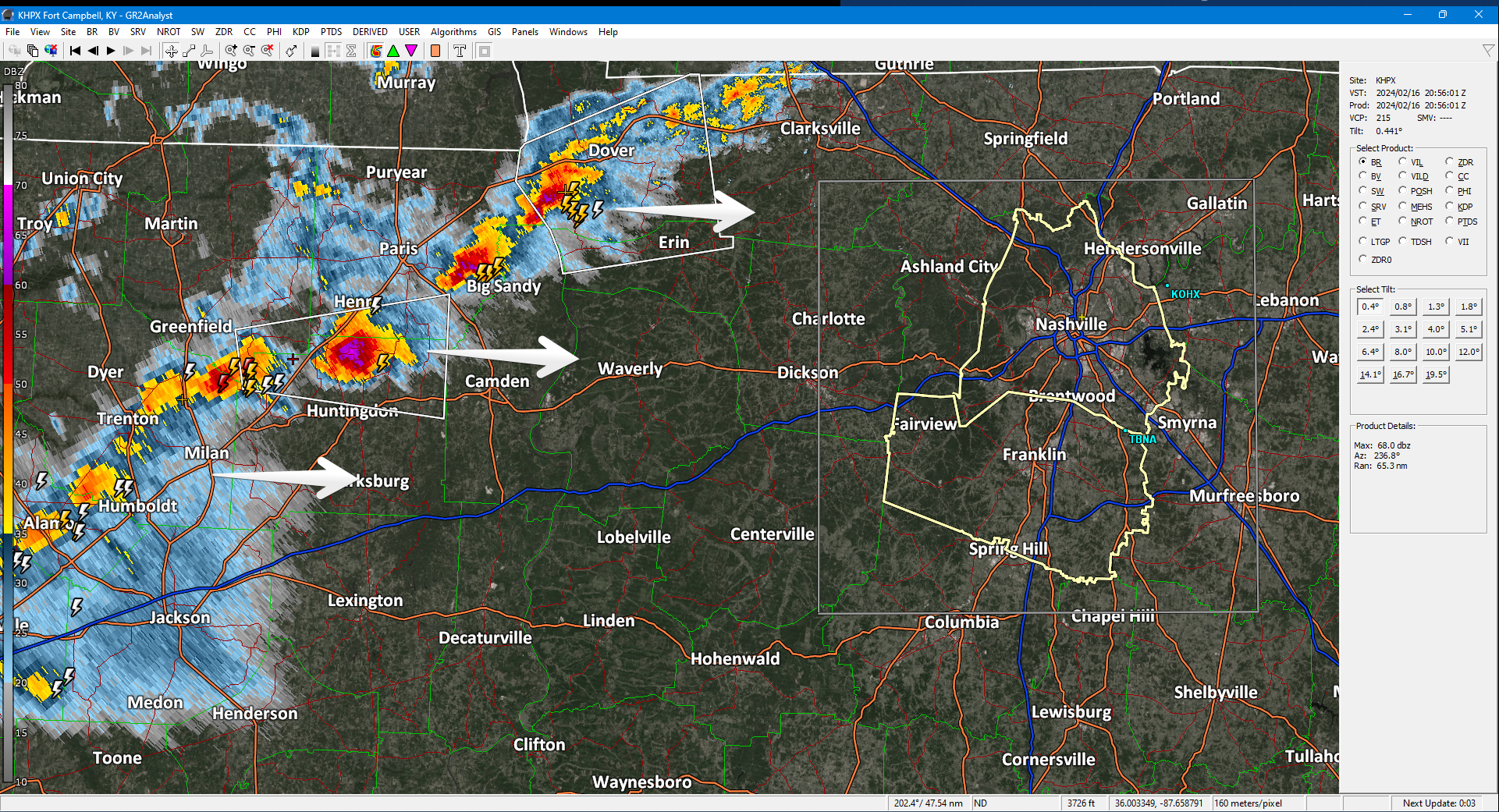
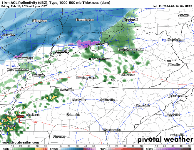
At 3 PM a strong thunderstorm line formed in West TN moving our way. Lightning, small hail, gusty winds, brief heavy downpours. 5-6 PM ETA per HRRR model. Very cold air behind it, bundle up if going out.
Nice day so far, but unfortunately change is coming.
HRRR model (above) shows:
Saturday will be dry, but cold.
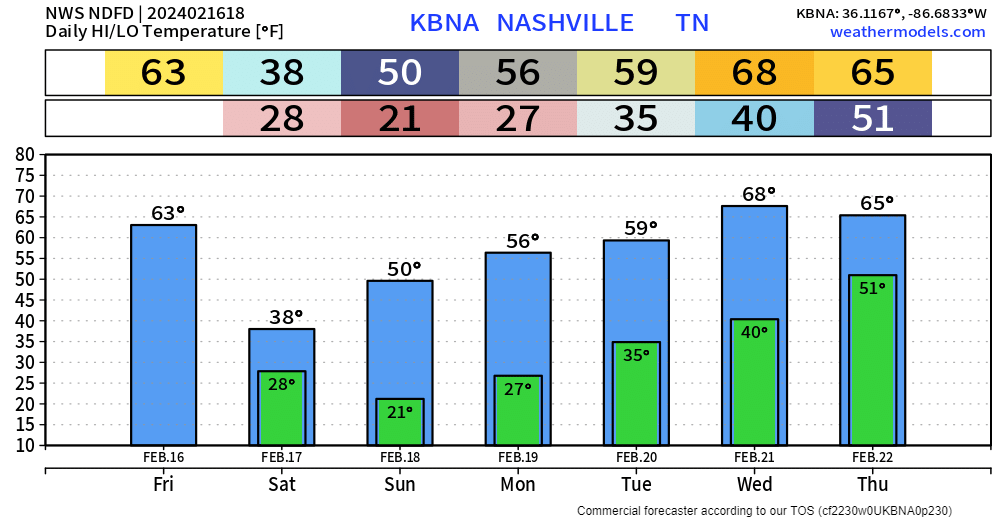
High temperatures Saturday are expected to only reach the upper 30s. Wind chills may not make it above the freezing mark tomorrow.
Thunderstorms and heavy downpours in model data, ETA 5-6 PM, plus or minus a few hours. You’ll want to be inside then.
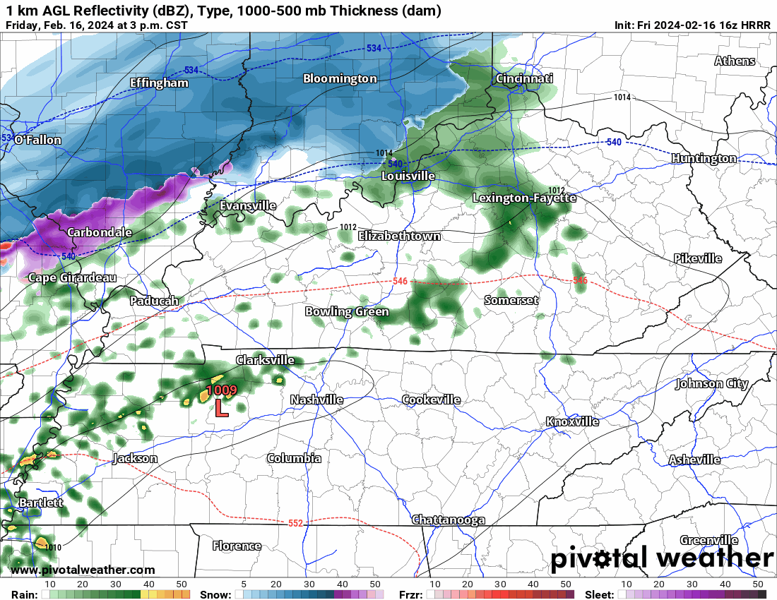
Rain passing thru bt 4:30 PM and 7 PM. Very little snow 9-10 PM tonight. Few/No travel impacts. Bridges, Overpasses, High Elevation Areas may be slick.

Wind chills below freezing from around 9 PM tonight through late morning Sunday.
You must be logged in to post a comment.