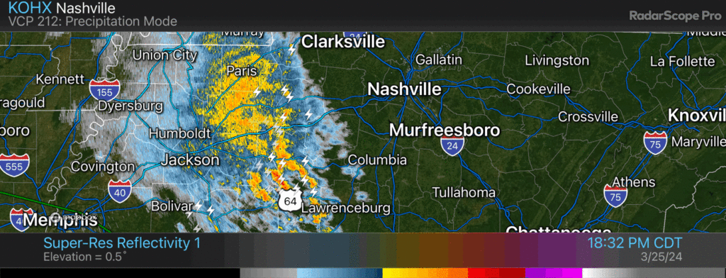
This is a lot of lightning for not very much rain. Most of it is CG so head inside (cloud to ground). 752 PM

This is a lot of lightning for not very much rain. Most of it is CG so head inside (cloud to ground). 752 PM
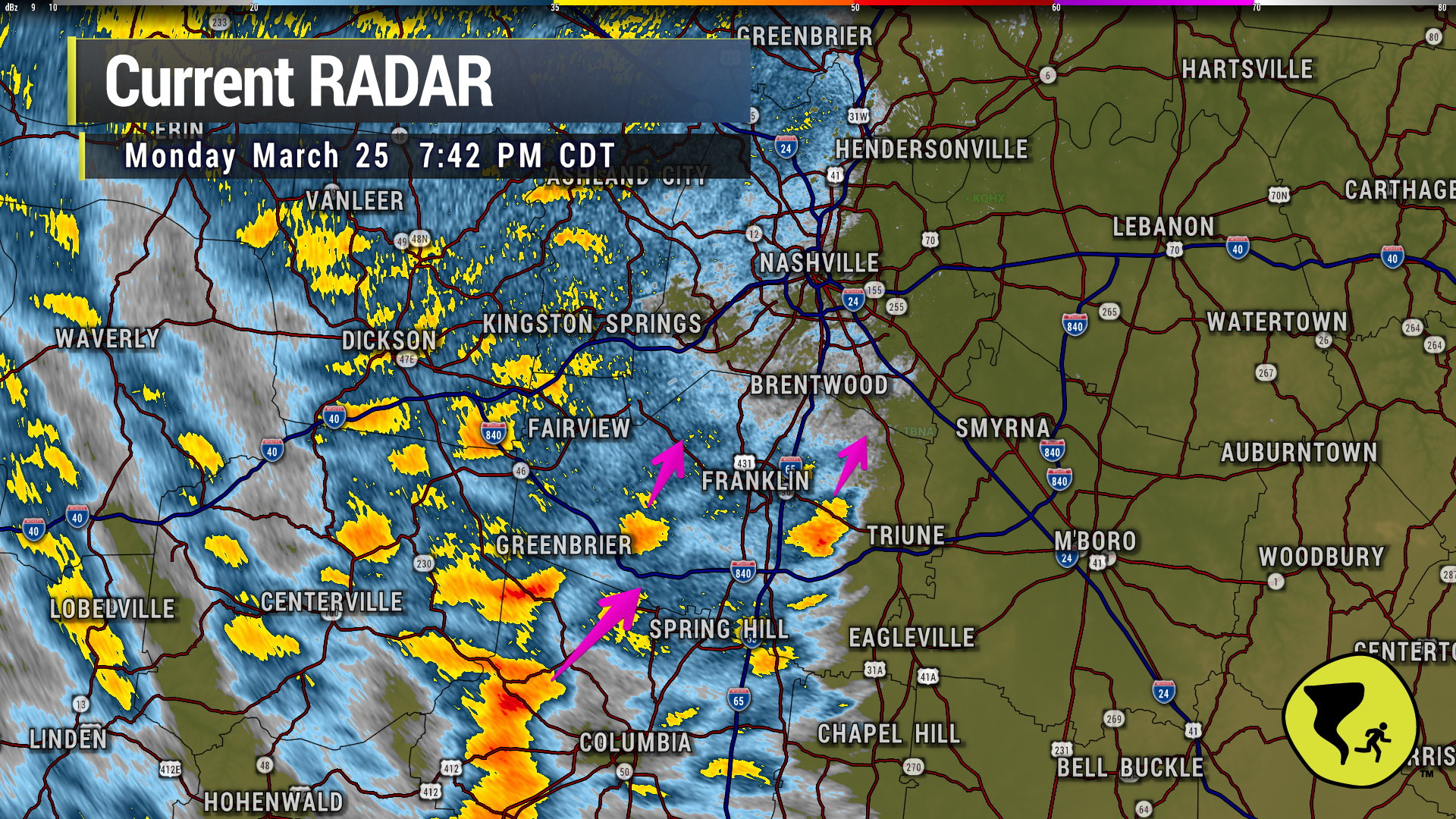
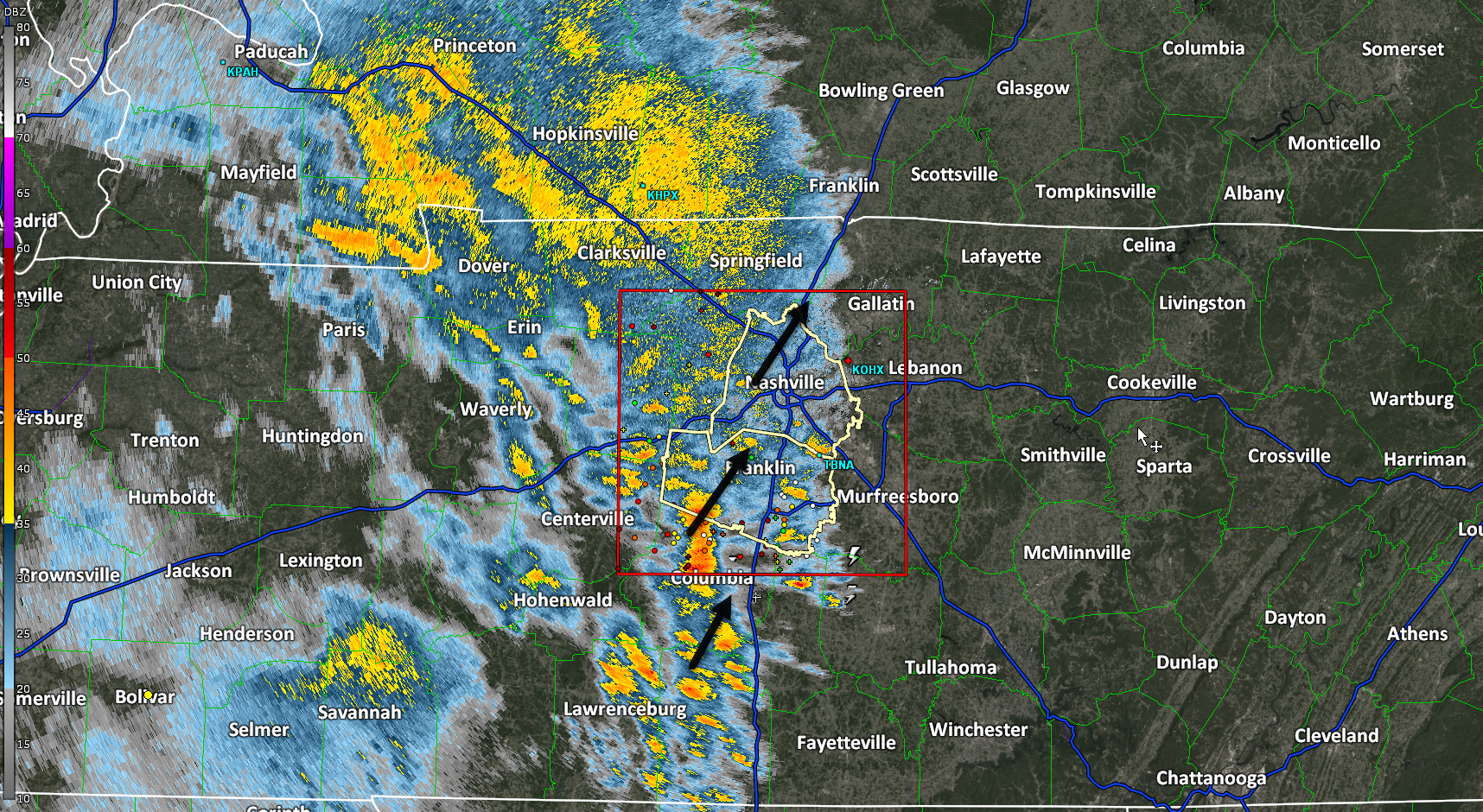
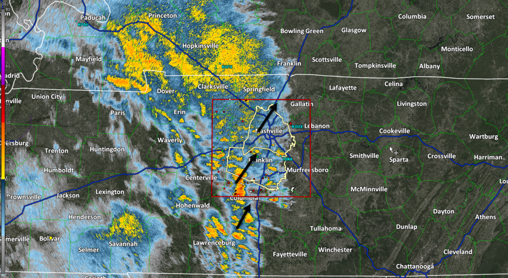
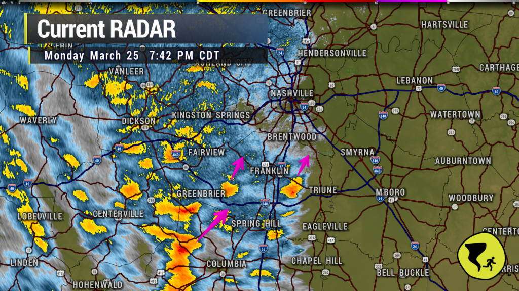
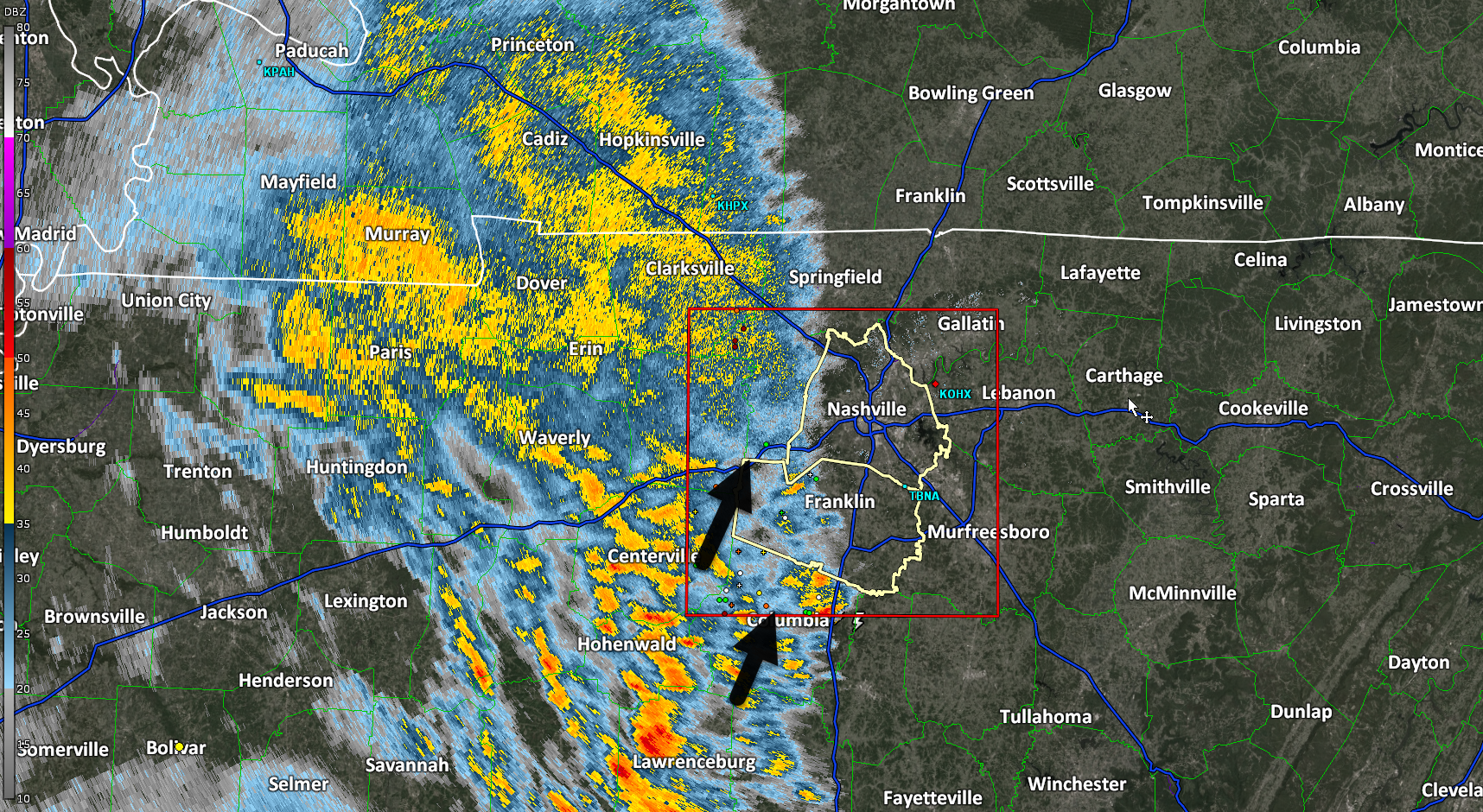
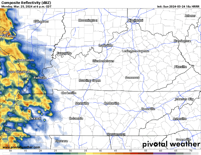
Couple of heavier downpours approaching Nolensville, Brentwood and W Franklin. Just a good ole regular thunderstorm. We like being able to say that. 7:42 pm
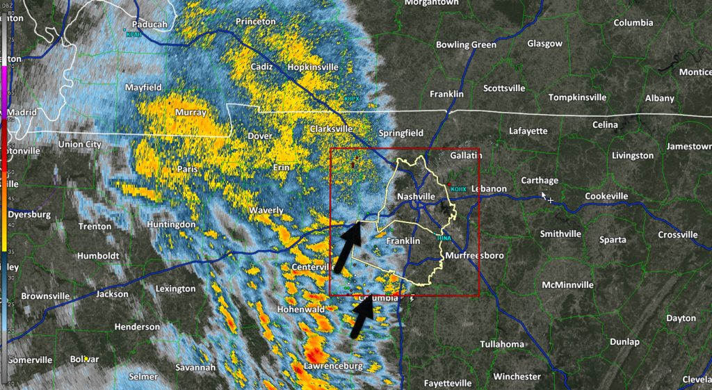
Several CG (cloud to ground) lightning strikes slowly incoming. Head inside.
Wind will continue to howl as we head into the evening and continue into tomorrow morning. Sustained winds of 20 – 30 mph, and gusts up to 50 – 55(!) mph are likely overnight. Secure any loose outdoor items.
Rain, thunderstorms slowly creeping closer, ahead of schedule.
Wind, lightning the only notable features.
Winds cranking. Last hour, BNA reported 23 MPH sustained, 33 MPH gusts. Both should increase tonight.

Rain ETA getting later. 9-10 PM per latest HRRR model.
I do not expect severe weather. Unlikely this is a “stay up all nighter.”
Winds get strong around 8 PM and continue overnight/while we sleep. Gusts to 50 (!!!) possible. Secure loose objects. Tether 88 lb aunts.
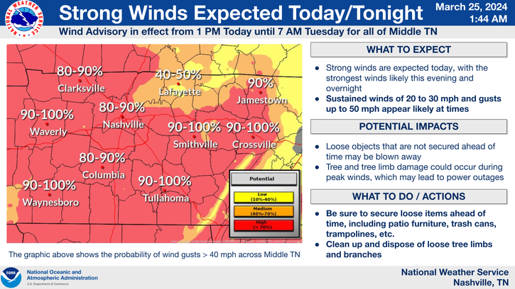
Winds 20-30 MPH sustained with gusts to 50 MPH late afternoon – overnight.
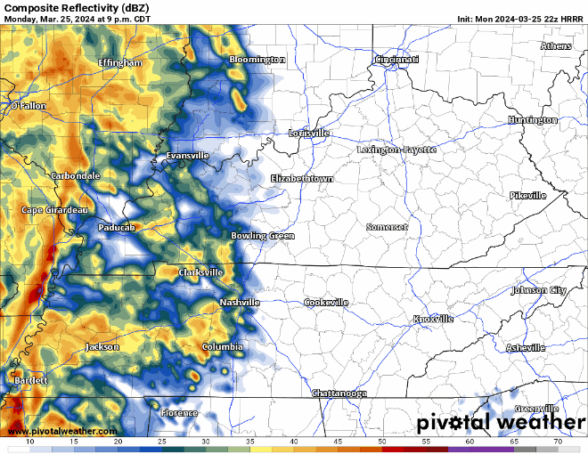
Rain ETA after dark lasting thru the night.
Neither tornado nor hail expected. Rain heavy and straight line winds strong. Lightning possible. Rain totals around 1” or so.
Winds will pick up throughout the day Monday, a Wind Advisory will be in effect from 1pm Monday – 7am Tuesday. Sustained winds of 20 – 30mph, with gusts up to 45 – 50mph possible. Secure any outdoor furniture, high-profile vehicles may have a rough time on roads like I-40.
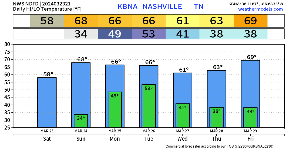
We’ll wake up Sunday morning with temps in the low 30s. Your backyard may get below freezing. We’ll be back in the upper 60s by the afternoon.
“Much of Middle Tennessee will experience an elevated fire danger tomorrow [Sunday] owing to increased wind speeds and very low RH values.” – NWS Nashville
You must be logged in to post a comment.