
There are currently no severe weather concerns for at least the next week.
Some rivers are still running high, it’ll take a little for the “big” ones to come down. Avoid flooded roadways – turn around, don’t drown.

There are currently no severe weather concerns for at least the next week.
Some rivers are still running high, it’ll take a little for the “big” ones to come down. Avoid flooded roadways – turn around, don’t drown.
Models continue to struggle. Forecasters are ready to fire these models into the sun.
MORNING RAIN
This was the radar at 8 AM. All this rain is supposed to move north into Ky. as shown by the red arrows. But it’s also creeping a bit east — the white arrows — right over Davidson Co. Not sure how far into town it’ll get.

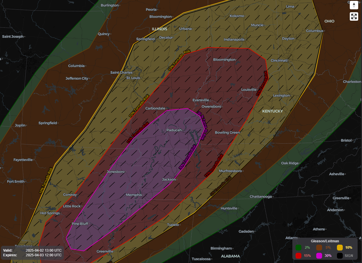
Update as of 3p: The SPC did decide to include us on the very edge of a Tornado Watch until 10p. The forecast holds true. The highest severe threat is well to our west and any threat of severe weather/tornado is quite low – but not impossible. Stay weather aware!
Flooding reports have been common throughout our two counties this morning and will likely continue thru the day. If you see flooding affecting roads and/or structures, please report it with #tspotter.

Today will be one of those days that you’ll need to stay connected and weather aware throughout the day.
Frequently check back in for updates, know where to shelter if a warning is issued for you.
1049 AM UPDATE: Last two HRRR model runs show a brand new potential concern: mid afternoon supercells somewhere in Middle TN which could produce tornadoes. This was not in the forecast (or in any of the data) this morning, so take it with a grain of salt. We don’t hide data from you. Takeaway: pay attention to the weather ALL DAY, not just tonight.
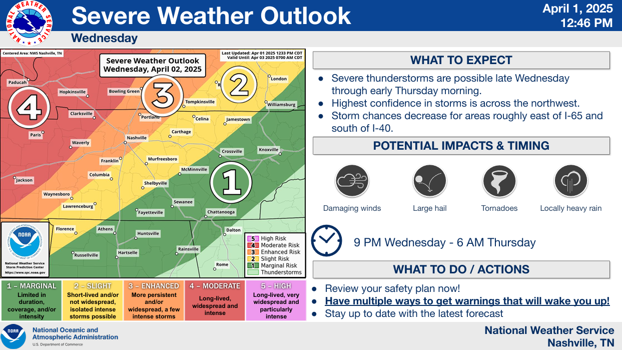
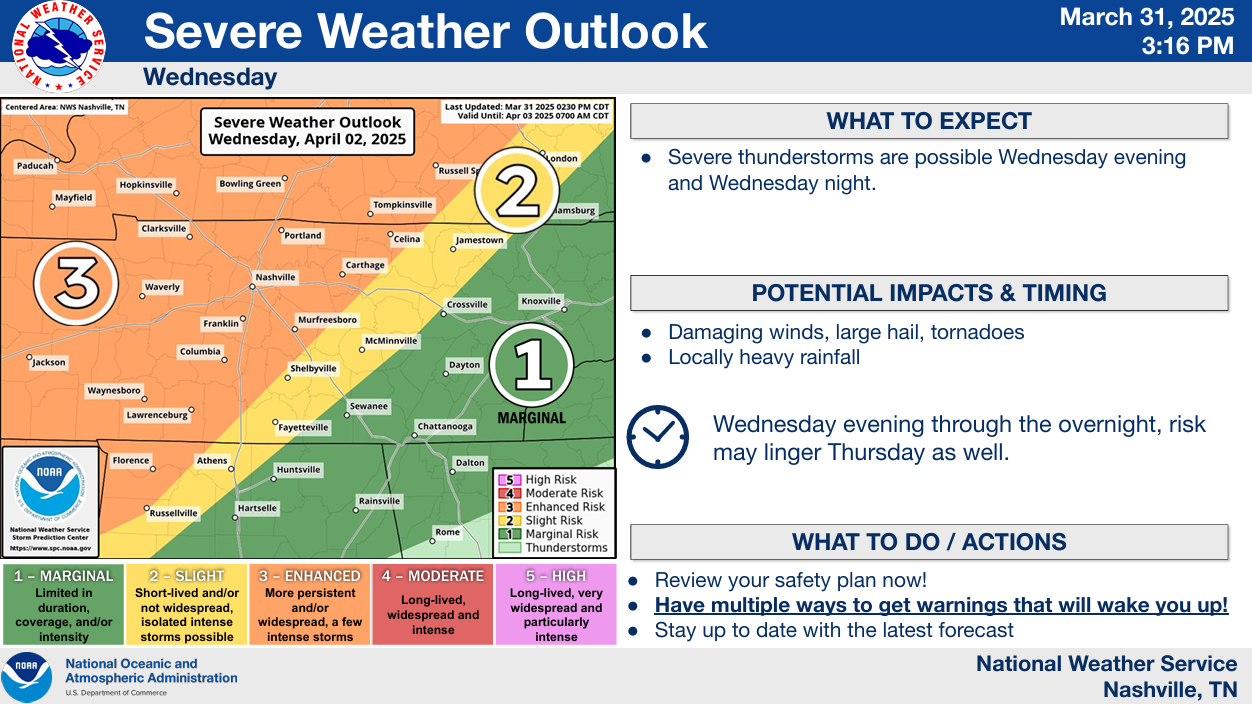
No April Fools jokes here. We are about to enter an active (and very complicated) pattern that will give us the potential for severe weather and flooding everyday Wednesday through Saturday. This does not mean we will see severe weather and flooding every single day – in fact, majority of the days we might not see either. However, the chance will exist.
We’ll have a small break from the crazy weather for the rest of today and Tuesday.
Two main concerns we’ll be watching for the remainder of the week – severe weather and flooding. Both deserve attention.

Please stay weather aware thru early Monday morning.
We are continuing to watch the threat for severe weather from late this afternoon thru early Monday morning.

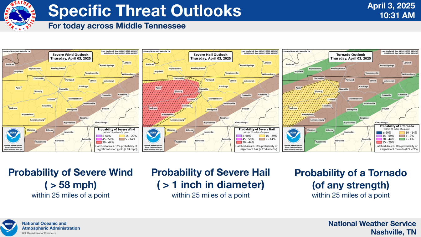
The Storm Prediction Center has us outlooked with the following probabilities of ‘x’ within 25 miles:
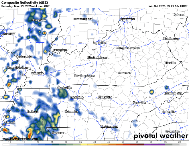
Scattered rain will continue to move thru the area for the remainder of today (Saturday). Rain gear a good idea as you walk out the door for your evening plans.
You can check the radar anytime on our website here: Radar | Nashville Severe Weather
You must be logged in to post a comment.