Two stories for today. First, Nicole will be making landfall on the east coast of Florida in the next 24 hours. If you have interests in Florida and need more info on impacts there, reference the National Hurricane Center.

Two stories for today. First, Nicole will be making landfall on the east coast of Florida in the next 24 hours. If you have interests in Florida and need more info on impacts there, reference the National Hurricane Center.
Ok, I’m back. Just as I was about to start typing, sprinkles began appearing on my laptop for the second day in a row. We really do think these will dissipate and not be a big deal today. Most won’t see them at all.
They’ve been stubborn. Their estimated time of departure? Elusive. The sprinkles and light rain showers today shhhhould be gone by this evening. But, as this is being written, another round is moving SW to NE through Williamson Co.
Some patchy fog is possible this morning. A boundary in place will keep the low clouds over us. This boundary is a bit of a deviation from yesterdays forecast. The clouds hang around until Monday. A few passing showers aren’t out of the question, but no organized rain development is expected per the HRRR (below).

The headline says it all. Today is a glorious weather day. Upper 70s to low 80s, abundant sunshine, and it’s Friday. Cocktail on a patio type of afternoon and evening. You earned it. EDIT: It might be windy.
I’m so glad we aren’t a newspaper. Not sure that headline would make it past an editor. But since I’m the editor, I approve.

…anyway. Today and Tomorrow are going to be great weather days. Upper level ridge will give us upper 70s and minimal cloud cover. However, this too shall pass.

So, the sprinkles. A couple of models had indicated that we could get some rain today, but most said nope. The forecast leaned dry. For the most part the showers that have developed have been mere sprinkles. Reason? Our friend (or foe) the Dry Air Monster. He’s not very strong today, but he’s there, visible on the morning weather balloon…eating rain as it falls through the air.
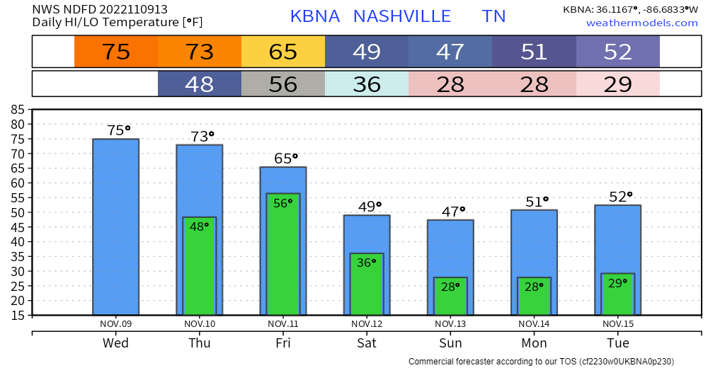
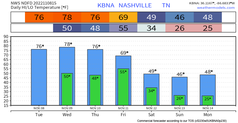
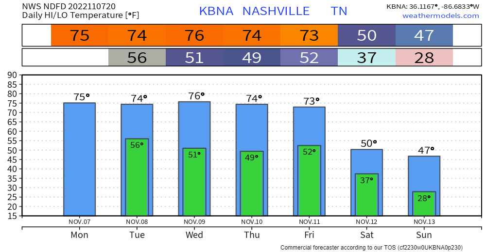
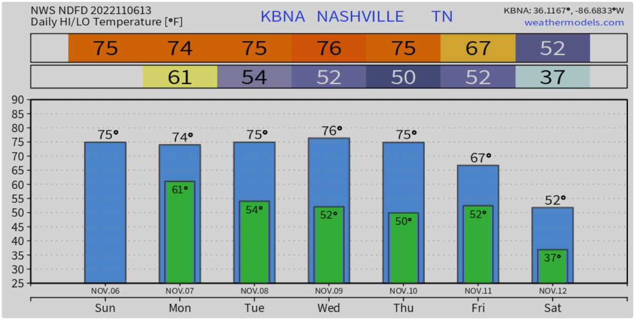
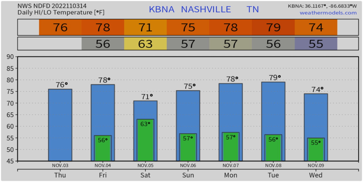
71° today, steadily increasing to near 80° this weekend. Average for this time of year is around 67°
Rain chances come back late Saturday into Sunday. Latest Euro model thinks we’ll see a half inch or less. Timing is ?? But will become more clear as we get closer. Severe weather and/or flash flooding is not expected.
Rain amounts over the last 24 hours came in right around forecast amounts; generally somewhere around two tenths of an inch. Probably didn’t get your local creek flowing, but every little bit helps add moisture to the soil under our feet. As trees and grass go dormant for the winter, rain will be able to make it to our waterways more easily.
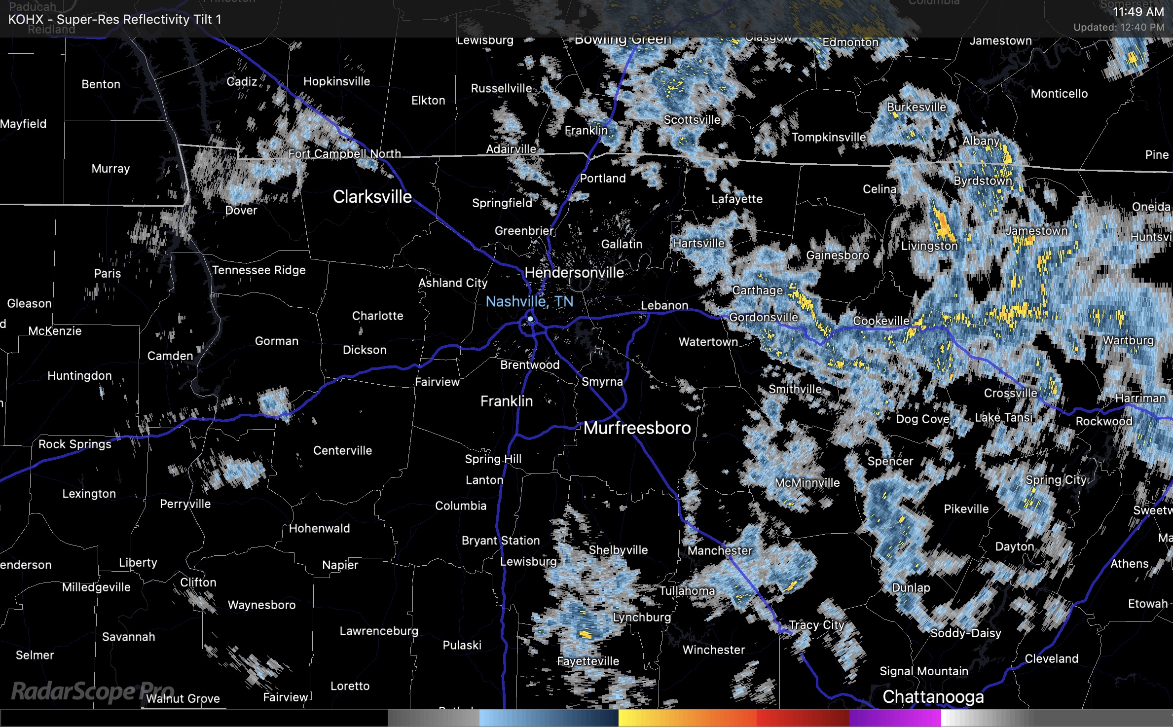
Radar shows some thin rain bands are spinning in today. Some of us will see more than others. We have a chance for more rain this afternoon and evening. Low end chance for thunder and heavy showers. Below is a mid day radar loop. Live radar can be found here https://nashvillesevereweather.com/radar/ .
You must be logged in to post a comment.