

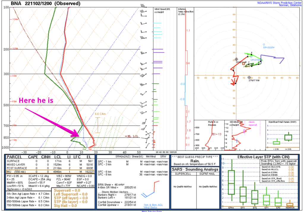
So, the sprinkles. A couple of models had indicated that we could get some rain today, but most said nope. The forecast leaned dry. For the most part the showers that have developed have been mere sprinkles. Reason? Our friend (or foe) the Dry Air Monster. He’s not very strong today, but he’s there, visible on the morning weather balloon…eating rain as it falls through the air.
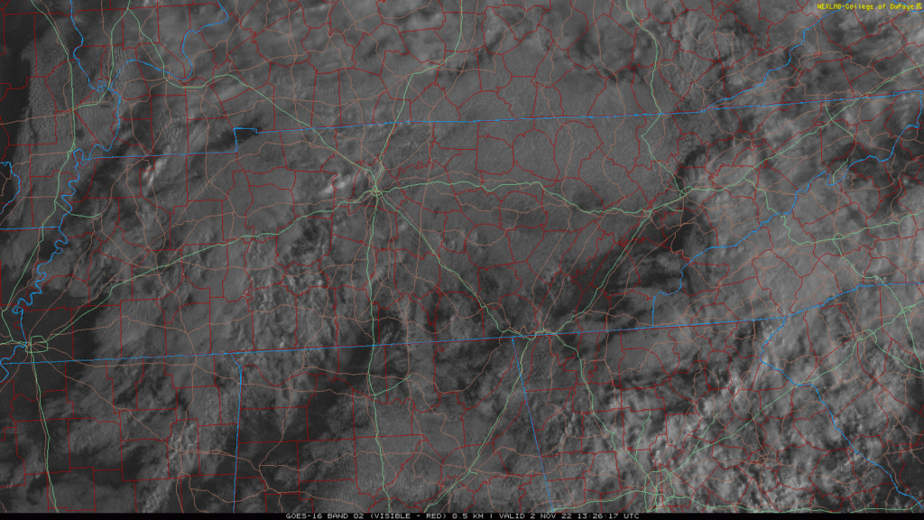
Any drops that make it to the ground shouldn’t be of much consequence. We might even get some sun out out of the deal this afternoon. Here’s the satellite loop as of 10:21 am.
Weekend Rain
Too early for specifics, but it looks like Saturday into Sunday is when rain chances will be the highest. Will probably impact outdoor activities, but wouldn’t cancel completely yet. This system will drop heavy rain west of us and be weakening by the time it gets to us. So, rain could be weaker than currently forecast. But, here’s our best guess.
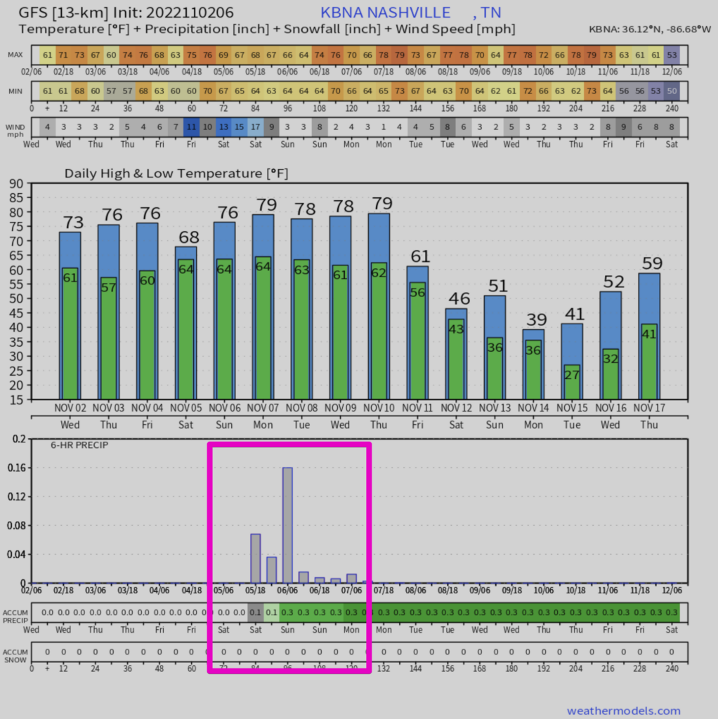
GFS thinks we’ll see a third of an inch or so on Saturday into Sunday.
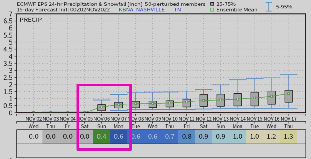
Euro generally agrees, but offers a bit more rain. Don’t draw too many conclusions. For illustration purposes only.
We’ll have a better idea on timing over the next couple of days.
Quick References:
Weather changes constantly.
Follow @NashSevereWx on Twitter for any changes to this forecast.
Live coverage during tornado and severe thunderstorm warnings.

Look good.
Support the mission.

We are 100% community supported. No ads. No subscription fees. Keep it free for everyone.


Categories: Forecast Blogs (Legacy)
You must be logged in to post a comment.