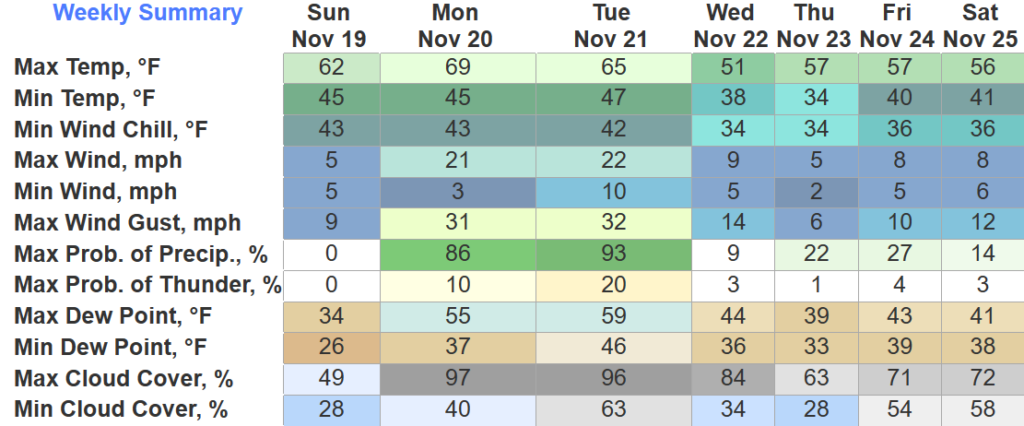
Temps have quickly recovered from below freezing and we are on our way to the upper 50s. Whole lotta sun and food. Keep an eye on your uncle who’s cooking the turkey. “Don’t worry I’ve done this hundreds of times” but it comes out dry everytime?

Temps have quickly recovered from below freezing and we are on our way to the upper 50s. Whole lotta sun and food. Keep an eye on your uncle who’s cooking the turkey. “Don’t worry I’ve done this hundreds of times” but it comes out dry everytime?
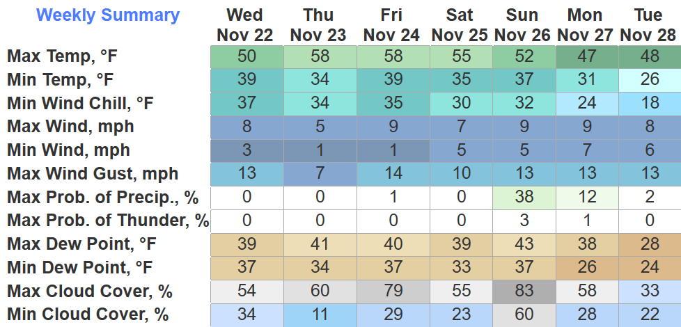
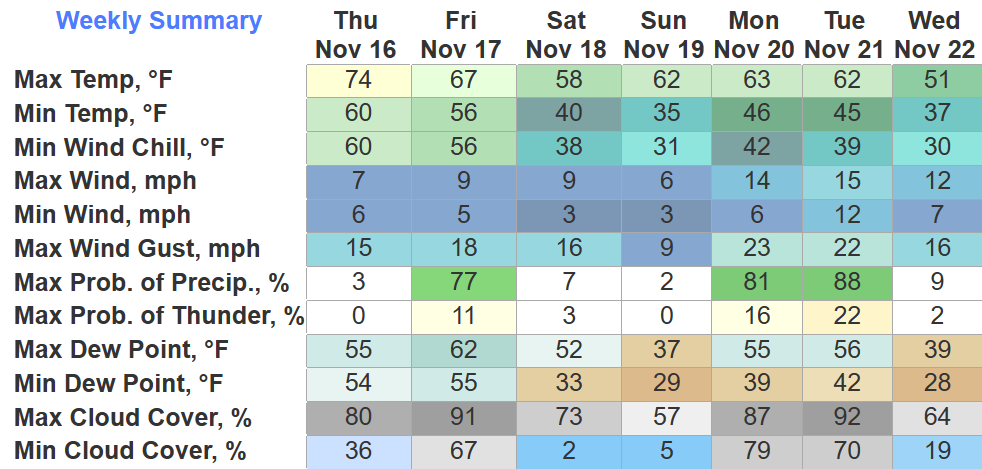
Cooler weather day than we’ve been having, but pretty typical for this time of year.
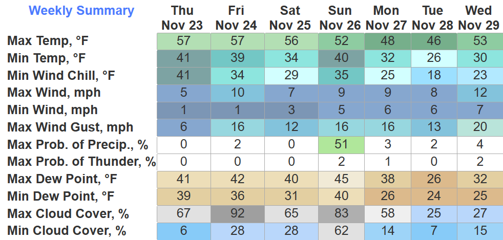
We’ll wake up on Turkey Day with temps hovering around 32°. We’ll warm up to near 60° by the afternoon, no rain chances. Perfect day for watching football, eating lots of food, and some naps.
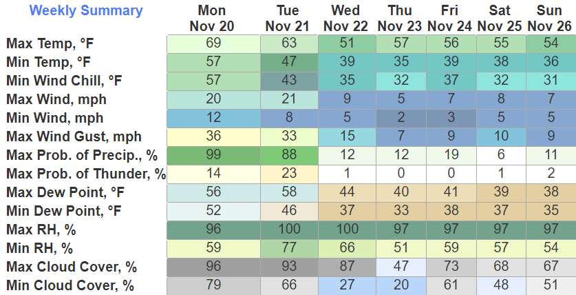
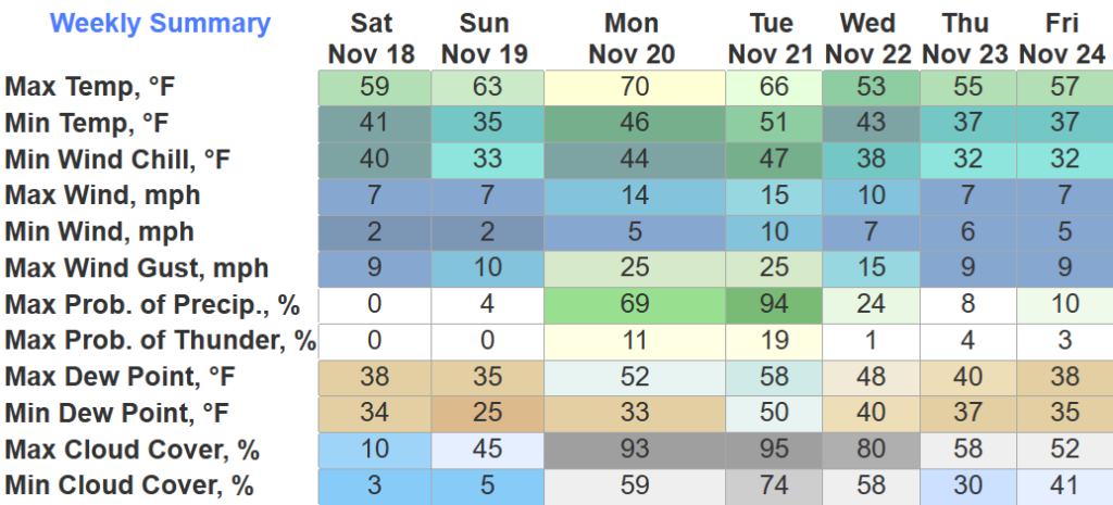
We finally got some decent rainfall across the area.
Looks like everyone received about 1″, the big winners look to be the Fairview area and far northern Davidson Co. with 2″+.
This will certainly be a help, but it won’t solve all our drought problems. New drought monitor comes out on Thursday to give us the update.
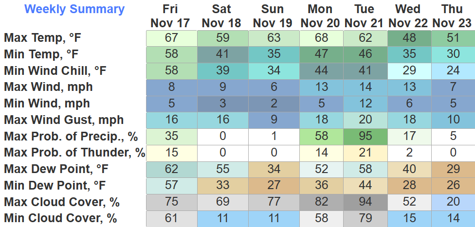
Still the two main headlines of today are the gusty winds and rain overnight.
A Wind Advisory will be in effect from 6pm today thru 6am Tuesday. Wind gusts up to 45 mph are possible. As of 4pm, BNA has already gusted up to 28 mph and winds will continue to howl. Secure outdoor furniture, trashcans, Christmas decorations, God’s frisbees, etc.
Two main messages for Monday. Let’s discuss.
Winds *before* the rain tomorrow will be gusty.
Gusts up to 30-45mph are possible Monday afternoon into Monday night. A Wind Advisory will probably be issued at some point. Secure outdoor furniture, X-Mas decorations, etc.
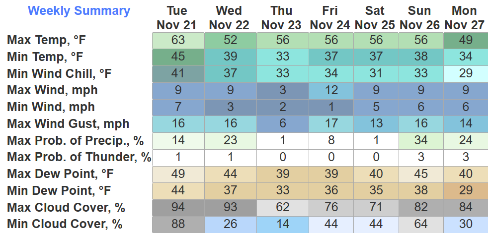
Nice quiet day today, tomorrow will be about the same. Temps near the freezing point as you wake up.
We finally get to start making up some ground on our rainfall deficit.

Current forecast has around 1.5″ for us Monday into Tuesday. Yes please.
Leftover drizzle should move out over the next couple hours. You can always check the radar here: Radar – Nashville Severe Weather
We get a dry Saturday + Sunday, cooler temps than what we’ve been dealing with this week. We may get close to the freezing mark Sunday morning.
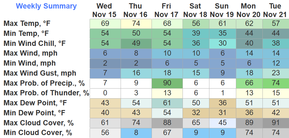
A toasty 77° today at BNA, one degree shy of tying the daily record high.
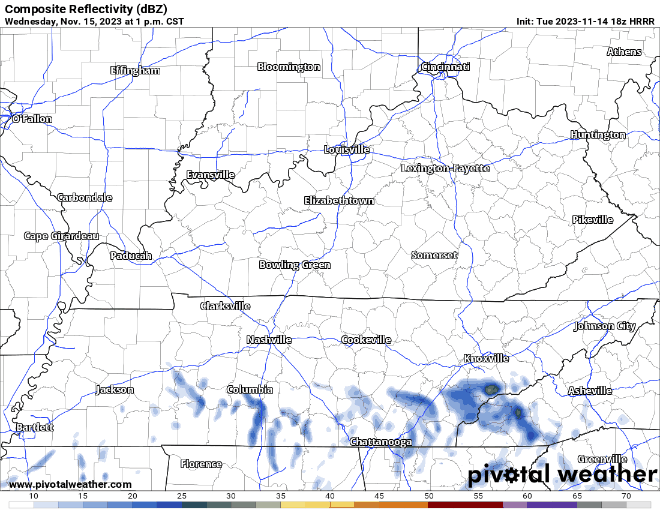
Some light rain chances come around tomorrow.
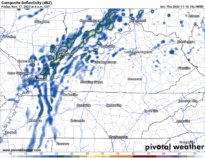
HRRR model (above) shows light on/off rain from morning until evening. I see no reason to alter plans, should be mostly gone by FNL kickoff.
Only chance today at some rain would be some sprinkles, defying the odds against the very dry air we have in place. Unlikely, but if they make it to the ground, NBD.
Thursday will be dry with high temps running about 15° above average.
Seems just about everyone got a great glimpse of the gorgeous sunset tonight.
Tomorrow we mightsee some sprinkles.
The HRRR model (above) shows some sprinkle chances tomorrow afternoon and evening. I have my doubts if any rain actually makes it to the ground, we’ll be really dry. At the most, just some sprinkles.
You must be logged in to post a comment.