
A toasty 77° today at BNA, one degree shy of tying the daily record high.
Some light rain chances come around tomorrow.
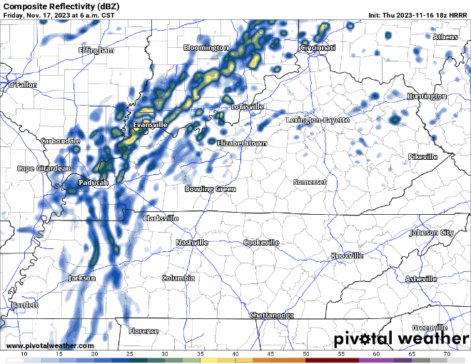
HRRR model (above) shows light on/off rain from morning until evening. I see no reason to alter plans, should be mostly gone by FNL kickoff.
Rest of the weekend will be dry and temps around average for this time of the year, maybe some frost Sunday morning.
A Good Soaking
Timing still is fuzzy, but late Monday into Tuesday we look to finally start making a dent in our rainfall deficit.
Models currently hinting at rainfall totals around one inch, which wouldn’t solve all our problems, but it’ll certainly help.
Currently not worried about severe weather with this system, but we’re keeping an eye on it.
Chilly + Dry Turkey Day
After the cold front moves thru Tuesday, our temps will drop a good bit. We’ll clear out, setting us up for a cool and dry Thanksgiving.
Quick References:
Weather changes constantly.
Follow @NashSevereWx on Twitter for any changes to this forecast.
Live coverage during tornado and severe thunderstorm warnings:

Look good.
Support the mission.

We are 100% community supported. No ads. No subscription fees. Keep it free for everyone.


Categories: Forecast Blogs (Legacy)
You must be logged in to post a comment.