
BNA only got to a high of 43° today, which is the coolest high since March 19th earlier this year. We’ll dip down into the low 20’s again tonight, I bet a few backyards could reach the upper teens.
Although it may not feel like the stereotypical fire weather, with our ongoing drought, low relative humidity, and gusty winds at times, fires could spread quickly.
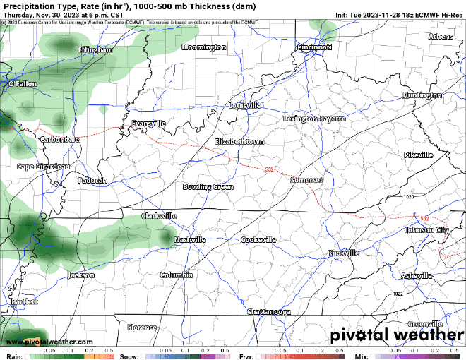
Rain chances return late Thursday night, shoutout to a low-pressure system. A majority of the rain looks to fall overnight Thursday into the early hours of Friday. “Most of Middle Tennessee can expect between 1/2″ and 3/4″ of rain…” says NWS Nashville. The Euro gives its best guess below
That’s not a drought-buster, but we’ll take anything we can get, little by little. Models start to disagree after Friday, but lower rain chances will stick around for the weekend, I see no reason to alter any outdoor plans quite yet.
Friday thru at least early next week we avoid dropping below freezing. If December being right around the corner makes you think about snow, bad news for you is there isn’t any in the forecast for the foreseeable future.
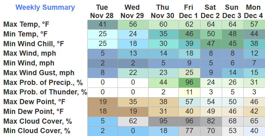
Quick References:
Weather changes constantly.
Follow @NashSevereWx on Twitter for any changes to this forecast.
Live coverage during tornado and severe thunderstorm warnings:

Look good.
Support the mission.

We are 100% community supported. No ads. No subscription fees. Keep it free for everyone.


Categories: Forecast Blogs (Legacy)
You must be logged in to post a comment.