
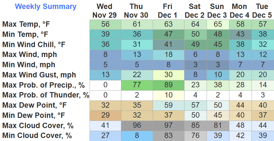
A few locations might reach 32° tonight, but other than that, we’ll take a pause on sub-freezing temps for a little while. Strong southerly flow will help our high temps reach the 60’s Thursday – Sunday.
Before the rain, wind gusts up to 20-25mph will be possible, paired with our drought, fires could spread quickly.
Rain chances return Thursday night.
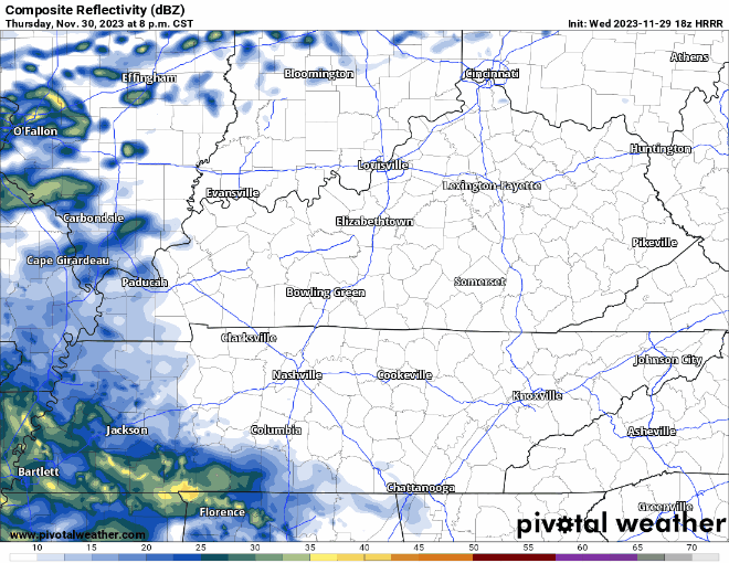
The HRRR model (above) shows rain moving in ~9-10pm tomorrow, subject to change. The majority of the rain will fall overnight, ending before sunrise Friday. Scattered showers are possible during the day Friday, but those look to be NBD. Rainfall totals look underwhelming and not much help to our drought, only 0.25″ – 0.5″ expected. Although the rain overnight will be fairly light, wind gusts up to 30mph are possible. Secure X-Mas decor.
Low rain chances stick with us throughout the weekend, but still see no reason to alter any outdoor plans just yet.
Fingers crossed Titans game this week is better weather-wise than last weeks.
Quick References:
Weather changes constantly.
Follow @NashSevereWx on Twitter for any changes to this forecast.
Live coverage during tornado and severe thunderstorm warnings:

Look good.
Support the mission.

We are 100% community supported. No ads. No subscription fees. Keep it free for everyone.


Categories: Forecast Blogs (Legacy)
You must be logged in to post a comment.