Search Results for:
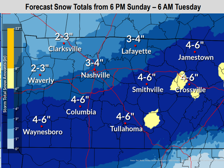
Winter Storm Watch Sunday Evening - Tuesday AM, Prepping for Dangerous Cold + Travel Impacts
Overnight tonight a cold front will swing thru, bringing in our very cold air. Along the front, there could be some flurries. Areas north of I-40 could see a dusting, no major impacts expected.
Both of our counties are under a Winter Storm Watch from Sunday evening thru Tuesday morning. This will likely be changed to a Winter Storm Warning later tonight or tomorrow.
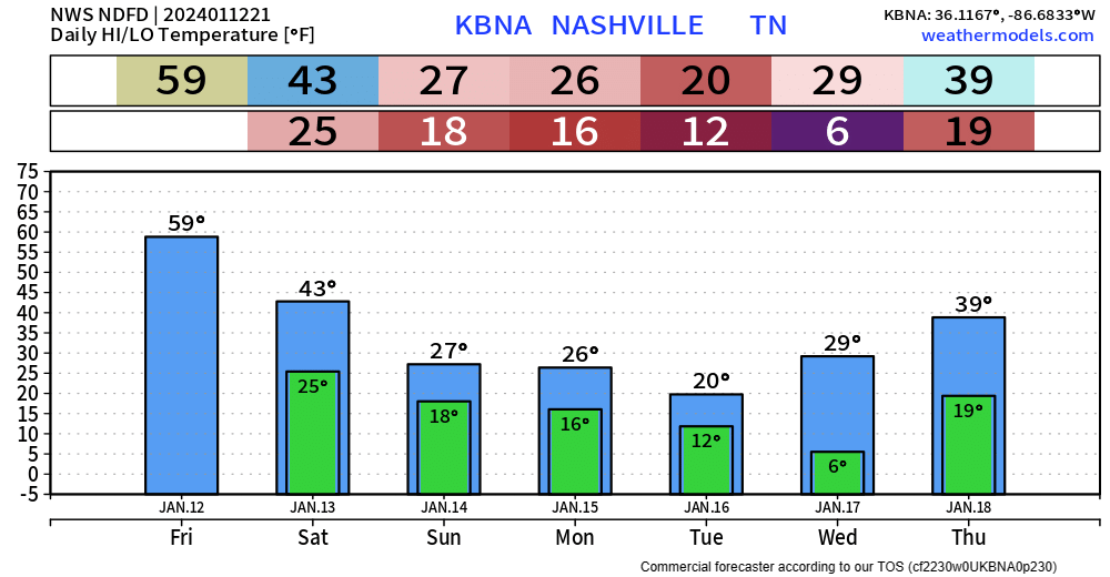
Wind Advisory Remains Thru Midnight, Dangerous Cold Arrives Sunday, Discussing Snow Probabilities
High-End Wind Advisory & Strong Storms Possible Friday. Frigid Air Likely, Maybe Snow Early Next Week.
Enjoy the rest of this nice day today, our weather will change rather quickly tomorrow.
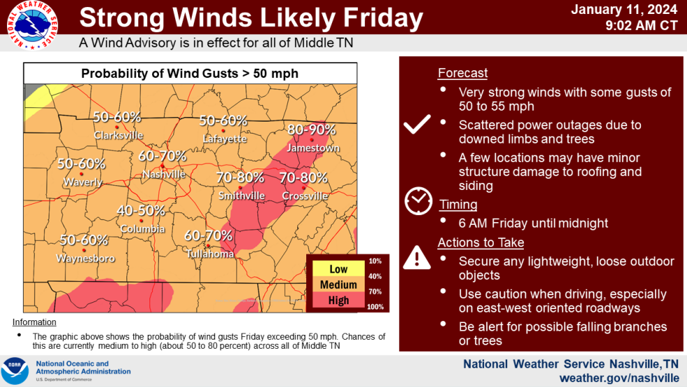
Yet another Wind Advisory has been issued for us from 6 am Friday thru midnight Friday.
Sustained winds from the SW at 25 – 35 mph with gusts up to 55 mph are expected. The graph above from NWS Nashville shows our odds of wind gusts 50+ mph at 60-70%.
More Wind & Storms(?) Friday. Dangerous Cold Arrives Early Next Week. First Legit Snow Chance of the Szn?
Windy & Rain/Snow Mix Tonight, Deja Vu Friday, And Talking About COLD + Sn*w Potential
Wind Advisory & Heavy Rain Tonight - Tuesday. More Rain Friday. Mumbles of Winter Wx Next Week.
Heavy Rain & Wind Advisory Monday PM + Tuesday, Another System Thursday/Friday, Arctic Air Incoming?
Quick Showers Tonight, Heavy Rain & Gusty Winds Monday PM - Tuesday
Cold Rain Tonight, Rain & Gusty Winds Monday/Tuesday
Rain will be a common theme in our forecast for the next 7 days.

HRRR above gives a good look at what the radar might look like tonight into early Saturday morning:
- a cold rain (just rain)
- arriving ~ 9 – 10 pm
- departing ~ 6 – 7 am Saturday
- 0.5″ – 1″ of rain expected
Rest of the day Saturday should mostly be dry. A few isolated, quick rain showers are possible Saturday evening.