There’s a lot to break down. Let’s do it.
Wind Advisory
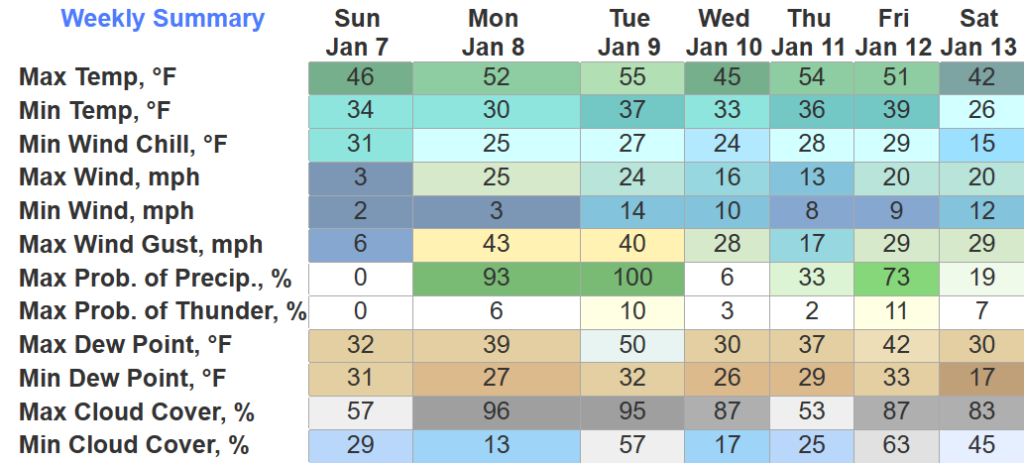
When? 6pm Monday – 6pm Tuesday
What? Sustained winds from 15-25 mph, with gusts up to 35 – 45 mph will be possible
Winds could blow around unsecured objects; tree limbs could also get blown down and cause a few power outages.
Much Needed Heavy Rain

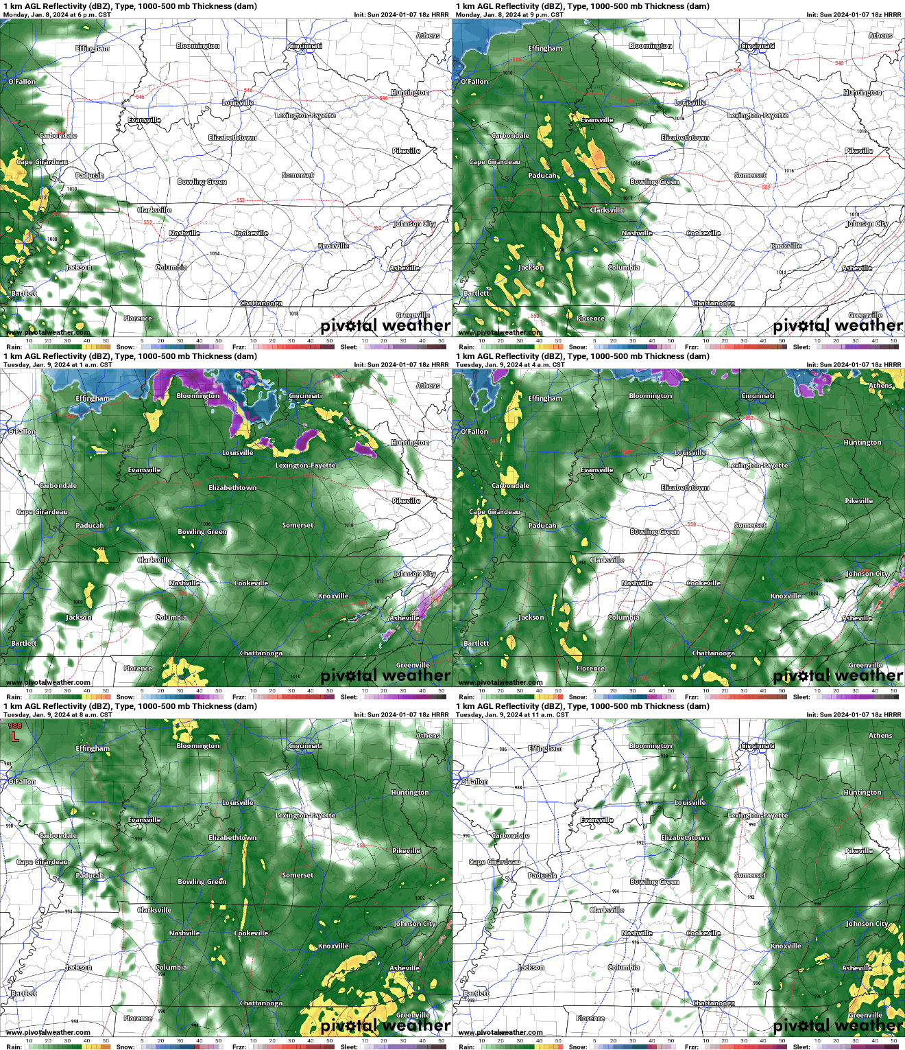
HRRR model shows:
- rain starting late Monday evening
- rain tapering off Tuesday morning
- no severe weather expected, maybe a rumble of thunder tho
- 1″ – 2″ of rain possible
Tuesday evening, we could get some more showers, possibly with some snow mixed in. No accumulation is expected for us, surface temperatures should stay above freezing.
Only A Brief Break Before Another System
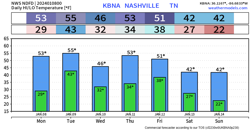
Wednesday will be our brief dry day before more active weather arrives Thursday. Details are very fuzzy, for now it looks fairly similar to the Monday/Tuesday event, with a good amount of rain and a shot at some wraparound sn*w (accumulation not likely). Best ETA right now is Thursday night, lasting into Friday PM. This will likely need updating throughout the week.
Arctic Air Incoming?
Medium range models continue to hint at a shot for our coldest temperatures so far this year next weekend.

The 6 – 10 day temperature outlook shows us likely experiencing below average temperatures, this trend continues in the 8 – 14 day outlook as well.
This however has quite a bit of uncertainty with it.
“It remains very unclear if/when this Arctic airmass could reach our neck of the woods if at all, which will have big implications on the potential for any winter weather around MLK day.
– NWS Nashville PM AFD
For now, we’ll just watch for the trends, and wait.

Quick References:
Weather changes constantly.
Follow @NashSevereWx on Twitter for any changes to this forecast.
We are 100% community supported. No ads. No subscription fees. Keep it free for everyone.
Categories: Forecast Blogs (Legacy)


You must be logged in to post a comment.