
Some light showers moving thru this evening, these should not last long, and should be outta here in the next couple of hours.
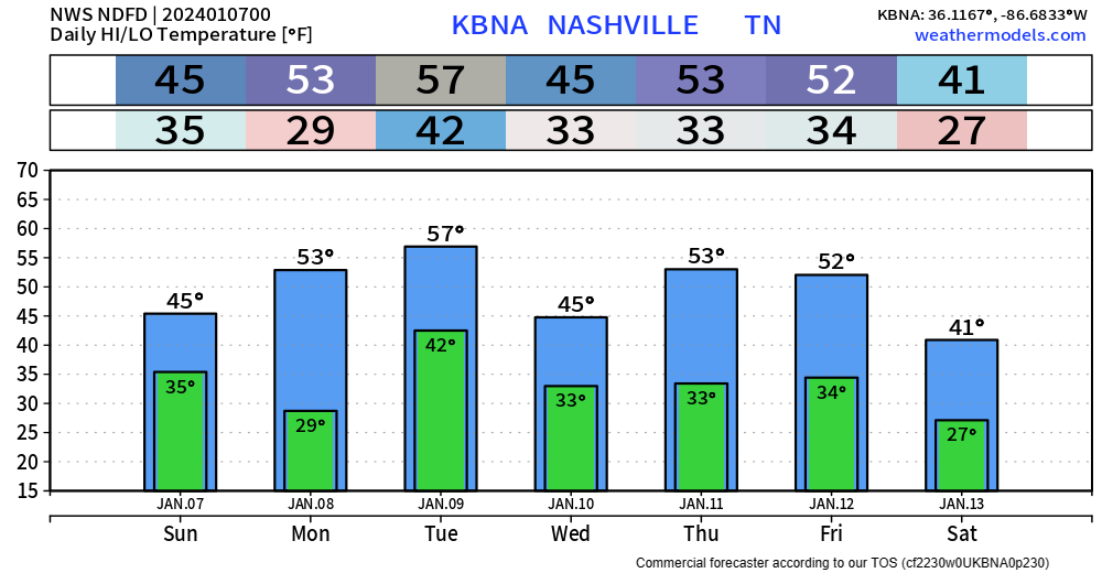
We’ll be dry for Sunday, but high temps will only make it up into the mid 40s, bundle up if venturing out to the Titans game.
Our weather will ramp up again as we head into Monday night.
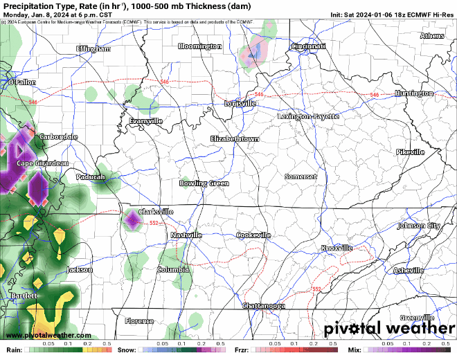
The Euro (above) helps illustrate the current (subject to change) thinking of:
- rain, heavy at times Monday PM thru Tuesday AM
- maybe some thunder, but no severe weather is expected
- a break from precip sometime midday Tuesday
- wrap around moisture may provide more showers with snowflakes mixed in
- surface temperatures are expected to be above freezing = no accumulation expected
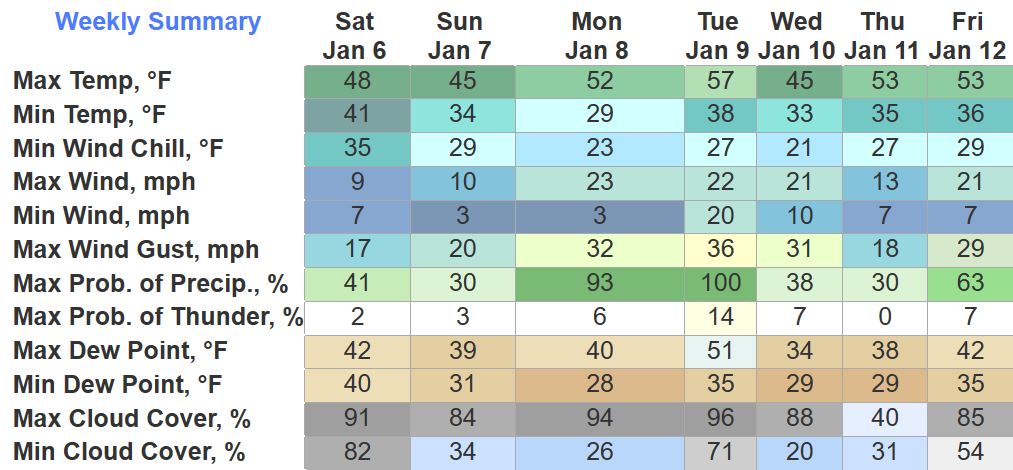
Gusty winds will also be around Mon. – Tues., particularly during the day Tuesday. Gusts up to 35 – 45 mph are possible.
Still several days out, so details are fuzzy. Check back in for updates.
Cold(er) Air?
We haven’t really had any below-average temps thus far this winter. Long range models are suggesting this may change in the 6-10 day range.

This is still wayyyy out there, so incredibly early to tell if we are looking at sn*w chances. We’ll be watching…
Quick References:
Weather changes constantly.
Follow @NashSevereWx on Twitter for any changes to this forecast.
Live coverage during tornado and severe thunderstorm warnings:

Look good.
Support the mission.

We are 100% community supported. No ads. No subscription fees. Keep it free for everyone.


Categories: Forecast Blogs (Legacy)
You must be logged in to post a comment.