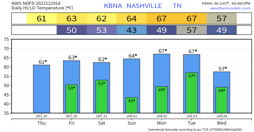
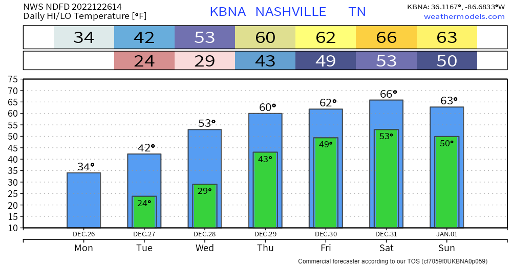
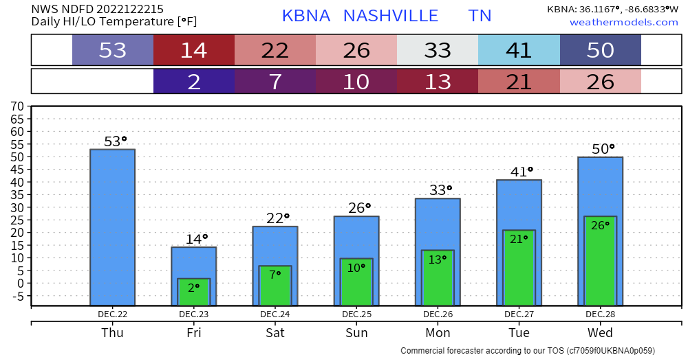
For the next 6 days or so, we’ll get a little preview of spring, as temperatures shoot well above average into the 60’s.
We’ll also see rain chances pick up today and this afternoon. Won’t amount to much – if any. Just a quick passing by shower.

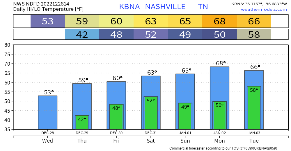
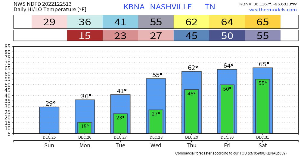
For the next 6 days or so, we’ll get a little preview of spring, as temperatures shoot well above average into the 60’s.
We’ll also see rain chances pick up today and this afternoon. Won’t amount to much – if any. Just a quick passing by shower.
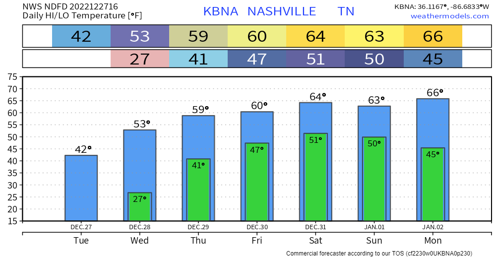
For at least the next 7 days, we won’t see the freezing mark, which is a welcome sight for many. For fans of winter, maybe not so much.
Rain looks to return Friday and Saturday. No severe weather or flooding concerns with this. Models are hopeful that the rain will move out before NYE night activities, this could change though.
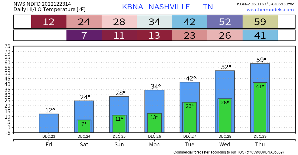
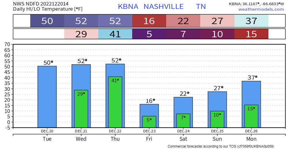
It was a storm we’ll tell our grandkids about one day. With a gust of wind we plummeted into a nasty season of spending 88 hours below freezing, some of those below zero, with punishing wind chills. Rolling blackouts, broken pipes and hazardous travel were part of the narrative for many of us this Christmas. But, better days are here.
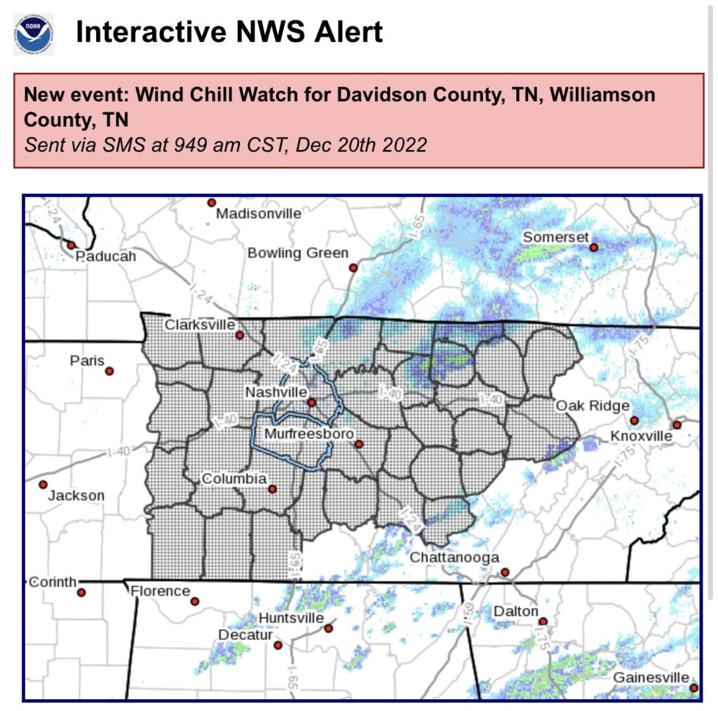
Both of our counties are under a Winter Weather Advisory until noon today. Isolated snowfall amounts of one inch are possible in some isolated areas, but most places will be around half an inch.
We shouldn’t see any major travel impacts, but any snow that falls will stick, so take it easy on the roads and give yourself some extra time today. Snow should end around noon, and we may see temps briefly get above freezing, which will help with melting.
Merry Christmas!

We’ll take waking up to temperatures in the upper teens, certainly feels like Christmas! Winds have died down, so wind chill isn’t much of a factor, but it’s still cold. Certainly not the 76° we had last year…but at least it’s not also a high of 15° like in 1983.
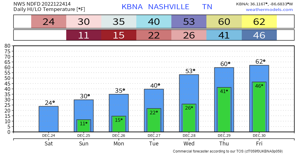
As of 8:30am, BNA is reporting double digits temps (10°) for the first time in ~32 hours. Temps will rise to the low 20’s, along with some sun, will hopefully help some road conditions improve, but several roads will still be hazardous, continue to take it easy. The “warmer” temps should also help to relieve some stress on the power grid.
Well, it snowed. Which has left some roads a mess, if you have to go out today, take it nice and easy. Also, the kiddos are probably going to want to play in the snow, however, this is not ideal playing-in-the-snow weather. In fact, it may be tongue stuck to flagpole cold. I wouldn’t try and see for yourself though.
3:30PM Update:
This afternoon, Davidson Co. was upgraded to a Winter Storm Warning. Snowfall totals of 1-2″ are expected, with a few pockets of 3-4″ possible. Impacts remain the same as mentioned below in the rest of the blog.
5PM Update:
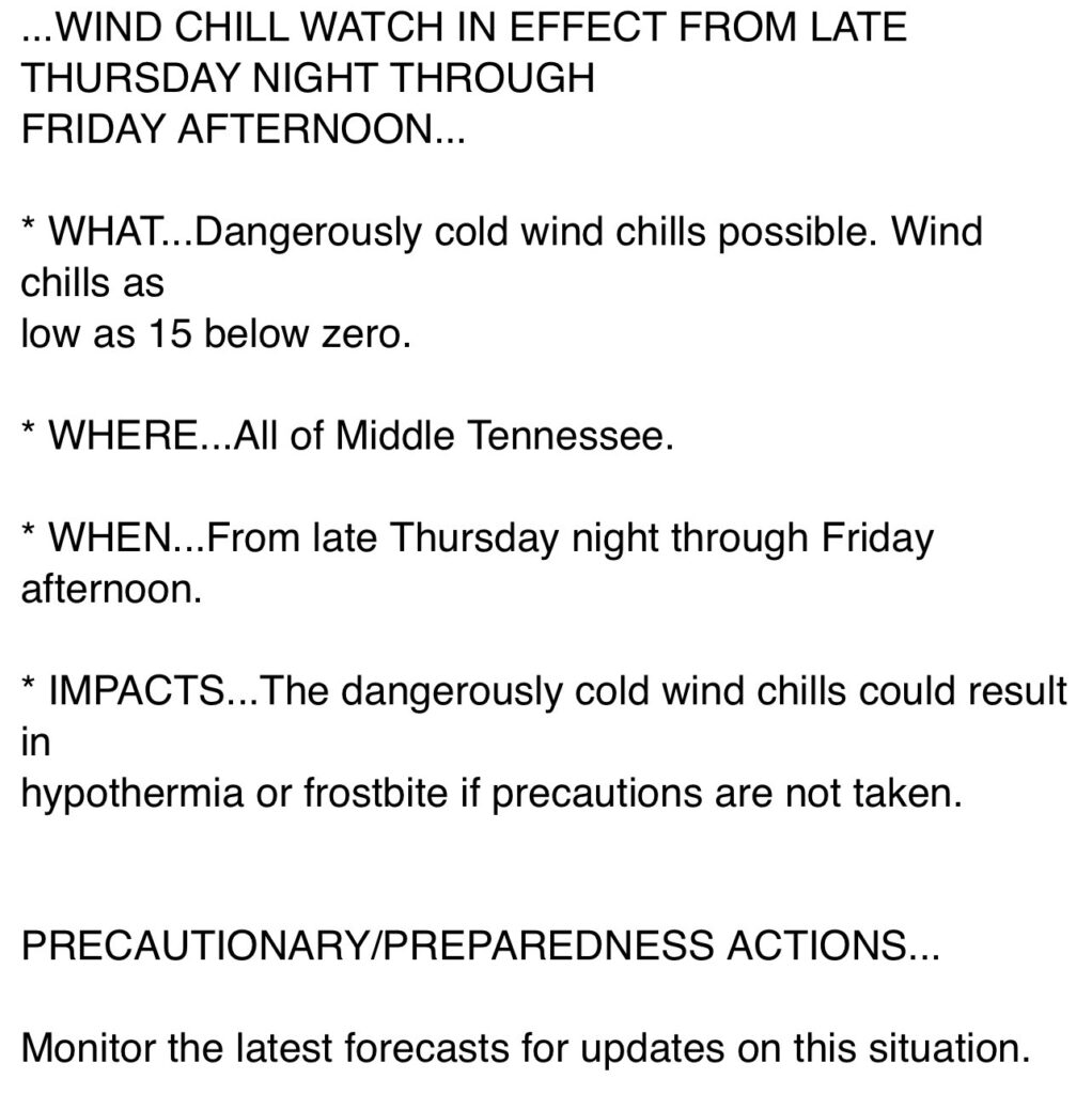
NWS Nashville issued a Winter Weather Advisory for both of our counties from 6pm Thursday – 6am Friday.
They also extended our Wind Chill Warning, now starting at 10pm Thursday thru noon Friday, accounting for the expected earlier arrival of the cold front.
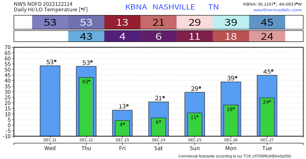
Today, Wednesday, and the majority of Thursday will be not too bad as high temps try to reach 50°. If you have something to do outside, I’d probably get it done now.
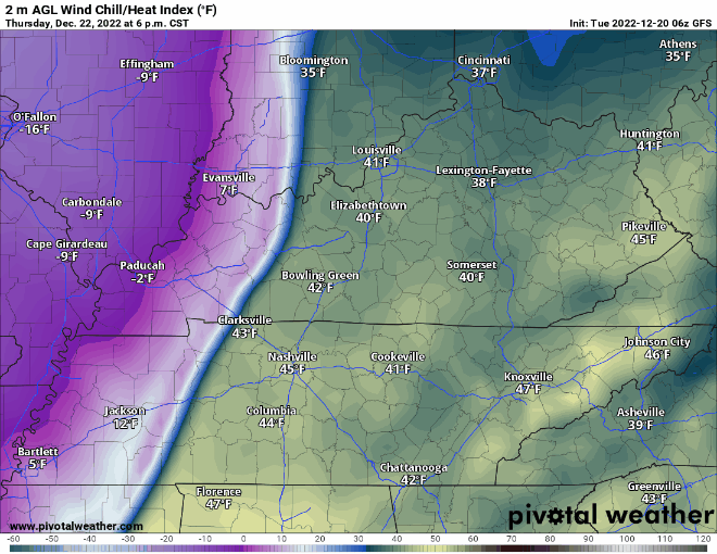
Thursday it should start raining sometime midday/afternoon. Then the arctic air arrives around 9p, give or take a few hours. Temperatures will plummet into the single digits overnight. High temperatures will struggle to make it into the teens on Friday, while wind chill values will not make it above zero throughout the day Friday and into midday Christmas Eve. A Wind Chill Advisory was issued for wind chill values of ten-fifteen degrees below zero, due to guests as high as 35-40mph. Temperatures will stay below freezing for “`~84 hours Thursday night into midday Monday. Anyone planning on going to the Titans game X-mas Eve needs to plan to really bundle up, as feel like temperatures will be in the single digits the entire game.
Especially if you are heading out of town, but even if you aren’t, the time to prepare is now.
You must be logged in to post a comment.