Today will feel more like a spring day, with temperatures reaching the upper 60’s. Clouds will clear out sooner than later, no rain. Our high is officially 68°, only 3° shy of the record for January 17 set in 1937.

Today will feel more like a spring day, with temperatures reaching the upper 60’s. Clouds will clear out sooner than later, no rain. Our high is officially 68°, only 3° shy of the record for January 17 set in 1937.
If you have anything to get done outside today, I’d recommend getting it done this morning.
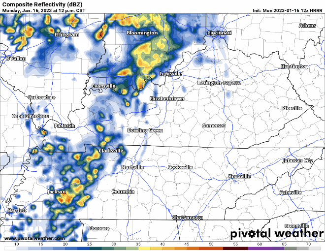
The HRRR model thinks rain starts around 1 or 2pm, give or take an hour or so. Rain should continue on and off throughout the night, ending before Tuesday morning.

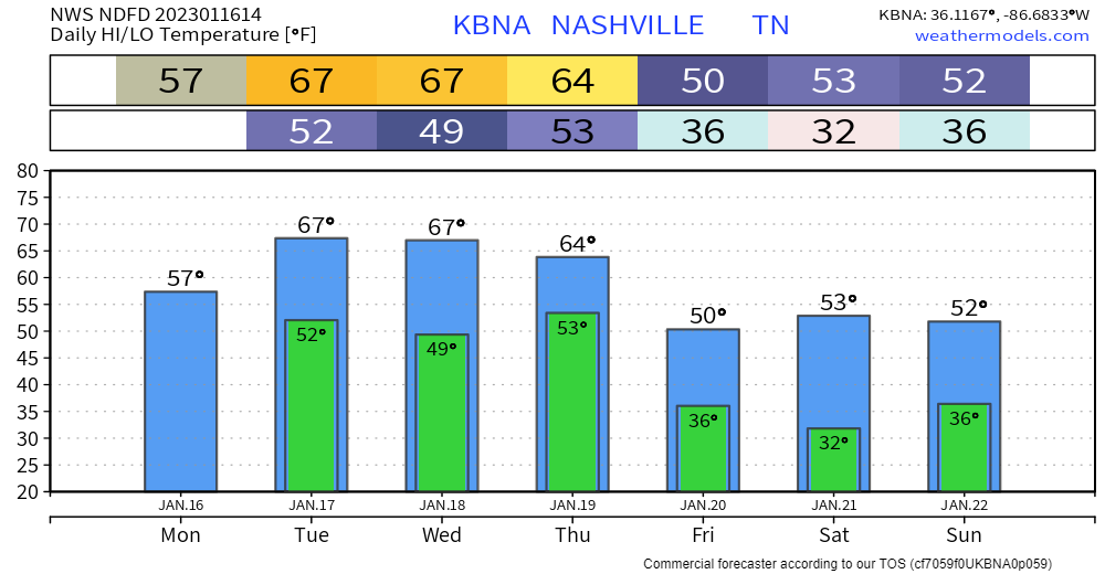
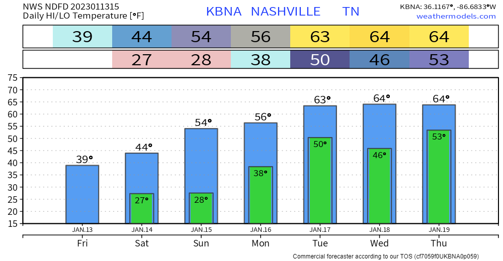
Temps will warm into the 50s today with a blue sky. We’re above seasonal temps all week. Temps mid week could even get into the 60s.
But with those warming temps we’ll also see an increased chance for rain for Monday and later in the week. After today, we’ll have a front move our way with showers for at least Monday afternoon.
The flizzard is over!
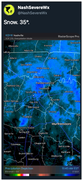
All in all we picked up 0.0″ of snow and 0% of us lost power. Winning!
TODAY… Temps will be in the lower 40s and after the cloud deck moves out, the sun returns. It will be a welcome sight.
Sorry snow lovers, but you’ll only get to look at the snow falling today. We comfortably sit above freezing and will stay that way all day (until tonight, but snow will stop before that). No impacts are expected. Head to the Plateau for snowman building.
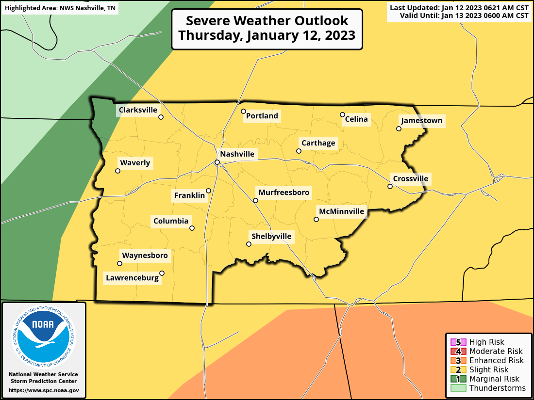
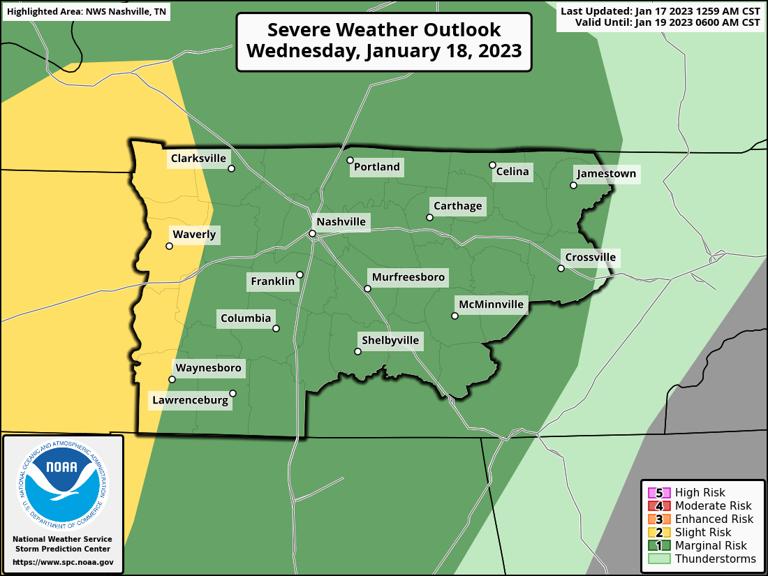
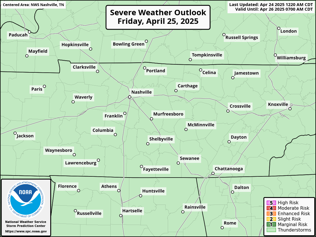
The Storm Prediction Center has our counites outlooked with a:
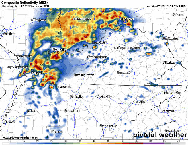
Main threats today are large hail and damaging straight-line winds. Golf ball sized hail, and some larger, has already fallen in Kentucky this morning.
Minus the clouds and maybe occasional shower or drizzle, today won’t be too bad with highs in the mid 60’s.
Tomorrow the Storm Prediction Center has outlooked both of our counites with:
Models aren’t doing the best job of agreeing on this. The latest run of the HRRR model thinks the majority of the storms completely miss us tomorrow and we get away with maybe just some rain. Meanwhile, a couple other models disagree and think storms, possibly severe, do impact us.
Fairly nice day today and tomorrow, highs near 60°. Maybe some drizzle throughout the day Wednesday.
For Thursday, the Storm Prediction Center has outlooked our counites with a 5% chance of severe weather within 25 miles.
Boring weather for the next few days. Temps will warm tomorrow to around 60º. Same on Wednesday. This is great! It would stay great except there is a chance of rain and thunderstorms Wednesday night and Thursday. There’s a small chance for some isolated overnight showers Tuesday night, but this seems very insignificant.

We’ve picked up vary amounts of rain the last 36 hours. Most of that rain is moved off to our east, but we will see drizzle cloudiness for much of today. A bright spot is the temperatures which are hovering around 50 at present and might get up to 55 later. Higher still if we can get a bit of sun.
You must be logged in to post a comment.