
Today will feel more like a spring day, with temperatures reaching the upper 60’s. Clouds will clear out sooner than later, no rain. Our high is officially 68°, only 3° shy of the record for January 17 set in 1937.
Tomorrow during the first half of the day will be very similar to today, and then a system moves in later that night.
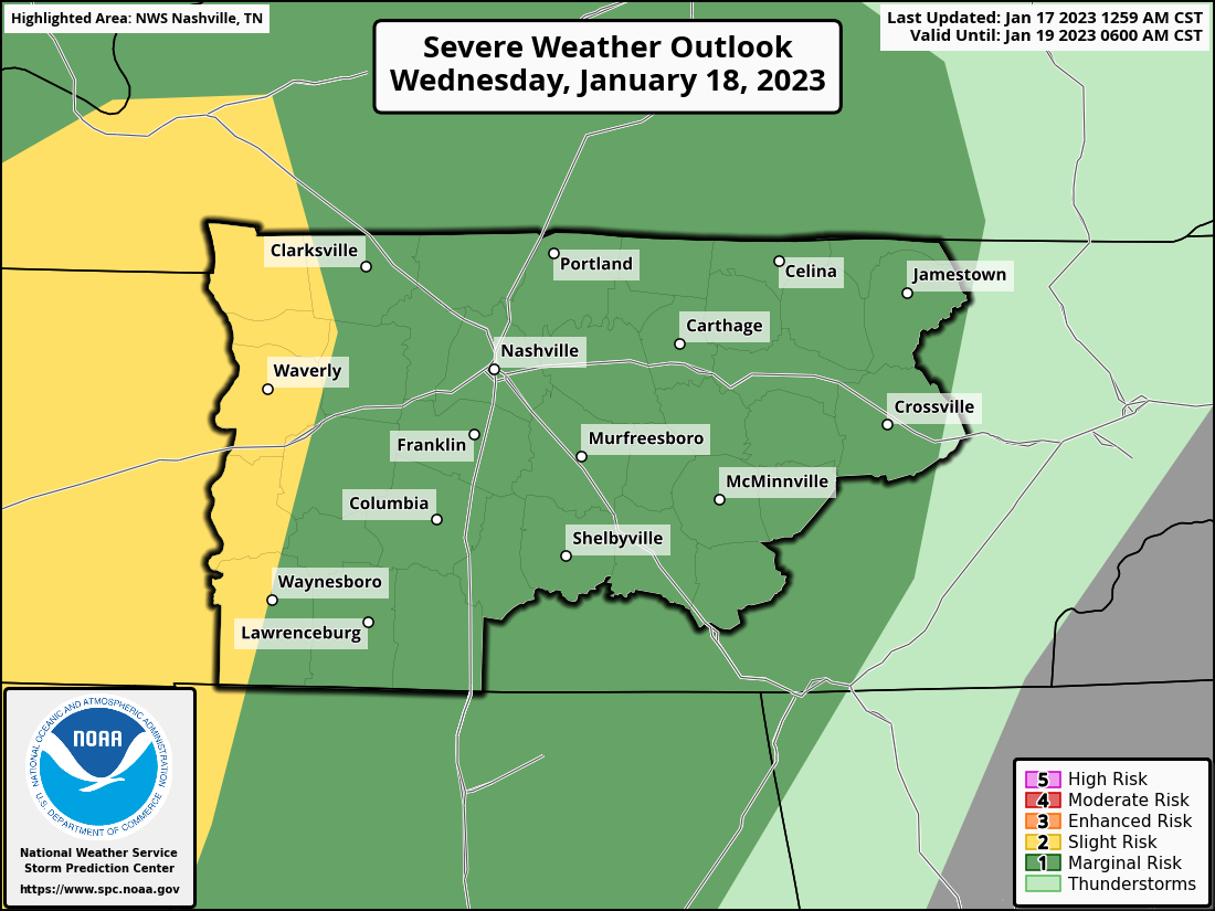
The Storm Prediction Center has outlooked our counties with a
- 5% chance of damaging straight-line winds within 25 miles
- 5% chance of severe hail within 25 miles
- 2% chance of a tornado within 25 miles
The Weather Prediction Center has also outlooked our counties with a 5-15% chance of flash flooding within 25 miles.
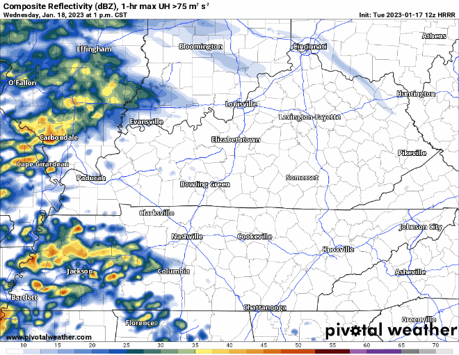
The HRRR model thinks just some showers will move through Wednesday afternoon, and then the main line moves in sometime around the midnight hour, I’d call it +/- an hour or two.
The HRRR model, and most models show extremely low, if any CAPE (storm fuel). This is good news for us, but we’ll keep an eye on it in case anything changes. Not overly concerned with this system, but no reason to completely let your guard down.
However, with this moving in while most people are sleeping, make sure you have a way to wake up if a warning is issued for you. A weather radio and/or a wake-me-up app are two great options.
Rainfall totals for this event look to be around 1″ – 1.5″.
Rain should move out before Thursday AM commute, leaving us to dry out and cool down. Our high temperature Thursday will likely occur at midnight.
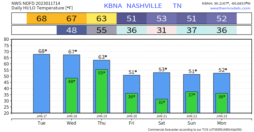
Temperatures will be where they ought to be for this time of the year for the weekend. Next rain chance looks probably Sunday, details still iffy on that one.
Quick References:
Weather changes constantly.
Follow @NashSevereWx on Twitter for any changes to this forecast.
Live coverage during tornado and severe thunderstorm warnings.

Look good.
Support the mission.

We are 100% community supported. No ads. No subscription fees. Keep it free for everyone.


Categories: Forecast Blogs (Legacy)
You must be logged in to post a comment.