
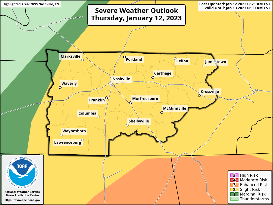
The Storm Prediction Center has our counites outlooked with a:
- 15% chance of severe hail (1″+ in diameter) within 25 miles
- 15% chance of damaging straight-line winds (58mph+) within 25 miles
- 2% chance of a tornado within 25 miles
Main threats today are large hail and damaging straight-line winds. Golf ball sized hail, and some larger, has already fallen in Kentucky this morning.
Winds ahead of the storms will be gusty, with gusts up to 35mph.
Time frame of severe potential looks to be 6am-2pm today.
The HRRR model shows storms developing to the west of us and moving into our area. This run thinks multiple waves of storms are possible throughout the afternoon.
Looks like damaging wind and severe hail are possible with any of the storms, but I think the tornado threat will be limited to the AM hours, as wind shear decreases after noon. Regardless, the tornado threat is very low anyway.
I wouldn’t totally alter your plans, unless they involve being outside, then I would change them. But as long as you are indoors, should be good to go about your day. Check our Twitter for updates and you can always check the radar here: Radar – Nashville Severe Weather. As always, if a warning is issued for us, we’ll go live on our YouTube channel.
If possible, I’d try to park your vehicle under shelter with the threat of large hail today. Dents or broken windows are no fun.
No real flash flood threat today, rainfall totals look to stay around half an inch. Rain should clear out by around sunset.
Temperatures will start to fall this evening and overnight, as temps will fall all the way into the mid 30’s. They are expected to stay above freezing. You may see some flurries Friday morning, but no impacts are expected. If you want to see snow on the ground, head for the Plateau.
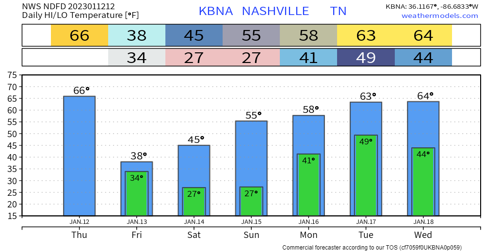
Temperatures will slowly rebound back to above average by early next week, just in time for our next rain chance. No severe weather expected with this.
Quick References:
Weather changes constantly.
Follow @NashSevereWx on Twitter for any changes to this forecast.
Live coverage during tornado and severe thunderstorm warnings.

Look good.
Support the mission.

We are 100% community supported. No ads. No subscription fees. Keep it free for everyone.


Categories: Forecast Blogs (Legacy)
You must be logged in to post a comment.