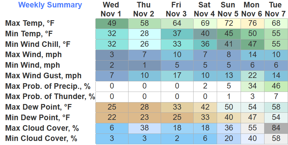
Rain has finally made it and will stick around on/off overnight and into the morning.
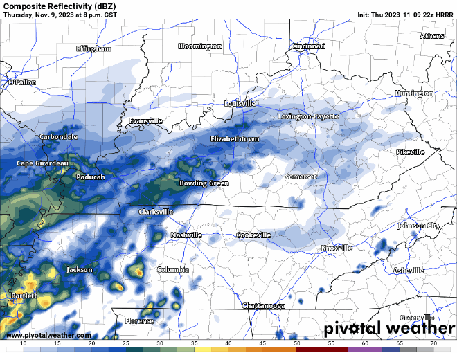
The HRRR model shows some showers for your AM commute to work/school but ending quickly after. We should be dry by lunch.

Rain has finally made it and will stick around on/off overnight and into the morning.
The HRRR model shows some showers for your AM commute to work/school but ending quickly after. We should be dry by lunch.
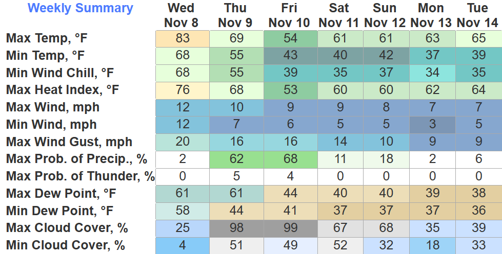
It seems we are big on ties, as we have tied the daily record high for today with a high of 83°. Our third straight day of tying, we wouldn’t want to take the glory away from past years.
We won’t see the 80s again for a while, cold front moving thru tomorrow will knock temperatures down to where they ought to be for this time of the, and bring some very, very, much needed rain.
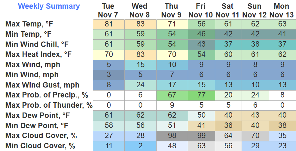
BNA made it to 80° today, tying the daily record high. Wednesday we’ll have another chance to tie/break the daily record high of 83°. Winds gusting up to 20-25mph from the south will help us get warm, and also would help spread fires, so pls don’t burn stuff.
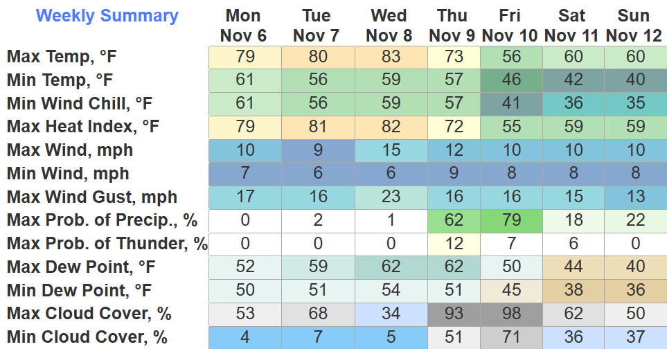
As of 4pm, Nashville has tied the daily record high at 79°. Tuesday the record high is 80°, Wednesday it’s 83°, both days we will get close to tying/breaking that record. Is it November or April?
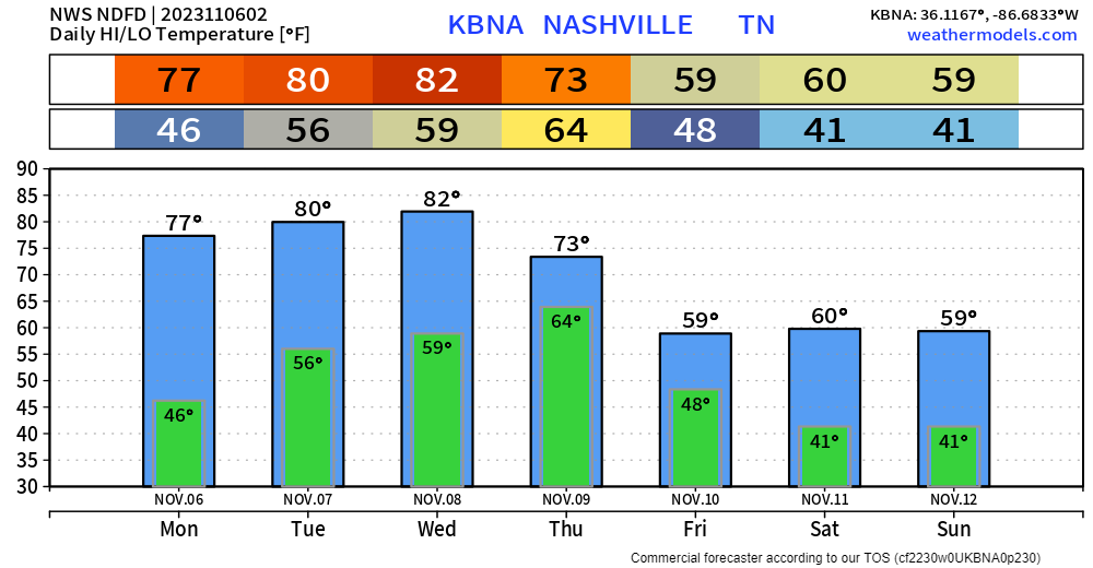
Record highs in Nashville for Monday, Tuesday and Wednesday are 79°, 80° and 83°, according to the National Weather Service. If we don’t tie or break those records this week, we’ll be awfully close. We’ll cool off behind a cold front for the weekend, but still not seeing any freezing temps in the long range computer models.
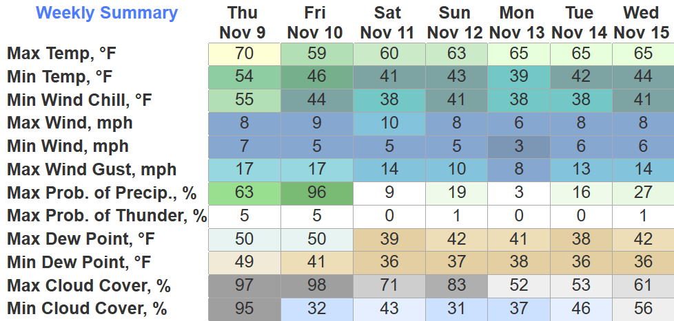
Temps stay very comfortable over the next week or so with cool nights and warm days. No freezing temperatures in the 7-day forecast. Listen closely, and you’ll hear your mums rejoice.
“I dream of rain; I dream of gardens in the desert sand. I dream of rain; I lift my gaze to empty skies above.”
New drought monitor came out today and did not bring good news.
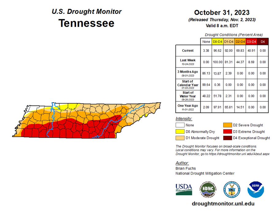
The southern half of WillCo. is now under an Extreme (3/4) Drought, while the rest of us are under a Severe (2/4) Drought. We haven’t experienced an Extreme Drought since 11/29/2016. Very, very little rainfall is to blame, and unfortunately, it looks to get worse before it does better.
Once again, we will be headed down below freezing tonight, 28° is the official low at BNA but your place will probably be a few degrees colder. Thankfully winds will be calm and there won’t be much of a wind chill.
You’ll really have to earn the candy tonight as you fight a jerk NNW wind. Winds will pick up over the next few hours, gusting up to 20mph. As of 6:30p, temperatures are in the mid 40s, but will quickly drop to the upper 30s by 8pm, but with the wind it’ll feel like the lower 30s. Might want to hit a light jog in-between houses to keep warm.
The cold front has pushed thru and brought some chilly (chili?) weather. The light rain will shortly end, leaving us with a dry, jerk north wind.
First freezes of the season mean Freeze Warnings have been issued, 3am to 9am Tuesday, and again 10pm Tuesday thru 10am Wednesday. “Frost and freeze conditions will kill crops, other sensitive vegetation and possibly damage unprotected outdoor plumbing.” Prepare as needed.
You must be logged in to post a comment.