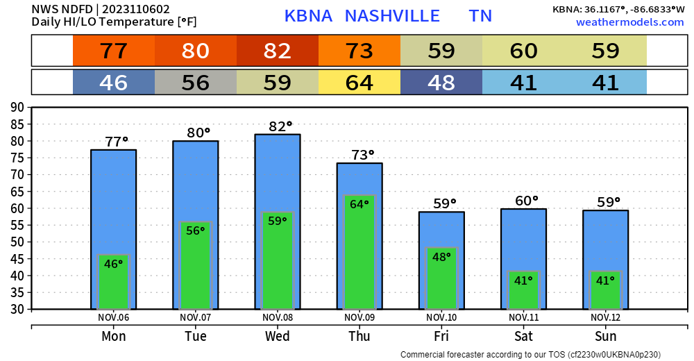
Record highs in Nashville for Monday, Tuesday and Wednesday are 79°, 80° and 83°, according to the National Weather Service. If we don’t tie or break those records this week, we’ll be awfully close. We’ll cool off behind a cold front for the weekend, but still not seeing any freezing temps in the long range computer models.
Precip
This cold front will bring rain chances, which we could really use. The window for rain opens on Thursday (mostly afternoon) and closes during the day Friday.
NWS Blend of Models drops around three quarters of an inch of rain on us Thursday/Friday. This would cause rainouts if these amounts hold true.

Weather 101 Continues
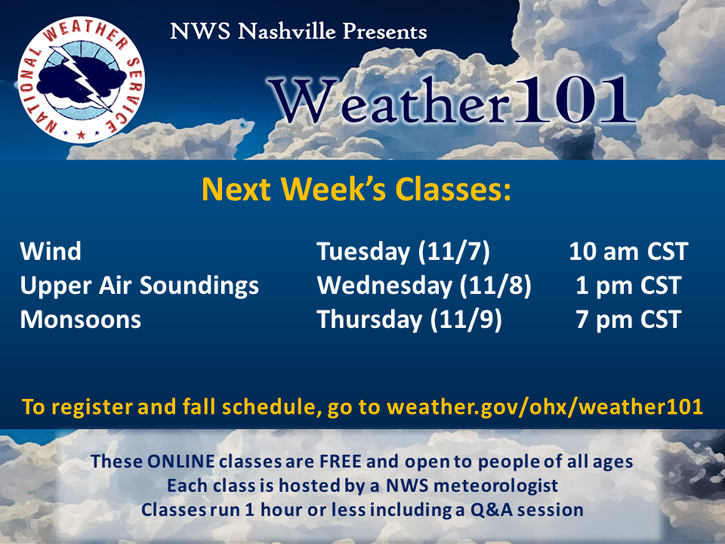
Our local National Weather Service office is continuing their free Weather 101 classes this week. Sign-up if you’re interested!

Quick References:
Weather changes constantly.
Follow @NashSevereWx on Twitter for any changes to this forecast.
We are 100% community supported. No ads. No subscription fees. Keep it free for everyone.
Categories: Forecast Blogs (Legacy)


You must be logged in to post a comment.