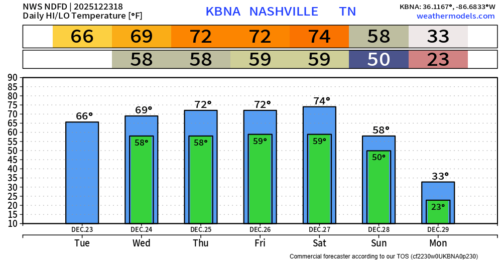
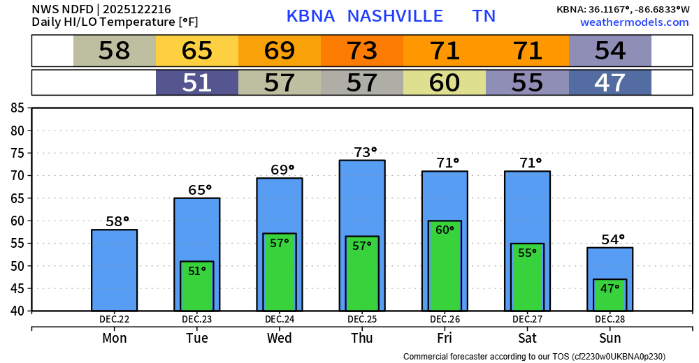
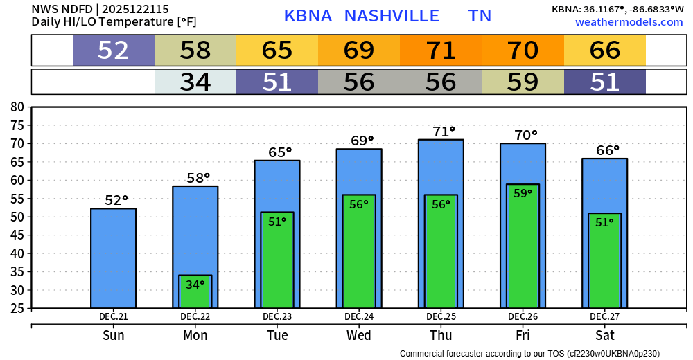
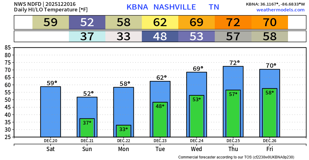
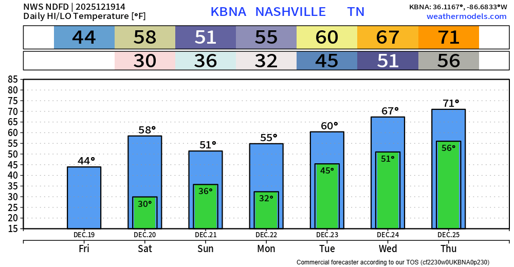
This looks absolutely nothing like what we dealt with last week. However, it still is worth keeping an eye on.
The Storm Prediction Center has slightly upped our chances for severe weather on Thursday, particularly for the afternoon and evening.
From 80s just a couple of days ago, we are looking at two straight nights of temperatures getting close to, if not below freezing…
Official lows for Nashville for tonight and Tuesday night are 33° and 34°, respectively. Although downtown is usually a few degrees warmer than everywhere else, so most of us likely will see a freeze. Cover up/bring in any plants.
Models continue to struggle. Forecasters are ready to fire these models into the sun.
MORNING RAIN
This was the radar at 8 AM. All this rain is supposed to move north into Ky. as shown by the red arrows. But it’s also creeping a bit east — the white arrows — right over Davidson Co. Not sure how far into town it’ll get.
1049 AM UPDATE: Last two HRRR model runs show a brand new potential concern: mid afternoon supercells somewhere in Middle TN which could produce tornadoes. This was not in the forecast (or in any of the data) this morning, so take it with a grain of salt. We don’t hide data from you. Takeaway: pay attention to the weather ALL DAY, not just tonight.
No April Fools jokes here. We are about to enter an active (and very complicated) pattern that will give us the potential for severe weather and flooding everyday Wednesday through Saturday. This does not mean we will see severe weather and flooding every single day – in fact, majority of the days we might not see either. However, the chance will exist.