
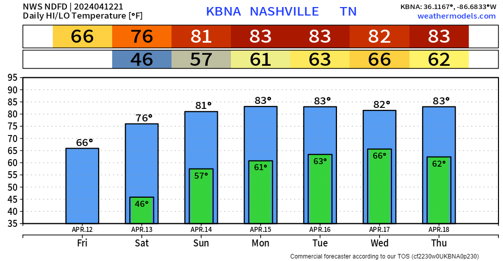
Another very warm day to add onto to our string of other very warm days.
Wednesday and Thursday will follow suit with highs in the low to mid 80s. Friday will begin a weekend of some cooler temps, with highs in the 60s for the most part.

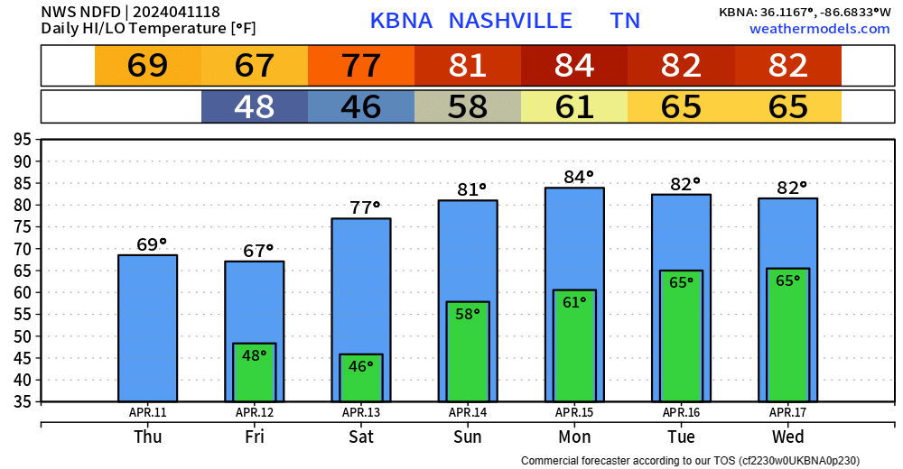
Another very warm day to add onto to our string of other very warm days.
Wednesday and Thursday will follow suit with highs in the low to mid 80s. Friday will begin a weekend of some cooler temps, with highs in the 60s for the most part.
Very warm today and tomorrow. Record high temps for BNA are 87° and 88° for today and tomorrow, respectively. Not quite sure we’ll make it to either of those, but it’ll be close.
We could see some light showers early Tuesday morning, but these will be light and NBD.
Monday looks like a great, dry spring-like day. High temperatures getting all the way into the mid 80s.
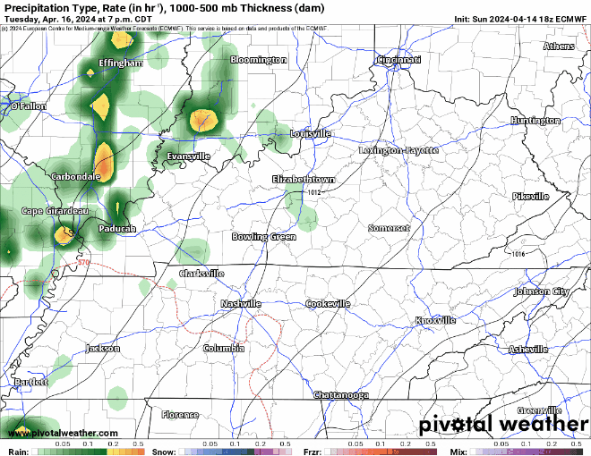
Tuesday still looks warm, but a few showers may swing around during the morning and evening hours.
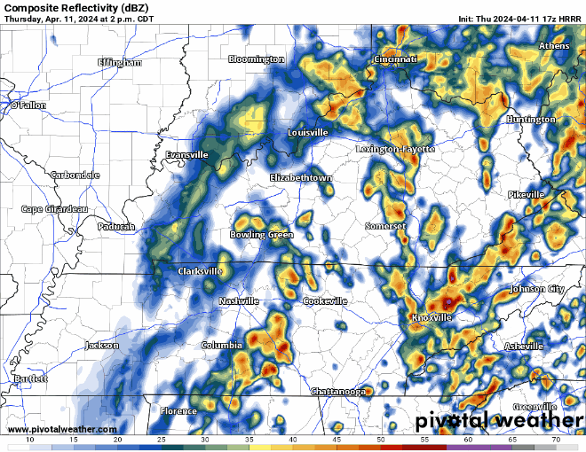
There could be a few storms Tuesday night as a weakening line of storm approaches the area, but no severe concerns for our area.
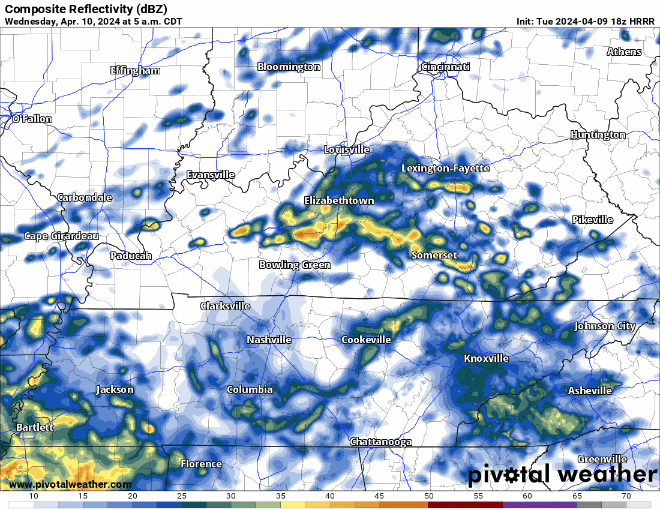
That line of showers/storms should be moving out by rush hour Wednesday AM, but we could be dealing with more storm chances later in the day.
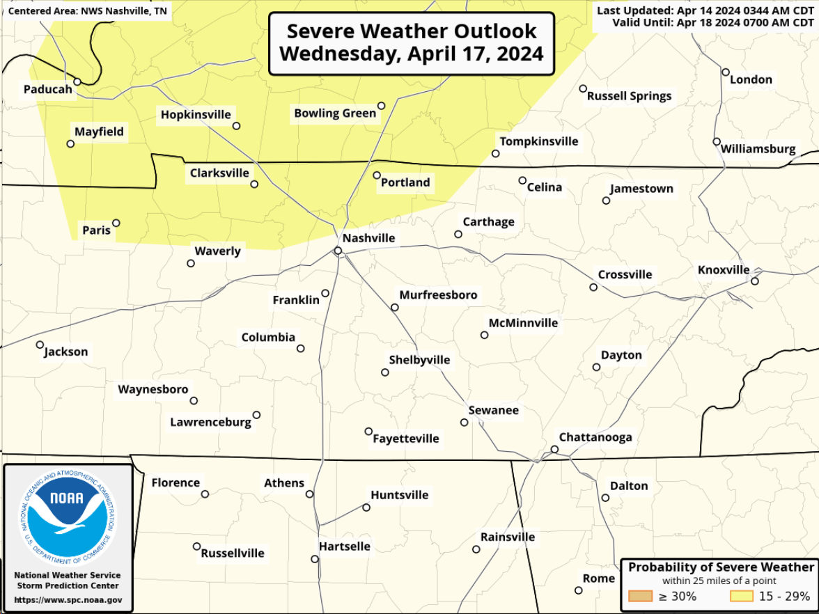
The Storm Prediction Center has included the far northern portion of Davidson Co. in a 15% chance of severe storms within 25 miles for Wednesday. This is still several days out, so a lot will change between now and then.
"Uncertainty continues on how strong or
widespread this activity may get as the upper level low weakens
while moving even further northward away from us, taking the main
upper forcing with it. Nevertheless, forecast soundings continue
to show quite favorable parameters for some strong to severe
thunderstorms ahead of the front, especially across our northwest
half, so we will have to keep a close eye on this potential." - NWS Nashville
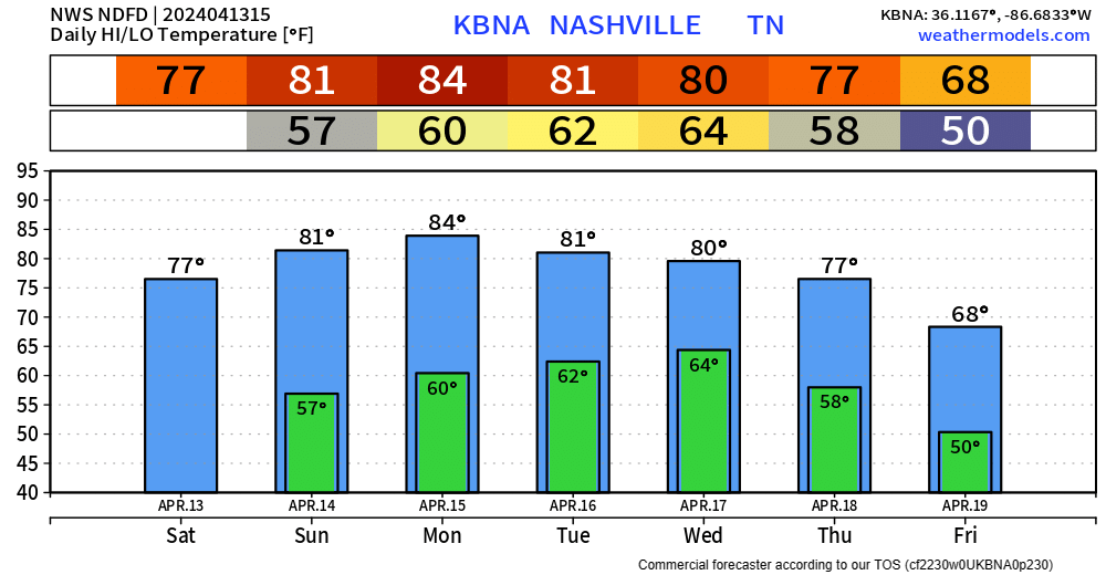
Big warm up starts today as highs will get up into the upper 70s, then low 80s for the first half of the new week.
We should be able to get away with a dry weekend, only hiccup may be an isolated shower Sunday afternoon, but majority of models keep us dry.
Winds will die down tonight, leaving us with crisp temps in the mid to upper 40s. Big warm-up starts Saturday, with a high of 76° and mid-80s by early next week.
Since it’s Spring and all…we live among the battle of the air masses. So, our next storm system moves across the central US just as we start warming up. The system should arrive here around Wednesday and could hang around until the weekend. While we are not currently outlooked for severe weather, it will bear watching. We can’t turn our backs to the western sky this time of year.
Just a few more showers to deal with today. Maybe a rumble of thunder, but no severe weather concerns.
Majority of the rain should be gone by sunset.
Friday thru Monday look fantastic.
Getting almost hot by Monday, with high temps in the md 80s. Rain chances return Tuesday or so.
We’ve been able to dodge a good bit of the rain today, but more is expected to move into the area tonight and tomorrow. Along with it, some gusty winds are possible overnight, not a bad idea to secure any outdoor furniture.
Mostly dry evening in store, a shower or two can’t be ruled out though. A rain jacket or umbrella will suffice for any outdoor plans this evening.
Wednesday we’ll deal with more rain/storm chances, a couple of storms could be on the strong to severe side.
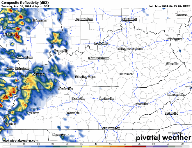
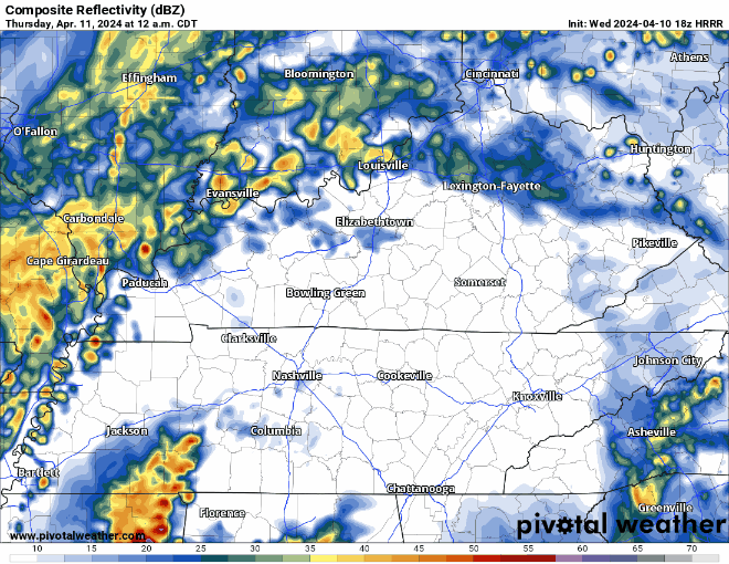
Current hailers in West TN are expected to stay west of us, but a few showers/storms cannot be ruled out tonight. Some gusty winds and small hail aren’t out of the question, but storms are expected to remain below severe limits tonight.
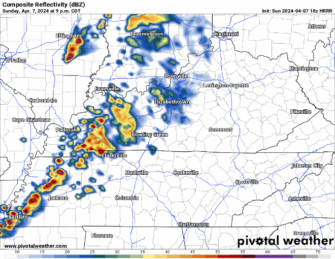
Storms in West TN will slowly make their way over tonight. Thankfully, they should lose their steam and we are not expecting any severe weather tonight.
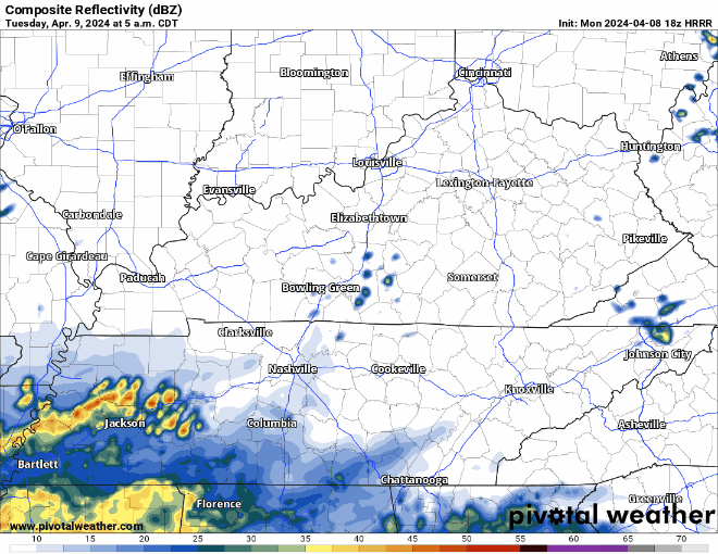
HRRR model (above) has an ETA of around midnight tonight. You may hear a rumble of thunder, but no worries. Rain should exit before Monday AM rush hour.
You must be logged in to post a comment.