
Mostly dry evening in store, a shower or two can’t be ruled out though. A rain jacket or umbrella will suffice for any outdoor plans this evening.
Wednesday we’ll deal with more rain/storm chances, a couple of storms could be on the strong to severe side.
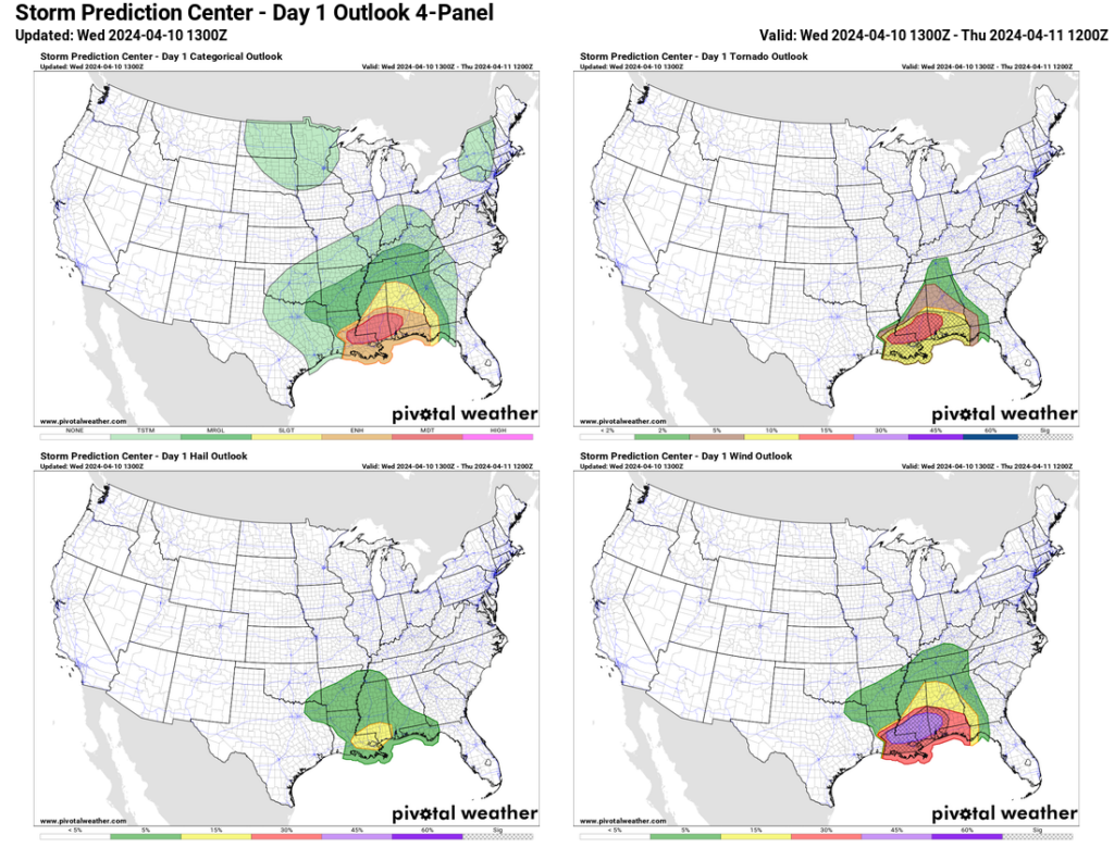
The Storm Prediction Center has outlooked both our counties with a:
- 5% chance of damaging straight-line winds within 25 miles
- 2% chance of a tornado within 25 miles
- we are not included in any severe hail risks
“There continues to be some concern for strong to possibly severe convection during the afternoon hours on Wednesday, especially across southwestern portions of our area. Some derived model soundings showing better instability and potential for strengthening low level atmospheric wind shear than others…but still a lot of questions in place to timing development and potential atmospheric recovery from possible Wednesday morning convection.” – NWS Nashville
AKA models now show there could be enough CAPE (storm fuel) and wind shear to support a strong to severe storm. However, there are still a lot of questions. There could be some rain Wednesday morning which could help limit how destabilized our atmosphere gets, similar to what happened last week, although our ingredients tomorrow will be nowhere near what they were last week. Several band members may be hungover/missing.
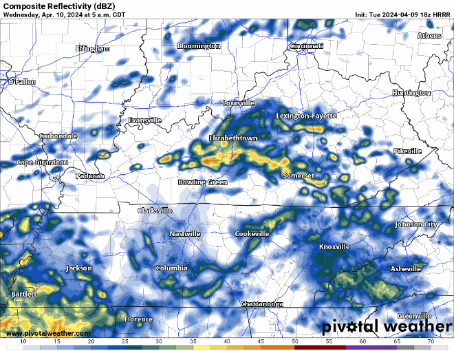
The HRRR model (above) shows some morning rain across our area (good news for us), then some storms (maybe strong or severe) possible in the afternoon. HRRR thinks the ETA will be around 3-5pm but this could and likely will change. Stay connected for updates, but this looks like a very low-end event.
Thursday looks more of the same.
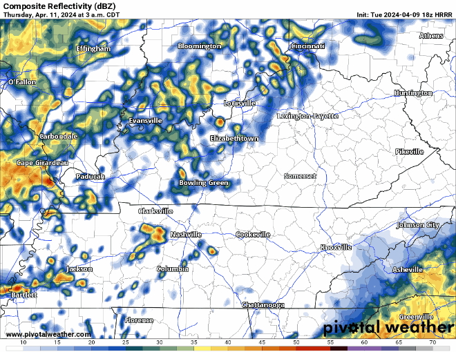
A lot of what happens Thursday will be dependent on Wednesday, but for now, some storms (maybe strong) look to move thru our area during the morning, with more on/off thru the afternoon/evening.
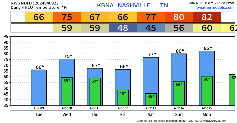
Total additional rainfall thru Thursday is expected to end up around 2-3″. A few low-lying spots may experience some ponding, but no widespread flooding issues are expected.
After a rainy week, we will welcome with open arms a beautiful weekend. Dry with a slow warming trend, with highs ending up near 80° by Sunday. Just what the doctor ordered.
Categories: Featured Blog