
Current Radar
THIS EVENING – 84° by 7 PM
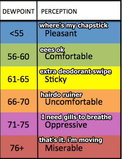
“Cooler,” drier conditions will remain as we head into the evening hours.
Rain will continue to stay far, far away:
It should be a really nice night to get outdoors.

Lows overnight will fall to the mid to upper 60°s!


You must be logged in to post a comment.