
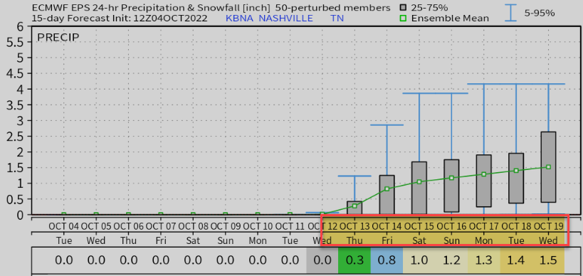
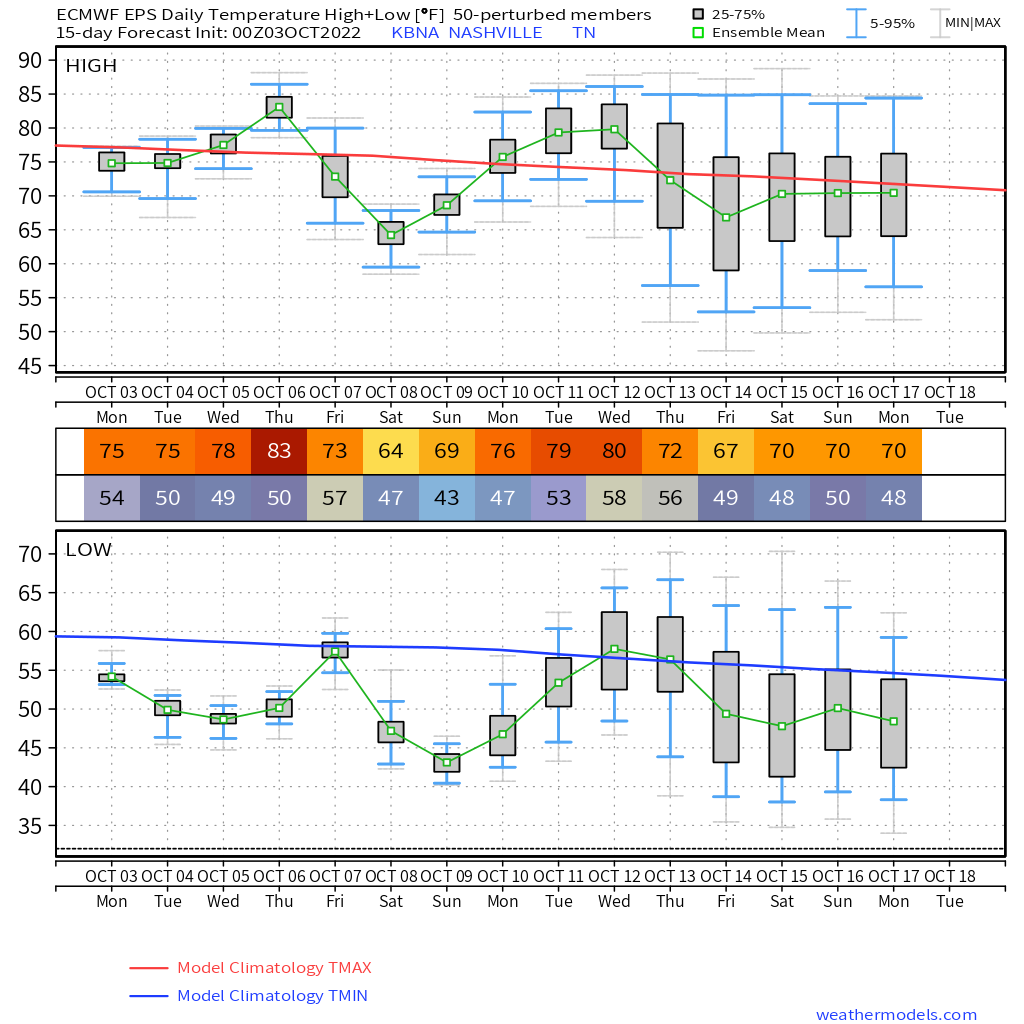
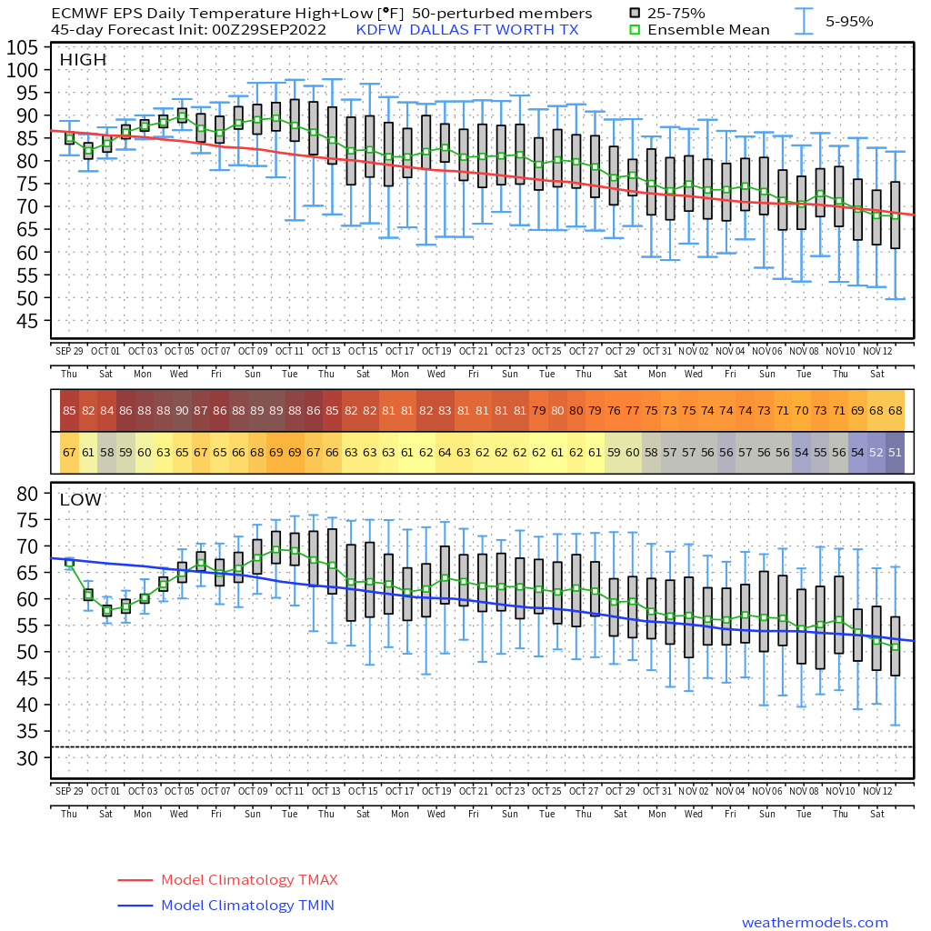
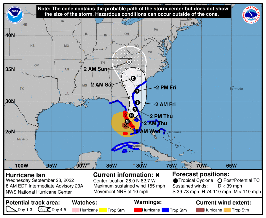
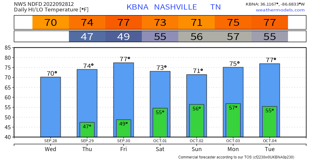
No rain until maybe the Thursday the 13th:
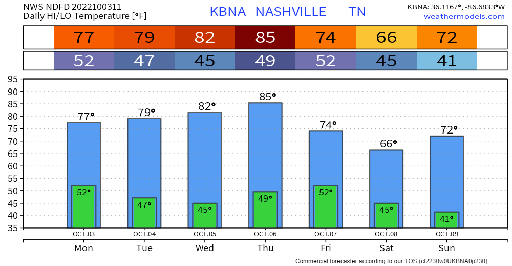
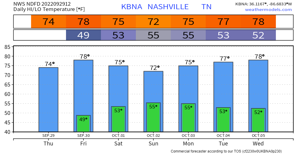
Many of us will dip into the upper 30°s around sunrise weekend.
- Frost should miss us to the east, up on the plateau.
- You’ll want your heater tho.
Alert tweeter Justin side-eyed Tuesday’s crap app forecast: 38° in the morning to 97° in the afternoon, guh.


You must be logged in to post a comment.