

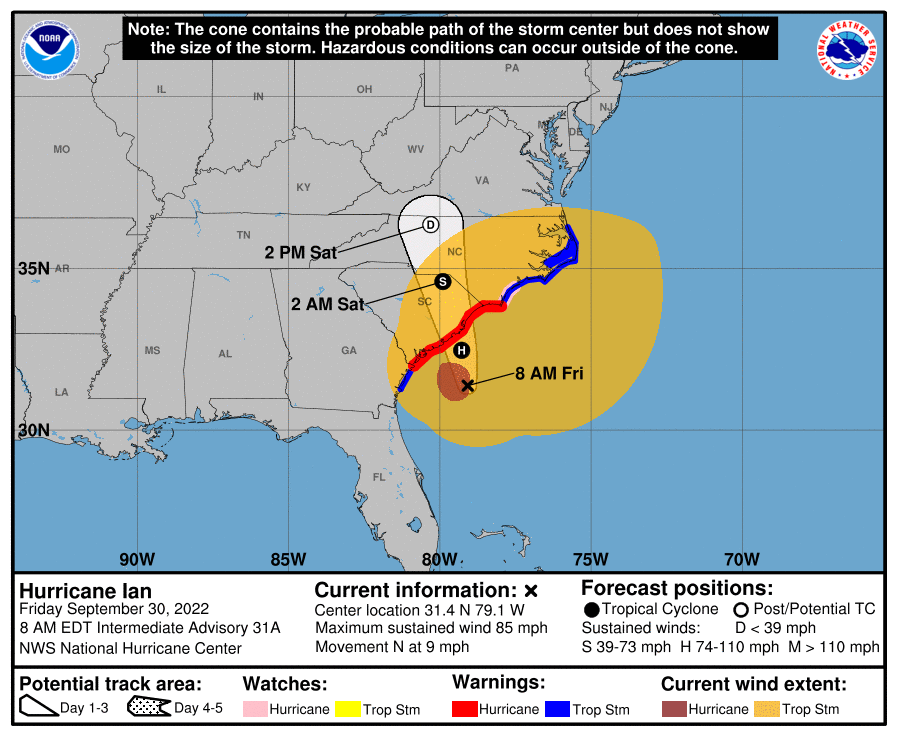
Ian is over there 👉🏽
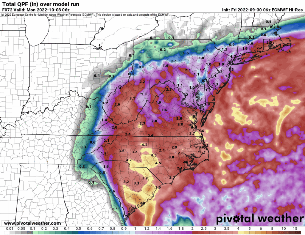
Ian’s rain is all going east of us this weekend:
No rain in sight.
- Models show a front next Thursday bringing us no rain.
- No surprise, October is our driest month.
Our average first fall freeze is November 1.
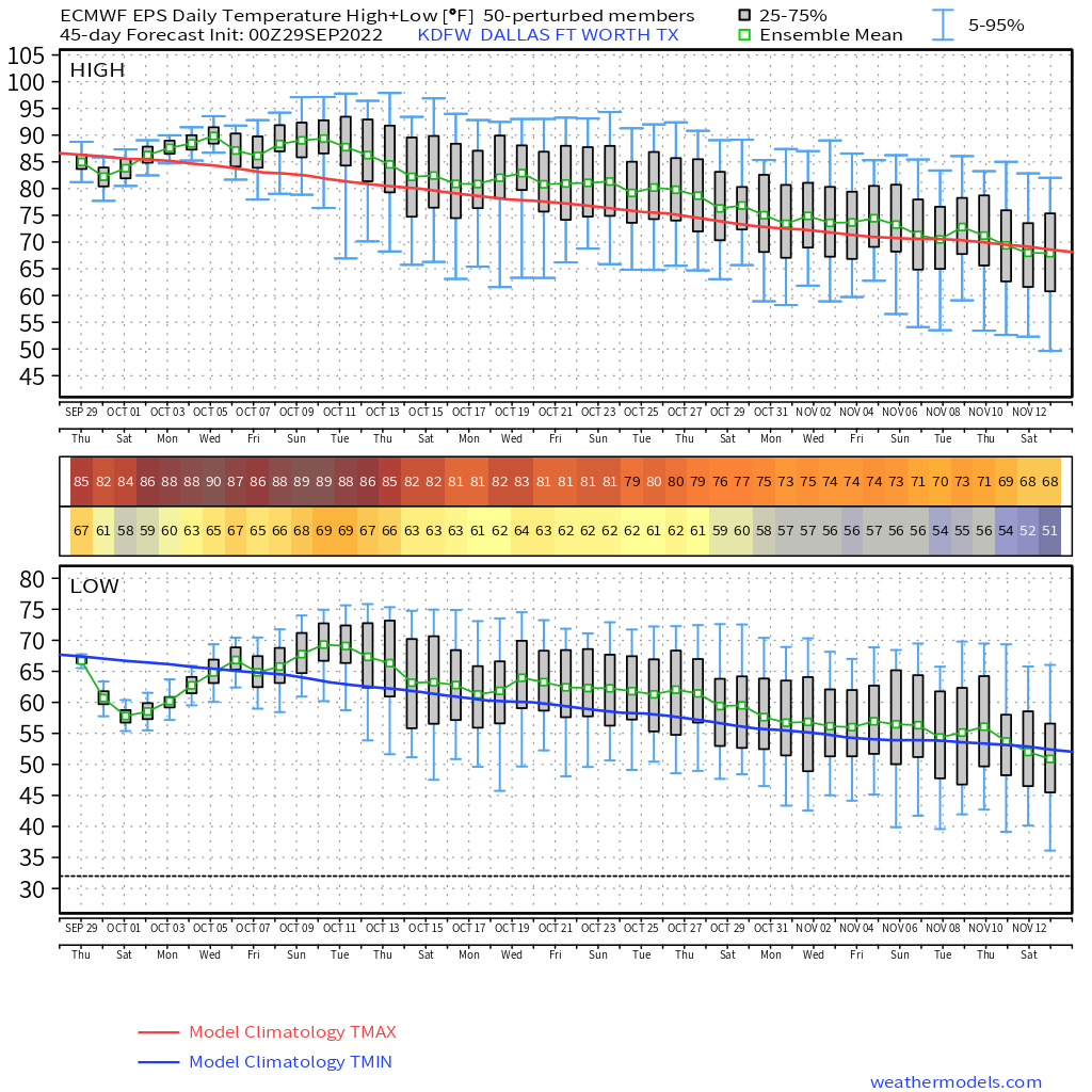
- Euro ensemble model 👇🏽 shows temps mostly above average until the second week of … November.
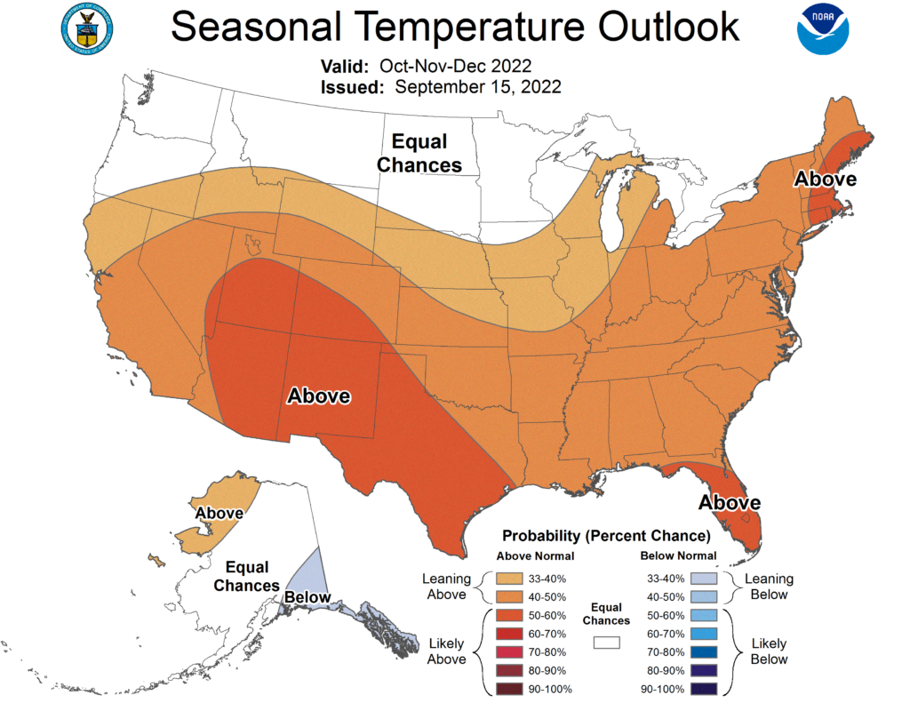
- CPC guidance 👇🏽 thinks above normal average temps (there will be cold snaps) through December:
This is not ideal. So-called “Secondary Storm Season” begins in November.
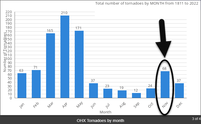
It’s called “secondary” storm season because it’s not nearly as bad as late winter/early spring.*
(*unless a storm hits you, then who cares what it’s called, my shingles are in the creek).
I’d rather have less heat and less moisture to feed storms ahead of inevitable fall cold fronts. That’s how November storms happen.
Leave drama for real housewives, football, and Twitter.
Quick References:
Weather changes constantly.
Follow @NashSevereWx on Twitter for any changes to this forecast.
Live coverage during tornado and severe thunderstorm warnings.

Look good.
Support the mission.

We are 100% community supported. No ads. No subscription fees. Keep it free for everyone.


Categories: Forecast Blogs (Legacy)
You must be logged in to post a comment.