

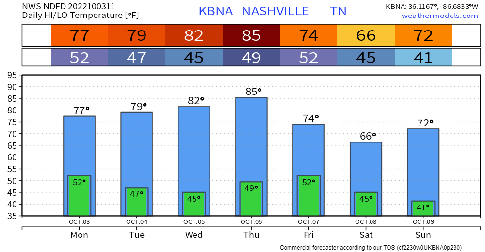
Mid week warm up incoming, then much colder this week.
- Upper 80°s Thursday in some models.
- Cold front arrives Thursday night.
- Much colder weekend mornings.
- Some us of will see upper 30°s before sunrise Sunday morning.
Euro shows several colder than normal mornings over the next two weeks:
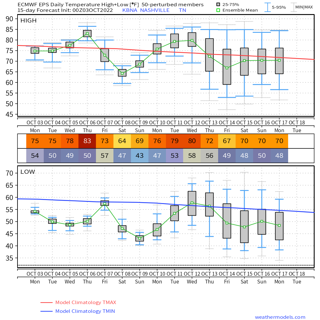
Euro and GFS models show no rain chances until on/after October 13.
- At least some fire danger remains
- Especially tomorrow as relative humidity drops more.
Quick References:
Weather changes constantly.
Follow @NashSevereWx on Twitter for any changes to this forecast.
Live coverage during tornado and severe thunderstorm warnings.

Look good.
Support the mission.

We are 100% community supported. No ads. No subscription fees. Keep it free for everyone.


Categories: Forecast Blogs (Legacy)
You must be logged in to post a comment.