
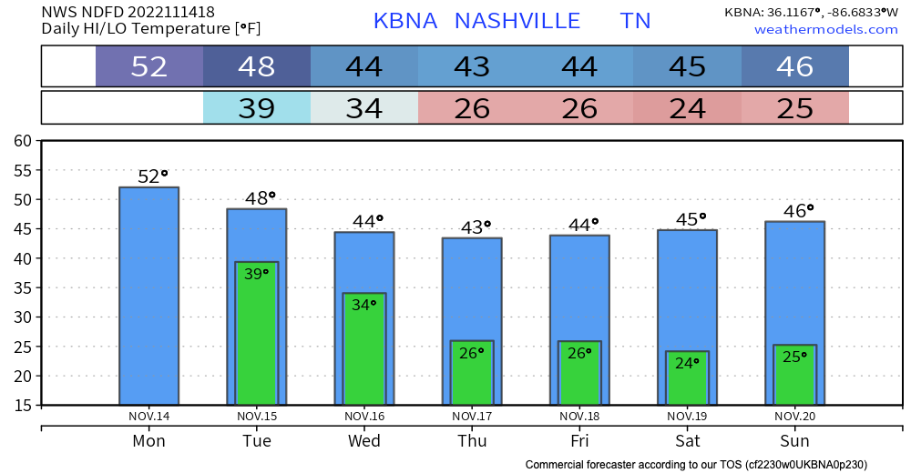
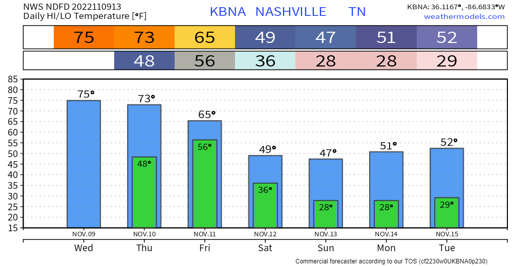
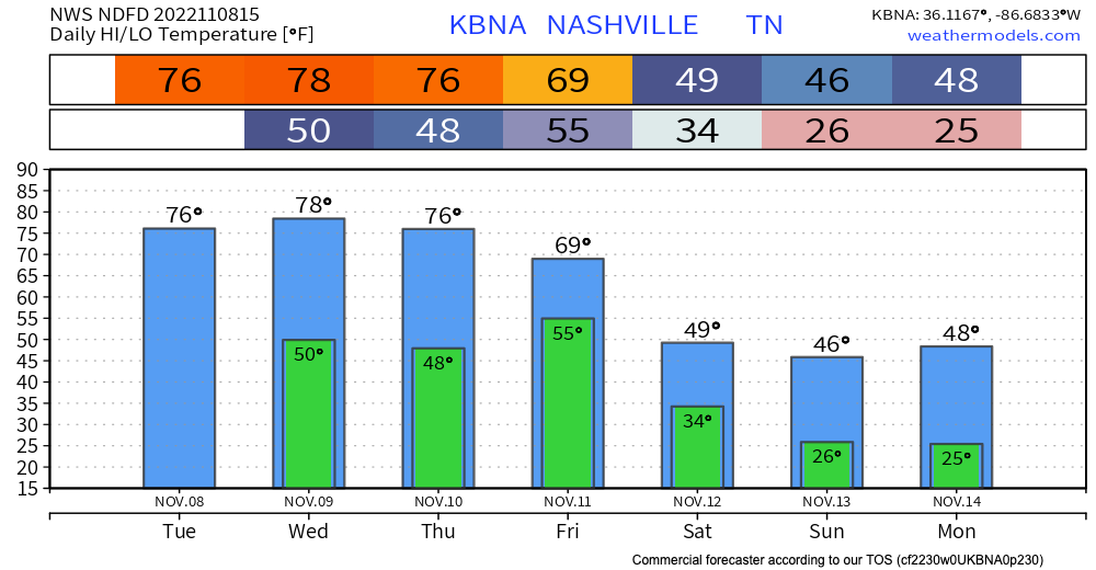
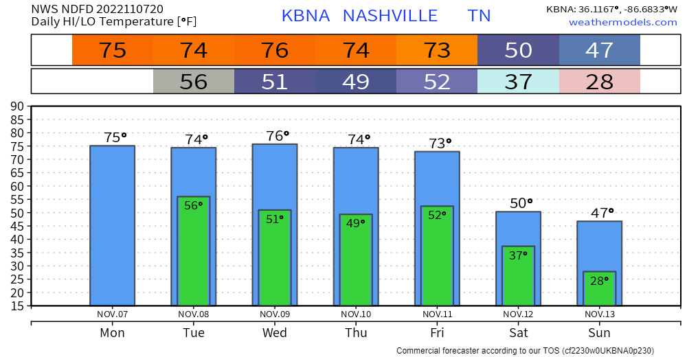
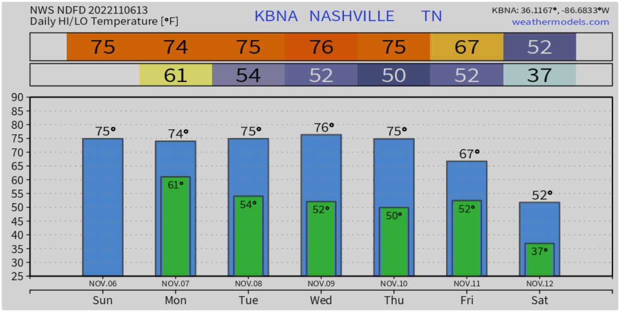
Sun today will give way to unsettled weather tonight. Rain should enter the area around 10:00 pm and continue overnight, ending around lunchtime Tuesday. 12z HRRR:
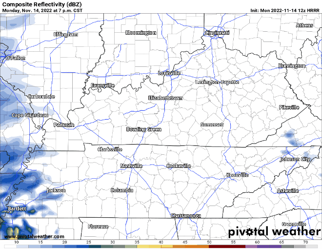
No severe weather or flooding concerns with this system…just a cold rain…about a third of an inch should be common,.


You must be logged in to post a comment.