

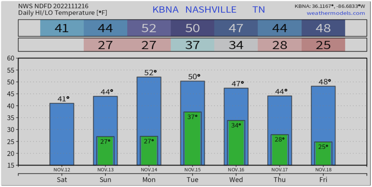
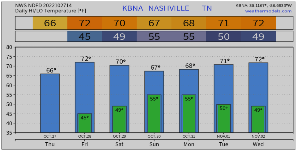
Oscillating between cold and colder and grey skies and sun is pretty typical for us this time of year.
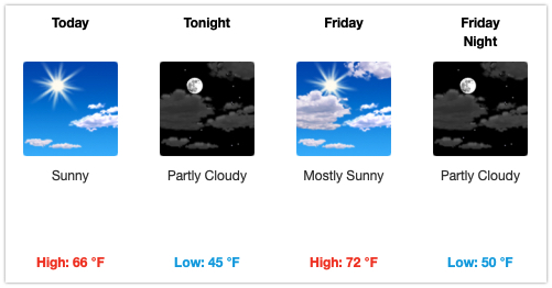
The warmer temps we’ve felt the last few weeks are a distant memory when you walk out the door today. The cold has set in. We’ll have plenty of sun today, but temps will struggle to make it into the mid 40s thanks to a stiff wind from the NW. At least it isn’t Blerg.


You must be logged in to post a comment.