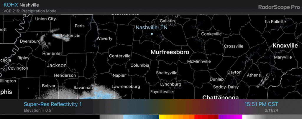
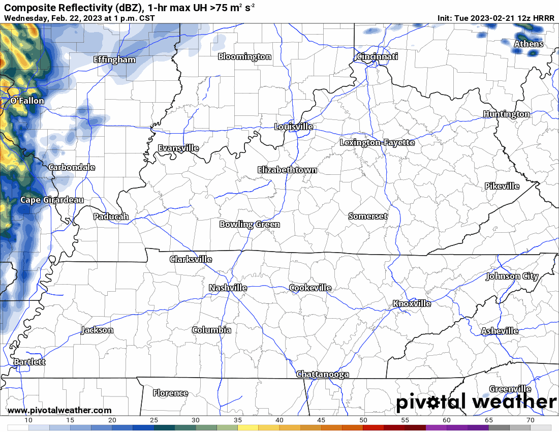
Radar at 440pm shows a little rain entering Middle TN. No big deal.

Radar at 440pm shows a little rain entering Middle TN. No big deal.
Today and Tomorrow will be fantastic. Bright sun in the morning. A little cloud cover in the afternoon.
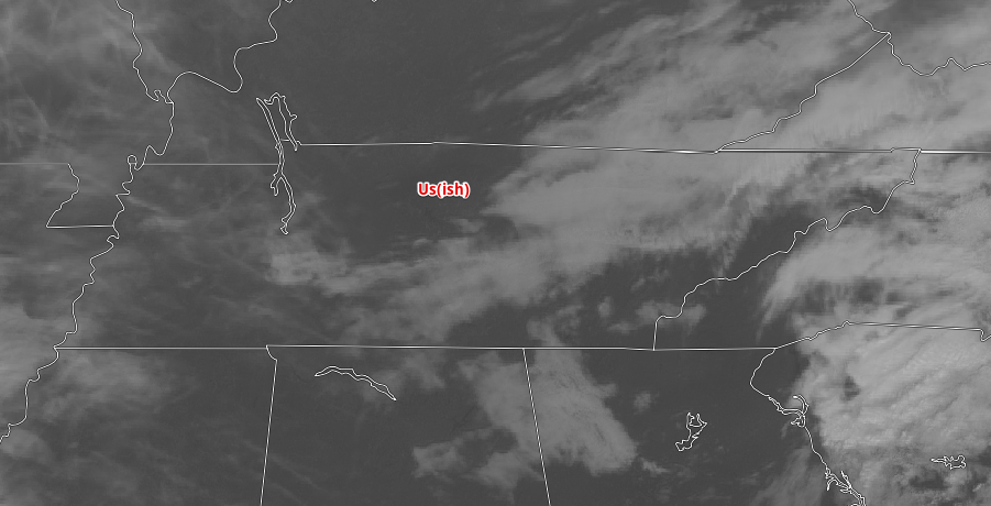
In the satellite image above you can see most of the high clouds have moved out. Temps will rise to nearly 60 both days. Some gusty winds are possible late Friday afternoon and into the evening, but nothing notable expected.
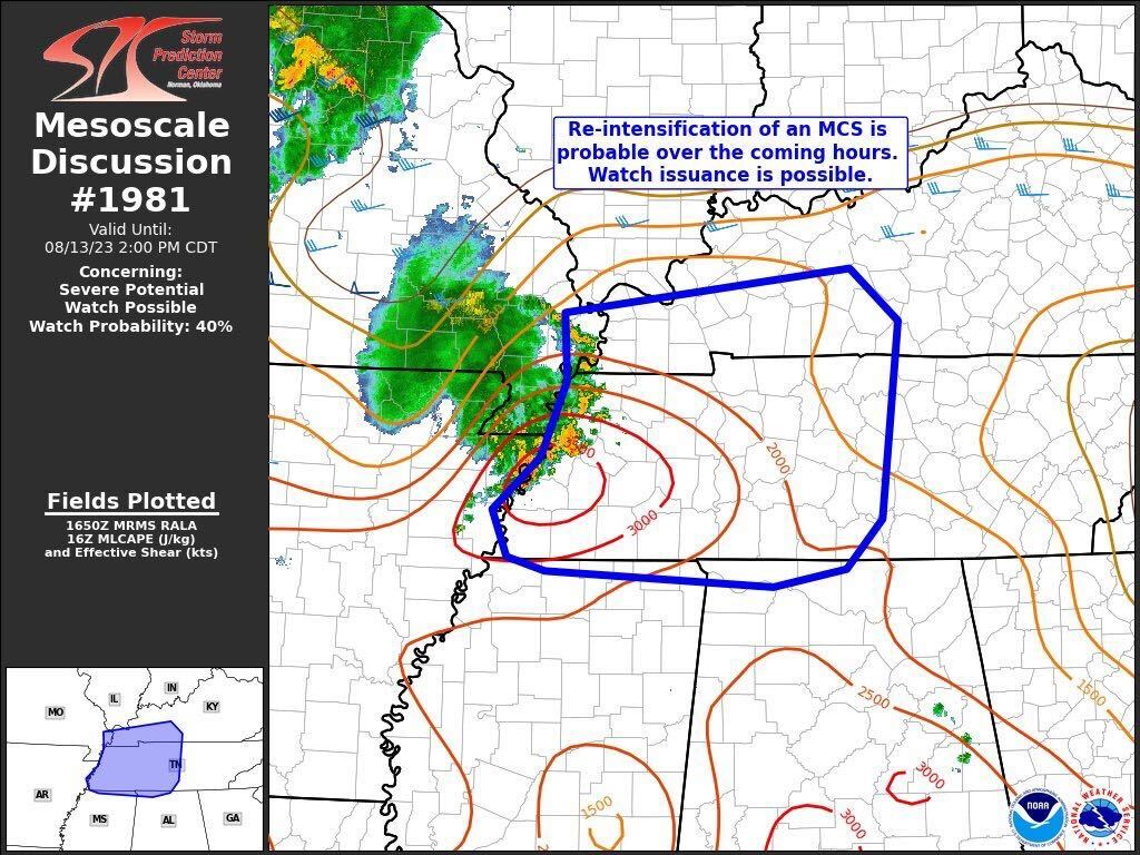
An approaching cold front will bring us a cool down, but first it will threaten us with severe weather.
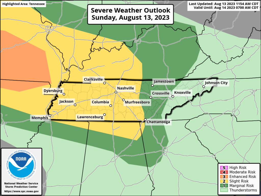
Currently, the hot and humid air and abundant sunshine are adding instability to our atmosphere. A severe thunderstorm watch has been issued by the storm prediction center.
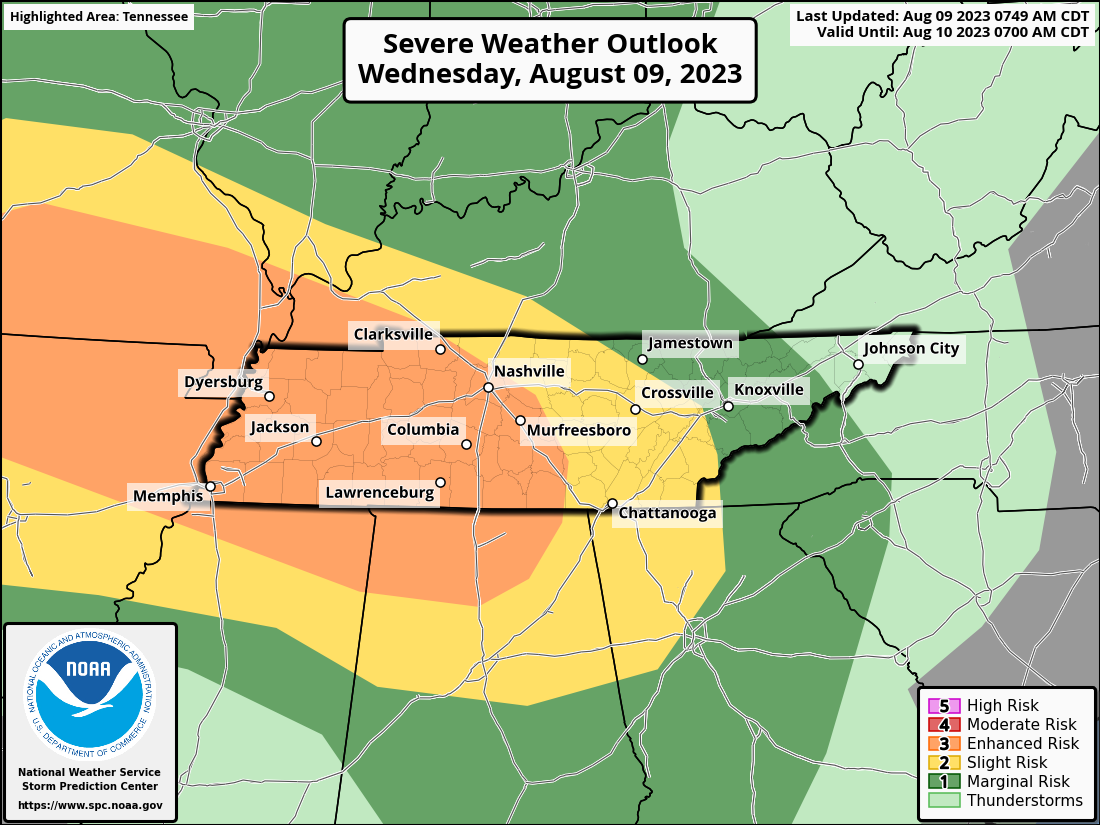
The convective outlook for today places most of Davidson and Williamson Counties in an area of enhanced risk. There is an enhanced risk for brief spinup tornadoes and damaging straight line wind. Let’s get into the details.
There’s a clear sky overhead and temps should reach the mid 80s. Rad.
After the last weekend and last night, we could use it.
Some of us are waking up with damage. If you have damage from storms last night, please use #tspotter when you tweet it to us. There may have been some straight line wind damage for some of us, but no rotation was observed. The NWS said that an area of 55-65 mph winds were possible in Wilson county last night.

Editor’s note. This is the hardest blog I’ve ever written. And it’s not the meteorology that had me stumped. -Will
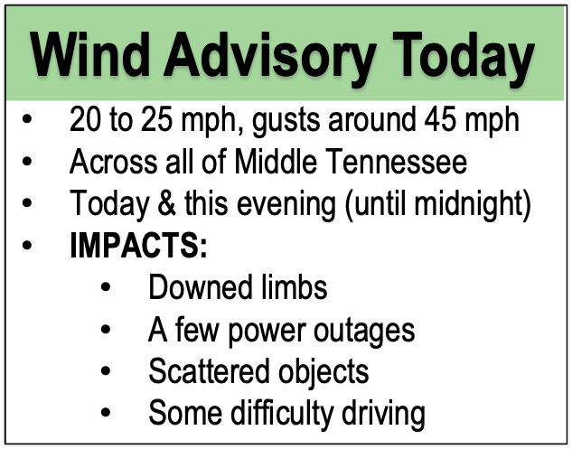
Today, winds will be similar to yesterday.
West northwest wind 10 to 15 mph increasing to 15 to 20 mph in the afternoon. Winds could gust as high as 30 mph.
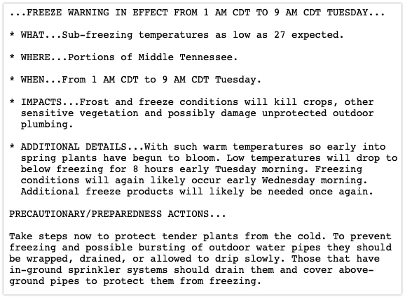

A freeze warning has been issued for our two counties (and much of Middle TN) beginning overnight through tomorrow morning. Here are the deets .
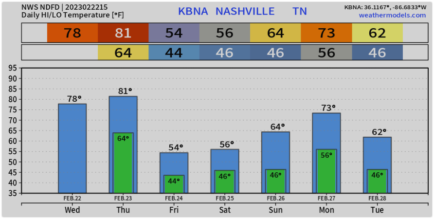
This weeks weather will be pretty. As mentioned yesterday, we’ll have cold mornings and sunny, warm afternoons. Temps will try to get into the 50s today and tomorrow, then trying for the 60s Wednesday and Thursday.

For most of the week we’ll see a repeating pattern of cold mornings and sunny days with temps rising into the high 40s to 50s. This is pretty typical for this time of year.
We’re not expecting severe weather, but storms are possible. Wind advisory today and tonight.
Here’s info…
As you walked out the door today you undoubtedly noticed the warm air. Record temps in store for today and tomorrow.
The rain is gone and the skies are mostly clear. We’ll see temps close to 70º this afternoon.
Overnight the wind picks up clouds move in. The wind might even reach advisory criteria. Expect max gusts between 30 – 40 mph. The HRRR predicts a few waves of rain tomorrow night as a front approaches. We don’t expect severe weather, but a rumble of thunder is possible into Thursday morning.
You must be logged in to post a comment.