
HRRR model (below) thinks showers/storms will pop-up and move through this afternoon and evening.
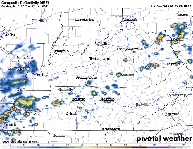
Similar to yesterday, storms could initially be strong, a storm or two could reach severe limits with some damaging straight-line winds, along with heavy downpours and frequent lightning. When thunder roars, go indoors. Rain could linger for a few hours this evening.
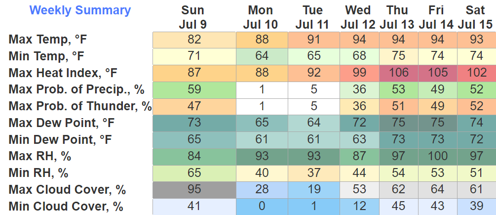
Monday and Tuesday look dry, and for early July, the humidity won’t be awful with dewpoints in the low to mid 60’s. Makes me wanna raise the roof.

Wattery chances return Wednesday and will stick around for the rest of the week. Heat index values get back to gross and sweaty range. Currently, no severe weather in the forecast.
Quick References:
Weather changes constantly.
Follow @NashSevereWx on Twitter for any changes to this forecast.
Live coverage during tornado and severe thunderstorm warnings:

Look good.
Support the mission.

We are 100% community supported. No ads. No subscription fees. Keep it free for everyone.


Categories: Forecast Blogs (Legacy)
You must be logged in to post a comment.