
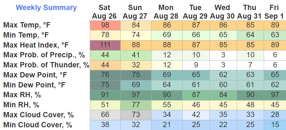
We have one last day of a Heat Advisory due to heat index values ranging from 105° – 110°. If you have to be outside, take frequent breaks in the shade and drink plenty of water. Look before you lock.
We have some chances at some storms to cool us off today, with a potential of one or two being strong/severe.
The Storm Prediction Center has outlooked us with a 5% chance of damaging straight-line winds within 25 miles. We are not outlooked for hail/tornadoes.
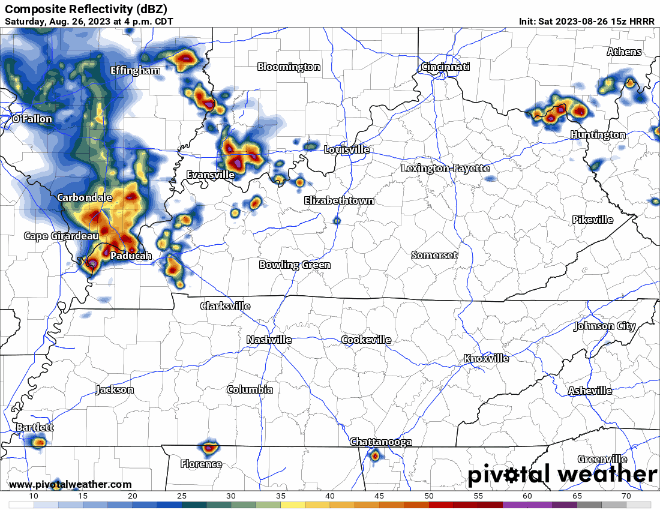
The latest HRRR model (above) thinks the storms just fall apart before arrival. Yesterday it thought the storms came right on thru, so it’ll be important to stay connected. If we were to see storms, the best timeframe would be from 4-8pm. That’s a big “if”.
The Start of Cooler Weather
After a long run with brutal temps, we finally get a well deserved break. Starting Sunday, high temps will be in the mid to upper 80’s for the week.
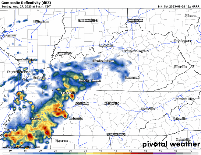
HRRR model (above) thinks we deal with on/off rain all day Sunday. There’s an outside chance at a storm having some damaging straight-line winds, but chances are very low. Much needed free grass watering.
Not much rain potential the rest of the week.
Quick References:
Weather changes constantly.
Follow @NashSevereWx on Twitter for any changes to this forecast.
Live coverage during tornado and severe thunderstorm warnings:

Look good.
Support the mission.

We are 100% community supported. No ads. No subscription fees. Keep it free for everyone.


Categories: Forecast Blogs (Legacy)
You must be logged in to post a comment.