
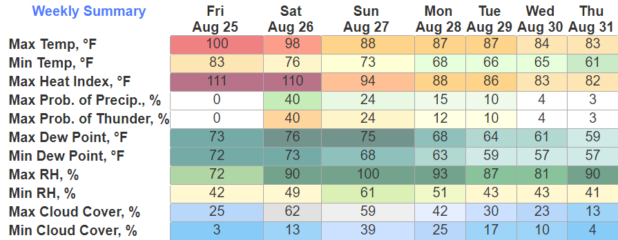
It was another brutal day temperature wise, heat index values were yet again in the 105° – 110°. At 4:14 we hit one hundo again at BNA, marking the first time since July 2012 with two consecutive days at 100 degrees.
Whether your at a high school game, or the Titans game, it’ll still be hot. Kickoff actual temps in the mid 90’s, getting down into the mid 80’s by the end of the 4th. With the humidity, it’ll feel warmer, be sure to stay hydrated.
Saturday
Saturday will be a double edged sword.
First half of the day, we’ll still be dealing with the heat. Another Heat Advisory has been issued for heat index values getting back into the 105° – 110° range. It’ll be the last day we have to deal with this for a while.
The second half of the day will consist of storm chances. The Storm Prediction Center has outlooked us with a 5% chance of damaging straight-line winds within 25 miles. We are not outlooked for tornadoes.
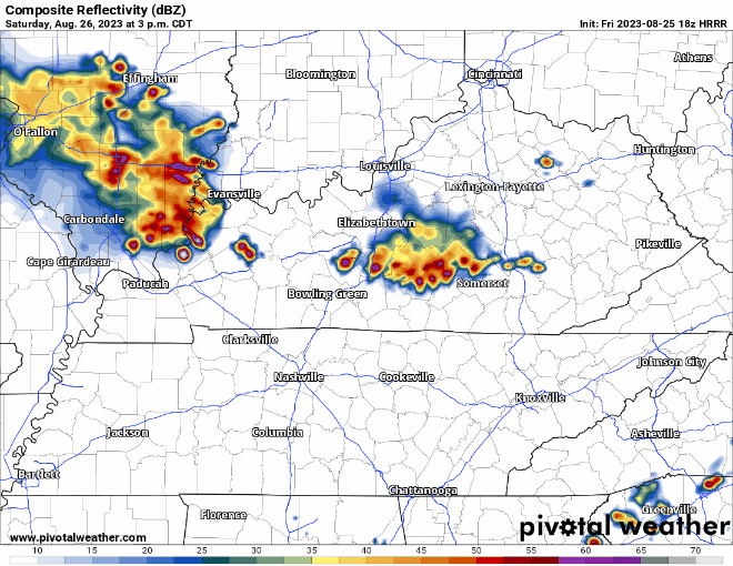
The HRRR model (above) gives us a timeframe of 4-8pm. Storms could contain damaging winds, torrential rain and lightning. If thunder roars, go indoors. We should clear out for your late night activities.
Sunday and Beyond
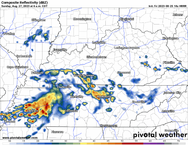
Sunday we’ll be dealing with on and off rain for most of the day. No storm worries.
Thanks to the rain and clouds, we probably won’t hit 90° which will be sweet.
High temps stay in the mid to upper 80’s for at least the first half of the week. Low rain chances too.
Quick References:
Weather changes constantly.
Follow @NashSevereWx on Twitter for any changes to this forecast.
Live coverage during tornado and severe thunderstorm warnings:

Look good.
Support the mission.

We are 100% community supported. No ads. No subscription fees. Keep it free for everyone.


Categories: Forecast Blogs (Legacy)
You must be logged in to post a comment.