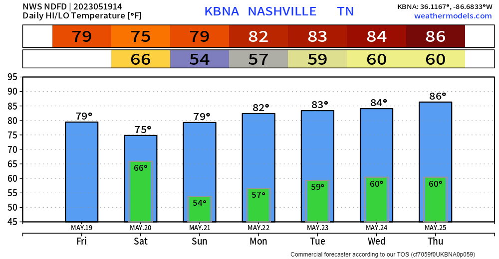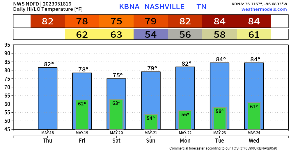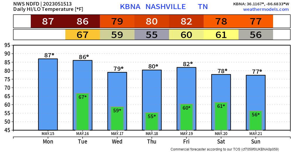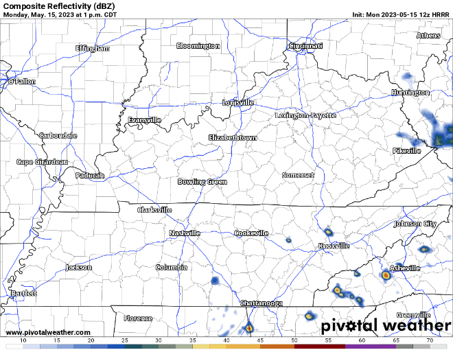
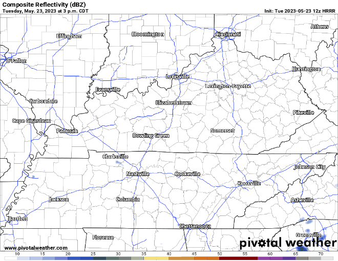
Today will be fairly similar to yesterday. You’ll have your low chance during the afternoon/evening at the Wattery with some Crazy Ivans, as shown by the HRRR model below.
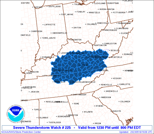
No severe weather concerns, however if you happen to see some rain, it may contain some lightning, gusty winds and heavy rain.