
Pretty muggy start to the morning. I played ten holes of disc golf this morning and worked up a slight sweat. Maybe it was because of how awful I was playing, but it was pretty humid.
With it being this humid, some showers will pop off this afternoon and evening.
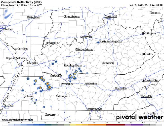
We didn’t start the fire storms. HRRR model (above) thinks showers start popping up around noon, decreasing in coverage by sunset. Some positive news, this run of the HRRR model thinks rain coverage is fairly isolated, and most of the activity misses us. You should never argue with a crazy mo-mo-mo-model. Except you can, the models aren’t always right. Signs are encouraging for a dry and delay-free concert and any other outdoor plans this evening, but I’d come prepared. No severe weather expected, but these storms could contain lightning, gusty winds, and heavy rain.
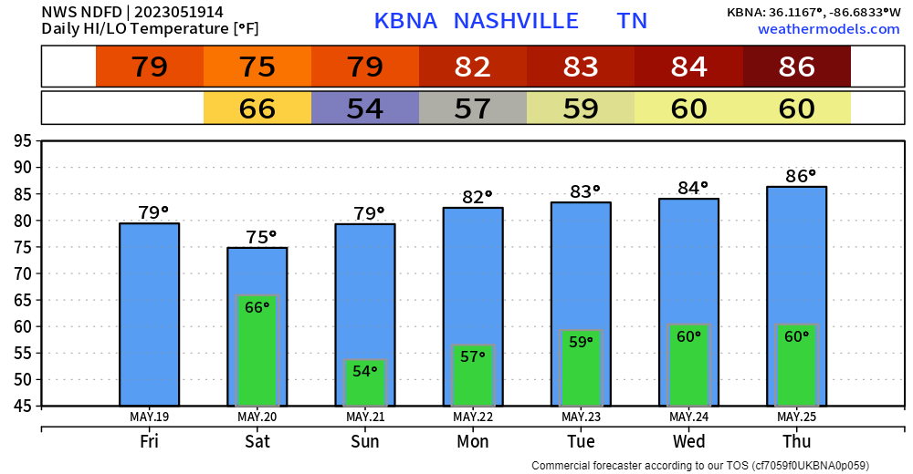
Saturday morning looks wet. Saturday afternoon onwards looks better.
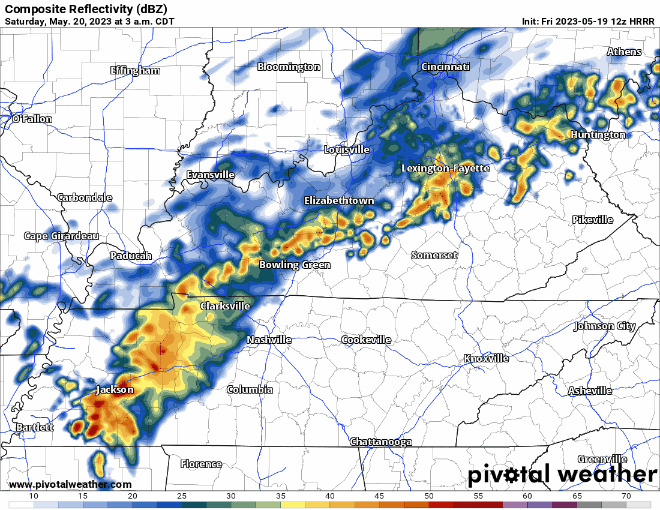
HRRR model (above) thinks rain, heavy at times, will arrive in the wee hours of the Saturday morning, moving out for the most part around lunchtime. Your afternoon plans may be a little wet, but your dinner and evening plans look like they have the green light. Dewpoints will also drop after the rain moves out, so it’ll feel nicer outside.
Sunday looks to be the driest day of the new week, with Wattery chances returning Monday and continuing thru at least Thursday. Temps will slowly warm up throughout the week as well.
Quick References:
Weather changes constantly.
Follow @NashSevereWx on Twitter for any changes to this forecast.
Live coverage during tornado and severe thunderstorm warnings:

Look good.
Support the mission.

We are 100% community supported. No ads. No subscription fees. Keep it free for everyone.


Categories: Forecast Blogs (Legacy)
You must be logged in to post a comment.