
BONUS LUNCHTIME UPDATE BECAUSE NEW INFO
The Storm Prediction Center issued a Severe Thunderstorm Watch until 8 PM for Sumner and Wilson Counties, along with several counties east of there.
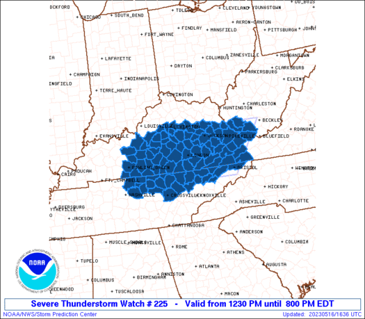
In the Watch area,
Bowing lines of convection will spread east across the watch area through early evening. Damaging gusts will be the primary hazard with this activity. The most intense cells may produce hail, and a brief spin-up tornado or two also will be possible.
Storm Prediction Center, 5/16/23
We are not included in this Watch.
But we still expect storms.
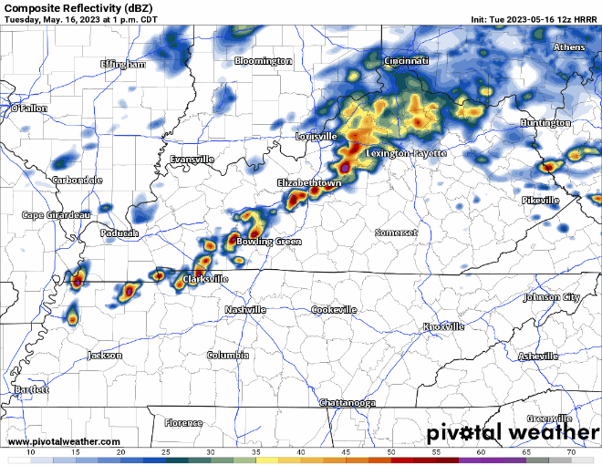
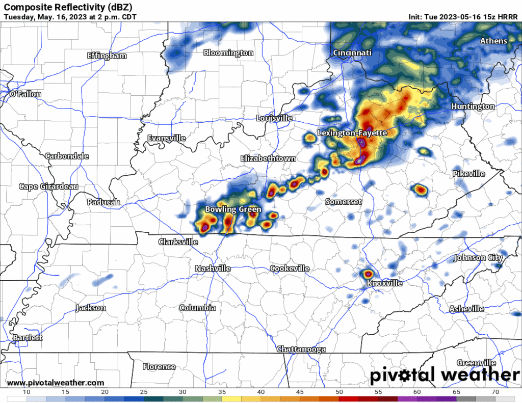
The latest HRRR model (15z) run shows lightning and heavy downpours developing around 4 PM and not leaving until dark.
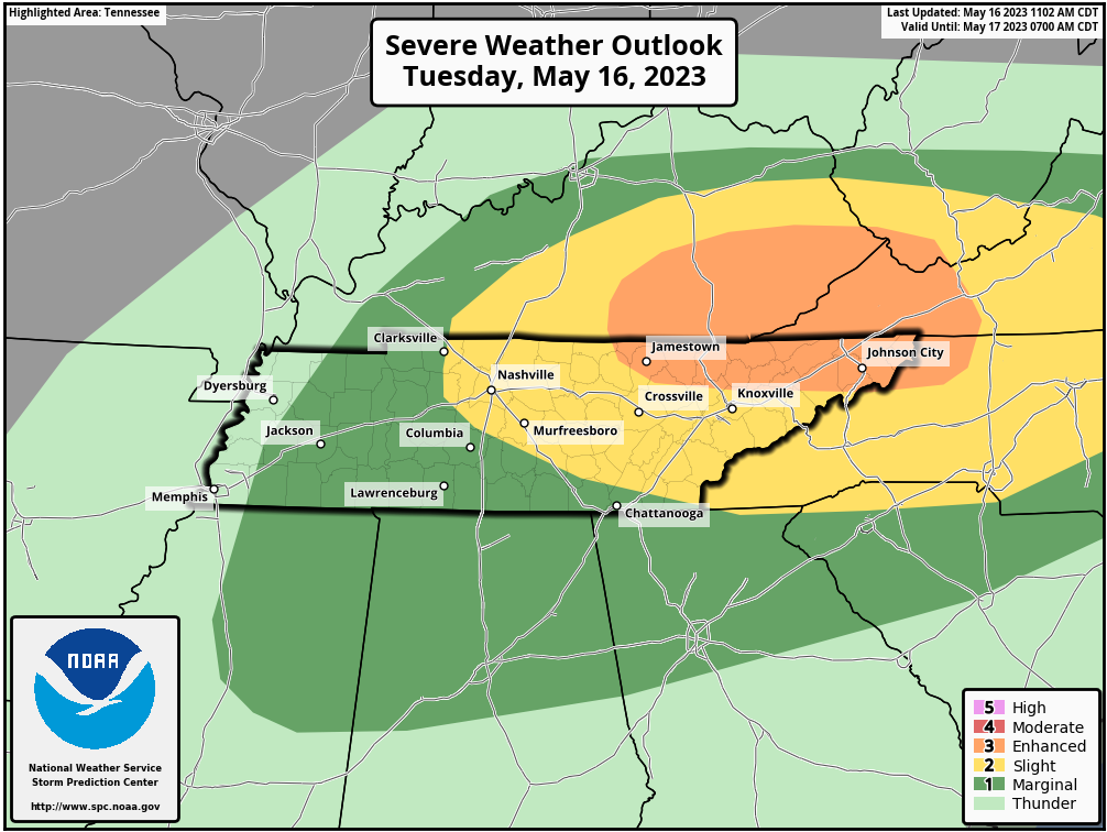
Even though we are excluded from the Watch, SPC says for us there is still a 5% probability of large hail and 15% probability of a damaging straight line wind gusts for us with these late afternoon/early evening storms. The tornado probability (2%) is just off to our east — we are excluded from that as well.
Storms should be in-n-out pretty quickly, so not really worried about flash flooding.
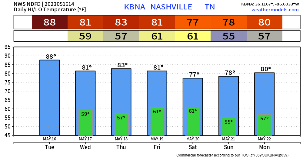
The two dry days have turned into one. If you have anything you need done outside, Wednesday is yo day.
Thursday, moisture will increase enough to where some people may win the Wattery. Doesn’t look all too widespread though.
Friday there looks to be a front that will move across our area at some point. Right now, it looks like said front may hold off until overnight Friday into early Saturday morning, sparing your Friday PM and Saturday plans. Higher-res models aren’t in range yet, but this is a good sign. We’ll be watching.
Quick References:
Weather changes constantly.
Follow @NashSevereWx on Twitter for any changes to this forecast.
Live coverage during tornado and severe thunderstorm warnings:

Look good.
Support the mission.

We are 100% community supported. No ads. No subscription fees. Keep it free for everyone.


Categories: Forecast Blogs (Legacy)
You must be logged in to post a comment.