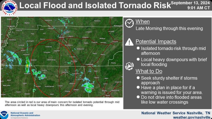
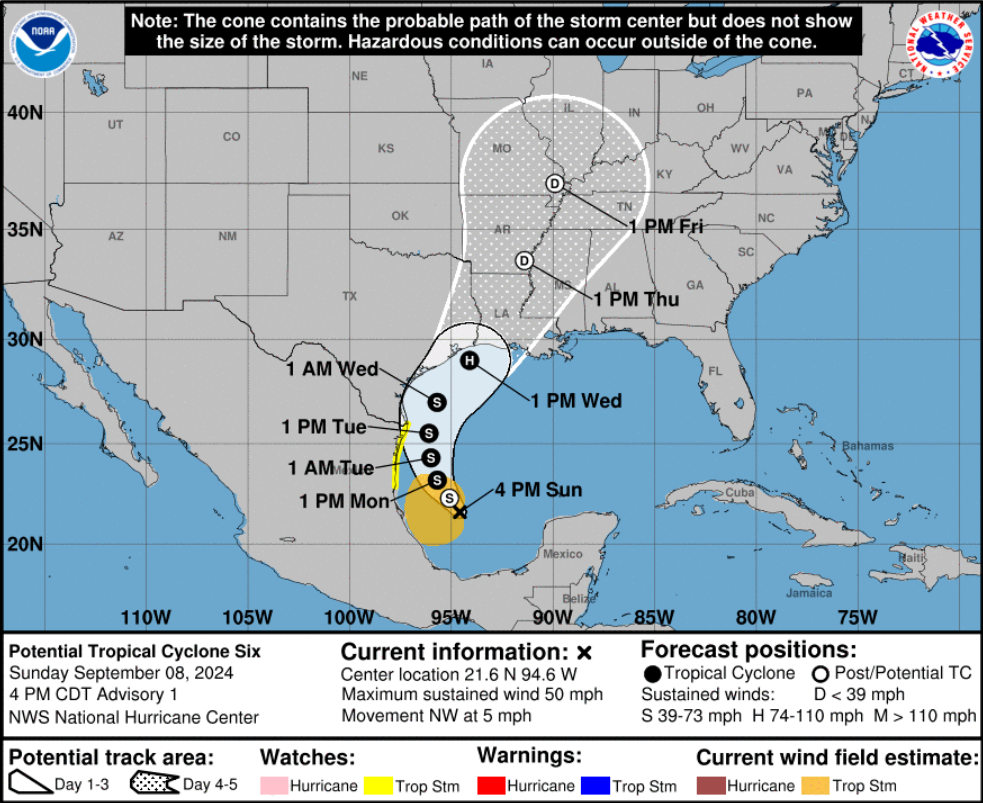
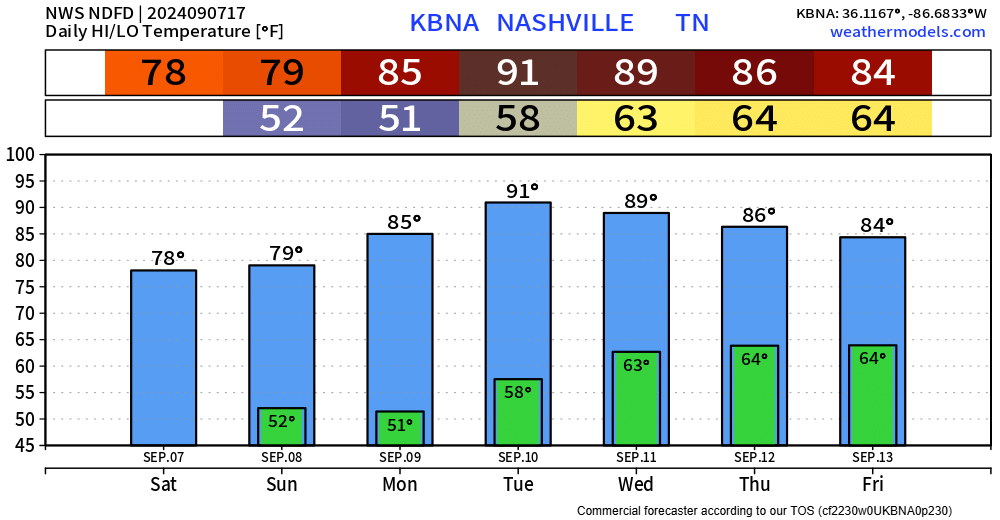
A few locations might reach 32° tonight, but other than that, we’ll take a pause on sub-freezing temps for a little while. Strong southerly flow will help our high temps reach the 60’s Thursday – Sunday.
Some light drizzle still moving thru the area, just enough to be slightly annoying.
Drizzle will be all gone by Monday morning as we wake up to temps below freezing, with wind chills in the low 20s.
This will be a common theme Monday – Wednesday. Thursday high temps finally warm up to the 60s and they’ll stay there as we enter December.
We finally got some decent rainfall across the area.
Looks like everyone received about 1″, the big winners look to be the Fairview area and far northern Davidson Co. with 2″+.
This will certainly be a help, but it won’t solve all our drought problems. New drought monitor comes out on Thursday to give us the update.
Still the two main headlines of today are the gusty winds and rain overnight.
A Wind Advisory will be in effect from 6pm today thru 6am Tuesday. Wind gusts up to 45 mph are possible. As of 4pm, BNA has already gusted up to 28 mph and winds will continue to howl. Secure outdoor furniture, trashcans, Christmas decorations, God’s frisbees, etc.